Creating a new pedestrian crossing to get across a certain problematic section of Jeanne d’Arc Boulevard is something I’ve been mulling over and wanting to talk about for literal months.
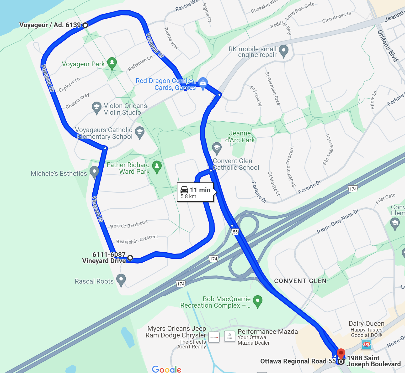
My version of this story contains some aspects of government bureaucracy, car-friendly transportation rules, and common-sense safety and accessibility changes. The exact spot I’m describing today is on Jeanne d’Arc, between the intersection of Vineyard/Fortune and Voyageur/Vorlage (names in the suburbs get weird where the same road gets multiple names even though sections of the road are less than a kilometre long.

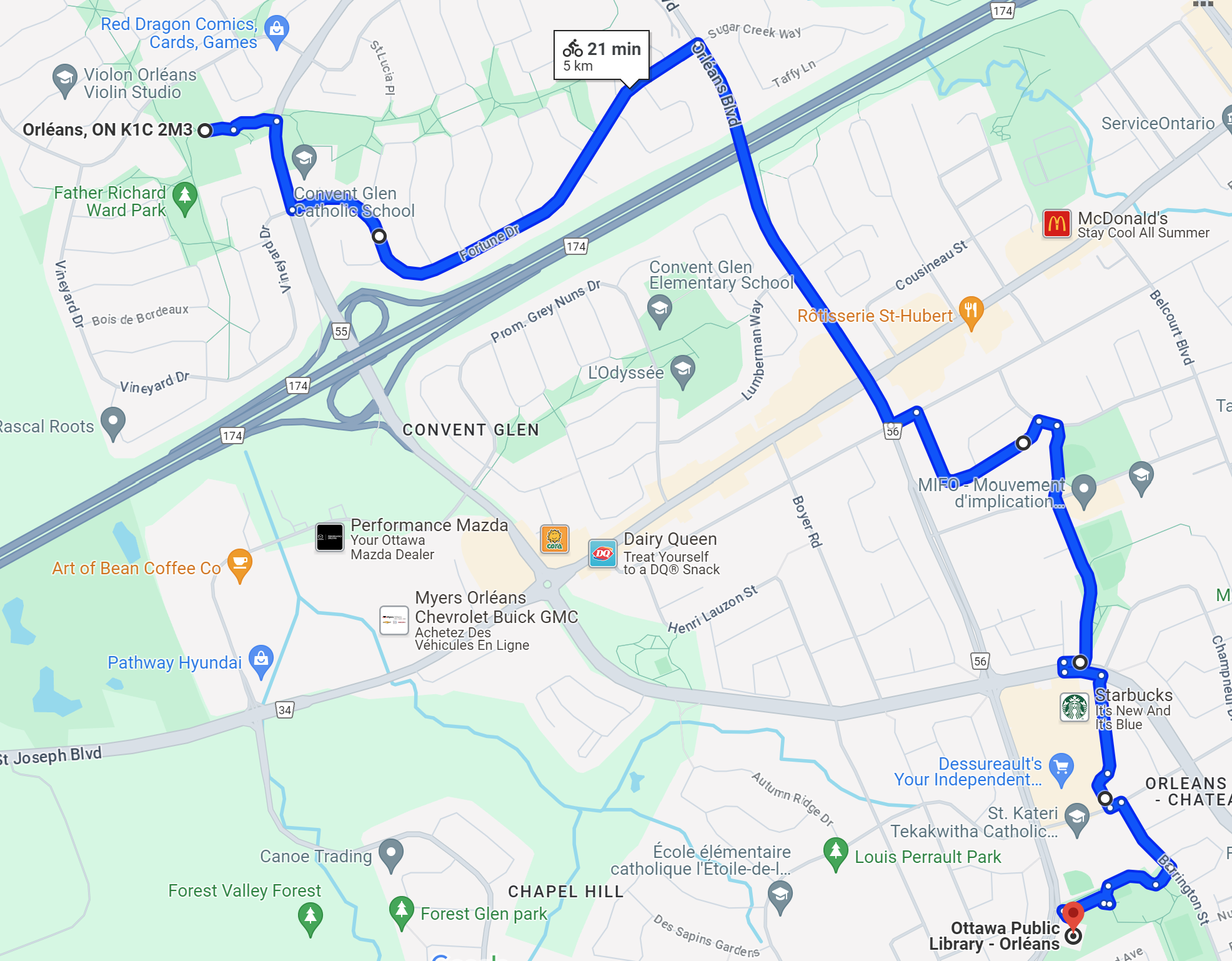
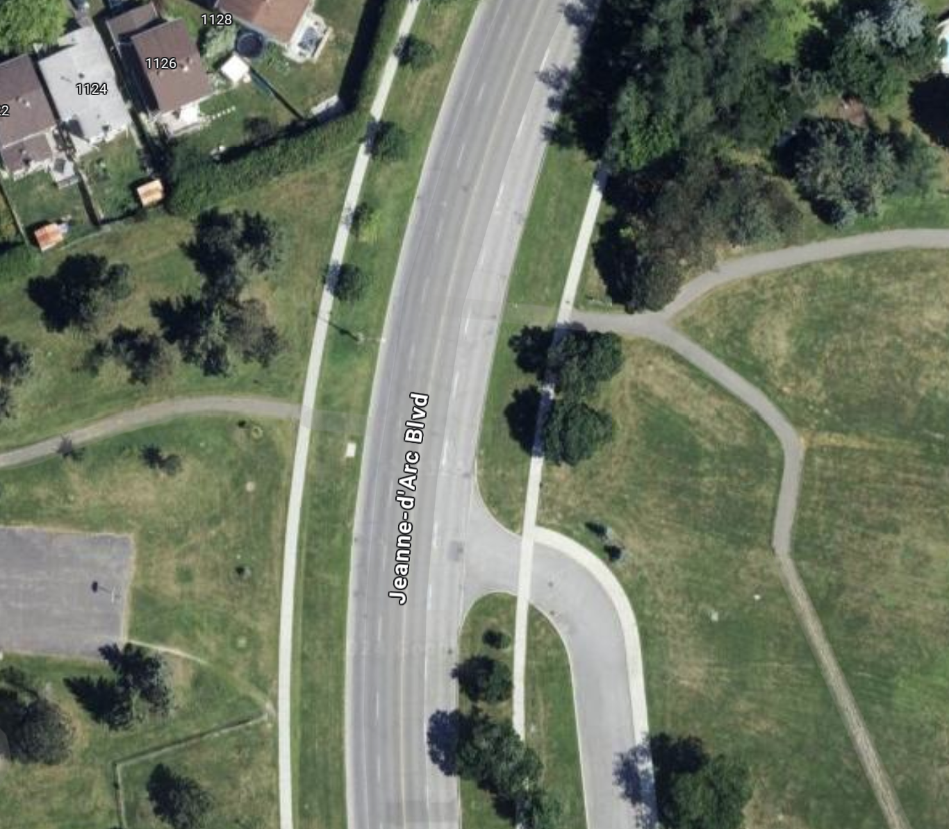
Even from the level of detail of this first map, keen-eyed observers can see there is something going on here, a pair of green lines that seem to match up almost perfect, separated by a big ol’ road. This is basically the exact spot that served as my measurement location for the first post on this blog: Jeanne d’Arc Boulevard North – Road Layout Update. This specific spot is also home to of the most obvious places for new pedestrian infrastructure in this whole neighbourhood.
Zooming In
Getting a little closer to this ‘intersection’, you can clearly see that an effort was made here to connect the path network, but maybe someone lost an argument, or it was decided that traffic being slowed or stopped one extra time here if someone wanted to cross was unacceptable.

Personally, in the 5 years I’ve lived in this neighbourhood, I have crossed this road at this point probably a dozen times. I’ve done it with a stroller, I’ve done it with a toboggan (to a community event, no less). It’s frankly embarrassing that the path system is so wholly broken by this one disconnect that it has probably prevented hundreds, if not thousands, of trips that could be walked but were instead driven.
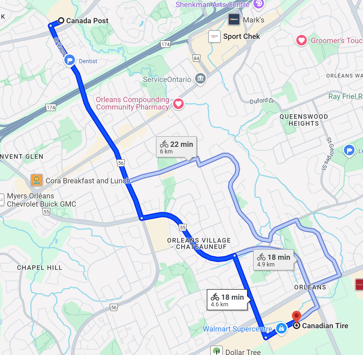
To those not familiar with the area, in the 300 m or so around this spot, there are two schools, a fire station, a basketball court (in dire need of a renewal, by the way), 2 soccer fields, a baseball diamond, a boarded hockey rink, a community shopping plaza (micro strip mall, basically), several large green spaces, parks and playgrounds, and some very nice active transportation paths that form a nice network. These amenities would all unilaterally become more accessible if this crossing were opened up with a controlled signal or any kind of pedestrian infrastructure.
The Bureaucracy
Now, for those of you thinking “Rob, why don’t you ask your local municipal representative about this”. It seems like a pretty obvious safety and accessibility win to open up this crossing, traffic impact would probably be minimal, and commuters might see their trips slowed by a few seconds 1-2 times a week at most.
I want to preface what I say next by saying that I don’t begrudge the local municipal staff, councillors, or really anybody involved locally for not rocking the boat for this. Incremental change like this, whether you agree it is a good idea or not, has become somewhat radical, especially if it makes things technically harder for cars.
Tangent: The Roundabout
However, another thing I’ll say before I talk about the politics of this is that a BIG discussion going on in the community right now, happened a little over 200 m away from this spot, is the addition of a roundabout near the local school, designed to help the buses visiting the soon-to-be-completed Jeanne d’Arc LRT station turn around once they’ve completed their routes.
This has become a huge discussion point because parents of the children at this school are concerned about safety at this intersection, and many view buses and this roundabout as dangerous for kids getting to school. I think this is pretty silly, the roundabout is very well considered, and will itself have a controlled pedestrian signal and a crossing guard. The design is almost certainly safer for students, given the lower vehicle speeds to navigate the intersection and the only result of these changes will be less car traffic through this intersection, not more.
Anyhow, this tangent is to add nearby context to the discussion, now back to the bureaucracy.
Now, when I reached out to my councillor to ask about this spot and the possibility of adding a crossing, I wasn’t necessarily expecting smooth sailing and that this would happen within a month or two. Even I am not that naive. However, I didn’t expect the actual response I got, which I’ll paraphrase here.
The Argument for Status Quo
I was told that provincial regulations dictated that a pedestrian crossing (PXO is the acronym they used, so I’ll borrow that here) could not be placed less than 200 m away from another signalized intersection. The other intersection I mentioned (with Voyageur/Vorlage) is about 160 m from the spot I’d propose makes the most sense for a PXO. I’ll note that this 200 m number is totally arbitrary, and I can think of PLENTY of exceptions to it in Ottawa that were surely based on some kind of reasoning that could be applied here. Usually, the reasoning would involve safety or some kind of exceptional road design.
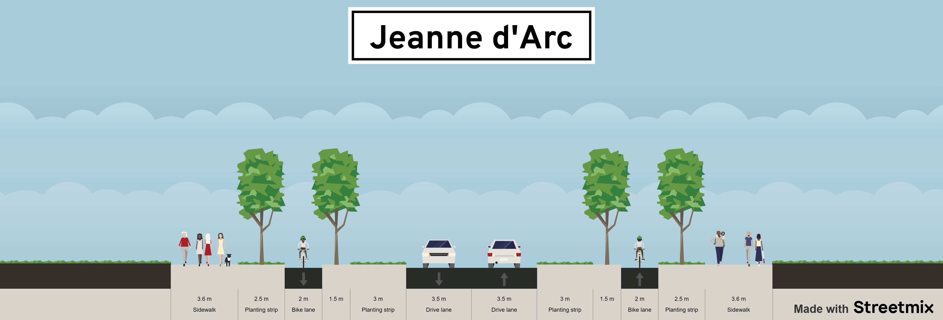
The argument was made (by traffic engineers and city staff, relayed to me by the councillor’s office) that because the road curves at this spot, and the speed limit along this stretch is relatively high at 60 kph, having motorists potentially need to stop for this PXO signal is dangerous. Personally, I would argue that if it is dangerous having pedestrians cross because of the speed and the design of the road, perhaps the speed limit shouldn’t be 60, since you are driving between an elementary school and a fire station.
More Road Design Considerations
Another factor to consider is that due to upcoming changes to the road nearby, like the roundabout going in, there is already ongoing discussion about the speed limit along this whole stretch being reduced to 40 kph. This is because over a relatively short stretch, passing several schools, the road already jumps from speed limits of 40 and 60 several times, and a new speed camera a couple of blocks further east on this road has been giving massive numbers of tickets to drivers in the community. This isn’t surprising, because the road itself is absolutely encouraging you to go faster than this with its design, wide lanes and clear sight lines.
The road will also bottleneck down to 1 lane on either end once the roundabout goes in, so I would make the argument now is a perfect time to bite the bullet and say that this road should just be 1 lane at 40 kph for the whole length in this section. At that point, not only would a PXO be more reasonable, having big flashing lights for motorists would be less necessary (though I would argue still a good idea), and travel distance in traffic would be reduced by half for pedestrians (only needing to cross two lanes instead of four).
This is About Tradeoffs
Now, before concluding this piece, I’d like to return to the provincial regulation requiring 200 metres between signalized intersections to add a PXO. With a distance to the nearest intersection in this case of about 160 m, here is what traffic engineers are suggesting when a pedestrian approaches this spot from either direction with a hypothetical crossing. Rather than having motorists slow down or stop for a few seconds occasionally to let a pedestrian or cyclist continue their walk along a path, it is suggested that they should have to walk at least 320 m (160 m there and 160 m more back) in order to allow for traffic flow. They are also saying that this should still be the case even if the detoured walk is a total of nearly 400 m. It’s no surprise at all to me that unless I am with my young family doing this on foot, I sometimes just walk across the road (dangerously!).
One last point to wrap up this logical garden path: there is already a roundabout going in at one of the two nearby intersections. The logic for that roundabout going in is that buses accessing the nearby LRT station need to be able to turn around. However, I would make the argument that if all the described changes take place (40 kph limit, reduction to one lane, adding a PXO crossing), having a roundabout replace the signalized intersection at Jeanne d’Arc and Voyageur/Vorlage as well makes perfect sense.
This intersection could also have a pedestrian crossing with lights like at the other roundabout, and given this change in traffic pattern, its entirely possible that traffic flow through the area on an average basis actually moves a little better, with less likelihood of starting and stopping almost all of the time. And when there is a higher likelihood of interactions between pedestrians and motorists at these places (rush hour and around the start/end of the school day), should we not be prioritizing the safety of our children anyhow? These intersections are already patrolled by crossing guards, surely these changes would only make their job easier.
In Summary
To wrap up, I have a lot to say about this set of upgrades to the road design of this stretch of Jeanne d’Arc Blvd. I think it is doable in a fairly short time frame and without too much expense, and the resulting road design is not only fairer and more equitable, but it’s safer and requires less upkeep and maintenance.