It was a real pleasure to sit down with Ben Durham on the “Wheels and Beyond” podcast. The conversation started off with the interesting way we connected through his sister, Jamie, who happens to be a colleague of mine. It was reassuring to learn I wasn’t the only one doing the daily commute without a car; finding that shared experience with Jamie was what sparked this whole conversation.
I got to share my “mobility story,” starting from my university days in Ottawa and how, even after moving to the suburbs in 2019, I’ve tried to maintain a lifestyle that doesn’t revolve around a car. We sold our second car during the pandemic, and honestly, I haven’t missed it. My cargo bike has been completely life-changing. It’s not just for my 20km commute; it has just plain become our second vehicle. I talked about how it’s the “minivan of bicycles”, perfect for hauling everything from kids and groceries to cases of Girl Guide cookies.
A big part of our discussion focused on the challenges and opportunities of suburban living. I explained how moving to Orleans with young kids opened my eyes to how car-centric design can make it difficult to build community and access amenities without driving. It was rewarding to share how my own kids are noticing the benefits of biking—the friendly interactions with neighbours, the freedom from traffic jams—things they just don’t experience from the backseat of a car.
This experience is what motivated me to start LessCar.ca about a year ago. I explained to Ben that the core idea isn’t about being “anti-car,” but about embracing “less car”. Cars are a powerful tool, a “superpower” as I called them, but that doesn’t mean it’s a good idea to use and rely on them for every single trip. By making conscious choices to walk, bike, or take transit more often, we save money, get exercise, and build a stronger community.
I was particularly keen to discuss the structural issues that hold our neighbourhoods back. We delved into how outdated zoning bylaws in many suburban areas prevent the evolution of our communities, making it illegal to build the kind of mixed-use, walkable places that so many people want (even if they may not realize it). This is a topic I’m passionate about, and I mentioned the “modernizing Orleans” package I’ve been working on to advocate for changes to our local transportation and zoning regulations. It’s crucial that we allow our neighbourhoods to adapt and grow incrementally.
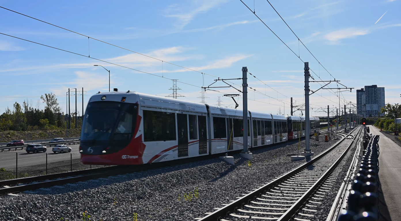
We ended on a hopeful note. I’m genuinely optimistic about the future, especially with the LRT extension coming out east to Orleans, which will be a game-changer for connecting the suburbs to downtown without as strong a compulsion to drive. The City of Ottawa has some excellent high-level plans, like the 15-minute neighbourhood concept outlined in the Official Plan, but the real challenge is overcoming public resistance and NIMBYism at the local level to actually get it done.
My main takeaway for listeners was a call to action: get involved. Go to your local community association meetings, talk to your neighbours, and advocate to the people in your community and elected leaders for the kind of neighbourhood you want to live in. The idea of “less car” is a positive one that benefits everyone through cleaner air, quieter streets, and safer, more connected communities. Even people stuck in traffic on the highway are wishing for less car.
Overall, it was a fantastic conversation, and I’m grateful to Ben for providing a platform to share these ideas. It reinforces the importance of continuing to push for more resilient, human-scaled communities across Canada and the world.
In Orleans, the car is king. It’s the default mode of transport for groceries, school runs, and even that quick trip for coffee. We often focus on the big-picture issues of car dependency – traffic, land use, emissions. But what if shifting away from the car, even just a little, could unlock significant benefits not just for our community, but for your personal well-being and bank account? It turns out, a less car-dependent life isn’t just good for the planet; it might just be the secret to a happier, healthier, and wealthier you.
The Invisible Burden of the Daily Drive
Think about your daily commute or errand run. The stress of traffic, the hunt for the closest parking spot, the honks from tailgaters – it all adds up. While seemingly mundane, this constant reliance on the car can contribute to:
Stress and Frustration: Traffic jams, aggressive drivers, and parking woes are significant sources of daily stress.
Reduced Physical Activity: Every short car trip is a missed opportunity for walking or cycling, contributing to a more sedentary lifestyle.
Social Isolation: Driving often means moving from one private space (your home) to another (your destination) without meaningful interaction, reducing spontaneous community conversations.
But beyond these, there’s a more insidious burden: the financial cost.
Your Wallet’s Silent Saver: The Financial Freedom of Less Driving
Let’s talk money, because for many, this is where the rubber meets the road (or rather, where the rubber doesn’t hit the road, saving you cash). The average cost of owning and operating a car in Canada is substantial. We’re talking upwards of a thousand dollars a month on:
Fuel: A volatile expense that drains your budget with every fill-up.
Insurance: A non-negotiable, ever-increasing cost.
Maintenance & Repairs: Oil changes, tire replacements, and the dreaded “check engine” light.
Depreciation: Your car loses value the moment you drive it off the lot.
Parking Fees: Even if you’re not paying parking fees directly, the cost of providing “free” parking is baked into everything you buy.
Reducing your car usage, even if you can’t go entirely car-free, directly translates to savings. Fewer kilometres driven means less fuel, less wear and tear, and you might get so used to it, when it comes time to replace the second car, maybe you realize you don’t need one. Imagine what you could do with an extra few hundred, or even several thousand, dollars a year! A vacation? Home improvements? More date nights at a local, walkable restaurant? The possibilities are surprisingly expansive.
Beyond the Dollars: The Quality of Life Dividend
The benefits extend far beyond financial savings. Embracing less car dependency can significantly boost your quality of life:
Improved Physical Health: Walking or cycling for errands builds physical activity into your day effortlessly. Even walking to a transit stop adds steps to your routine.
Enhanced Mental Well-being: Swapping stressful commutes for active travel can reduce anxiety and improve mood. The simple act of being outdoors and observing your surroundings can be incredibly calming.
Stronger Community Connections: When you walk or bike, you’re more likely to encounter neighbours, discover local shops and services, and become more familiar with your immediate surroundings. This fosters a deeper sense of belonging and makes Orleans feel more like a cohesive community, not just a collection of houses connected by roads.
Time Reclaimed: While a car might seem faster, the total time spent driving, parking, and maintaining it can be surprising. For shorter trips when you’re able to, walking or cycling can often be quicker, and it certainly frees up mental bandwidth.
Making the Shift in Orleans: Practical Steps
Living a less car-dependent life in Orleans isn’t about giving up your car entirely for most people, but about making conscious choices to reduce your reliance on it. This might involve:
Identifying Walkable Destinations: Are there local shops, parks, or friends’ houses you could walk or bike to instead of driving?
Embracing Public Transit: For trips out of walk or bike range, exploring OC Transpo options can save on gas and parking places like downtown, as long as there is a convenient route.
Car-Sharing or Ride-Sharing: For infrequent needs, consider services that provide access to a car without the burden of ownership.
Advocating for Better Infrastructure: Supporting initiatives for improved sidewalks, bike lanes, access to transit, and more accessible local amenities directly helps make less-car living easier for everyone in Orleans.
The road to a less car-dependent life in Orleans offers a compelling return on investment – not just for our community’s future, but for your personal happiness and financial well-being, too. It’s a journey worth taking, one step, or pedal stroke, at a time.
How a city organizes its space—its land use and population density—has a profound impact on its financial health and the daily lives of its residents. Denser, more compact urban areas are better able to generate tax revenue to pay for amenities and services because they accommodate more homes and businesses on less land. A single parcel of land with a multi-story building containing apartments or condos and ground-floor retail, for example, generates multiple times more tax value than the same-sized parcel with a single-story structure surrounded by a parking lot. At the same time, this concentration of services, amenities, and housing gives people a greater opportunity to live their lives with less reliance on a car. When workplaces, shops, schools, and parks are located close to where people live, walking, cycling, and public transit become convenient and practical choices for daily trips.
In this post, I’d like to make a comparison of two very different city streets that highlight the significant difference in tax revenue based on good and inefficient urban design.
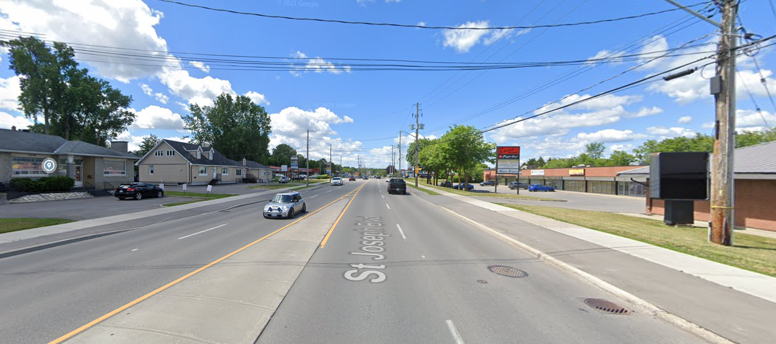
First: Kent Street in Centretown. Second: St Joseph in Orleans.
Measuring Efficiency
A helpful way to think about this is through the concept of land use efficiency, which is similar to the fuel efficiency of a vehicle. Just as a car can have good or bad gas mileage, land can be used more or less efficiently. While fuel efficiency is measured in litres per 100 kilometres (or perhaps miles per gallon), land use efficiency can be measured in dollars of tax revenue generated per hectare. With this measure, a bigger number means more efficient land use, a very practical consideration when it comes to what our city can afford at budget time.
As we established, fuel efficiency measures how far a vehicle will be able to take you for a given amount of gas. Land use efficiency, then, measures how much a given property will generate in tax revenue to pay for city services, amenities, and infrastructure based on the size of the given parcel of land.
This metric reveals how productively our land is being used to fund the essential city services we all depend on, and it will be the measure we use here.
The contrast between Kent Street and St. Joseph Boulevard is a lesson in the power of land use.
To start, let’s look at a 3-block wide section of Centretown around Kent/Bank Street (between Lyon and O’Connor). This is an area of mixed commercial and residential use, and it yields $16.8 million in annual municipal taxes from about 40 hectares according to the city’s tax data. The chosen section of Centretown features some apartments and condos but specifically doesn’t include the core downtown blocks with the most tax efficient high-rise office towers. This makes for a great comparison because it’s a sort of middle ground between the densest parts of the city and the sparse suburban landscape.
2024 Municipal Taxes: $16.8 M Area: 39.5 ha Revenue Density: $ 426k / ha
Kent and Bank Streets, with a mix of residential apartments and condos, ground-level retail, and more pedestrian- and bike-friendly infrastructure, creates a highly efficient and valuable urban landscape. Every block is maximized to house lots of people, generate economic activity and, consequently, provide a ton of value for the city. In addition, the people who live there who can probably get away with far fewer (or no) car trips in a given week.
Suburban “Density”: St Joseph Boulevard
By contrast, a key commercial corridor in Orleans, St. Joseph Boulevard, provides only $16.5 million in tax revenue from a much (8 x) larger area of 225 hectares. St Joseph is literally the heart of Orleans’ business district, and it represents a more traditional suburban model for a shopping area. Characterized by single- or two-story commercial plazas, vast surface parking lots, and a car-centric layout, its land use is dramatically less intensive.
2024 Municipal Taxes: $16.5 M Area: 225 ha Revenue Density: $73k / ha
This sprawling design generates significantly less tax revenue per hectare, effectively nobody lives on the street proper, and the street is just simply not a nice place to be outside a car. This increased distance to get from where people live to where they need to go means people living in Orleans are far more dependent on cars for more of their weekly trips, which means cost of living is almost necessarily higher, even if you factor in high housing costs for suburban homes.
The Math
Street Area
Kent/Bank Street
St Joseph
2024 Municipal Taxes
$16.8 M
$16.5 M
Developed Land Area
39.5 ha
225 ha
Revenue Density (taxes / developed area)
$ 426 k / ha
$73 k / ha
This results in a revenue density of $426,000 per hectare for Kent and Bank Streets versus $73,000 for St. Joseph. All of this means St Joseph offers 1.8% less tax revenue over a 5.7 x larger area, meaning land developed like Centretown is 5.8 x more valuable to the city.
This gap suggests a considerable opportunity for Ottawa’s eastern communities. Adopting principles of densification and modern urban planning could allow Orleans to increase its tax revenue and encourage local economic growth.
Comparing These Directly
If we overlay the size and shape of our Centretown area over St Joseph (rotated, of course) at the same scale, you can see the tremendous size of the St. Joseph Business District (Heart of Orleans) in comparison.
Keep in mind that the smaller Kent/Bank Street footprint (which doesn’t include the portion of the street with high-rise office towers that make up the part of this area further north into downtown) brings in slightly more tax revenue for the city than does ALL of the St Joseph region in significantly less space. For its size, Centretown outperforms St Joseph by a factor of 5.8x. Think of what the city could do with tax revenue coming from that portion of Orleans if the whole area were a similar density and distribution as Centretown.
Applying Centretown’s revenue density value to St Joseph and surroundings would bring in $96 million in annual municipal tax revenue, an increase over today of $79 million, which would enable things like better city services and amenities, more frequent bus service, all kinds of needed investments to make the area shine. This is just one stretch of one suburban corridor that can bring in that much additional tax revenue, imagine if other parts of the suburbs made even small but meaningful steps towards additional density and mixed-use neighbourhoods.
What Can We Do?
The good news is that the vision for a more prosperous and dynamic St. Joseph Boulevard is not a distant dream. The City of Ottawa has laid the groundwork for change multiple times already, first through the St. Joseph Boulevard Corridor Study early in the 2000s, and now through the Orléans Corridor Secondary Plan. These plans explicitly call for the transformation of the boulevard from a suburban commercial strip into a more intensely developed, mixed-use urban district. The goal is to create a “15-minute neighbourhood” where new and existing residents can access daily needs within a short walk, supported by improved transit and a more inviting public realm.
The Heart of Orléans Business Improvement Area (BIA) is a key partner in this revitalization effort, advocating for the interests of local businesses and promoting the area as a destination for arts, culture, and unique shopping and dining experiences. The BIA’s involvement is crucial in ensuring that redevelopment meets the needs of the existing community while attracting new investment.
It’s not to say this transformation will be easy, but the end result will be a layout that works for more people and the increased tax revenue in turn funds other improvements the city needs and is planning for.
The city’s urban design guidelines that apply here provide a clear roadmap for how this transformation can be achieved. These guidelines emphasize:
Mixed-Use Development: Integrating residential units above ground-floor retail and commercial spaces.
Increased Density: Encouraging the development of mid-rise and high-rise buildings, particularly around future transit stations.
Pedestrian-Friendly Design: Wider sidewalks, street trees, and reduced setbacks to create a more inviting and walkable environment.
Reduced Parking Requirements: Shifting away from large surface parking lots in favor of on-street parking and structured parking to free up land for more productive uses.
The financial upside of this shift is undeniable. If St. Joseph Boulevard could even begin to approach the revenue density of Kent Street, the resulting increase in municipal taxes would be transformative for Orleans and the city as a whole. This new revenue could be reinvested into the community to further enhance infrastructure, improve public services, and fund new amenities.
Modernizing the layout of our suburban districts is not just about increasing tax revenue; it’s about building more sustainable, resilient, and enjoyable communities. By strategically intensifying development along key corridors like St. Joseph Boulevard, we can create a more prosperous future for Orleans, one that is less reliant on cars, more supportive of local businesses, and ultimately, a more vibrant place to live, work, and play. The blueprint for a more valuable boulevard is already in our hands; it’s time to build it.
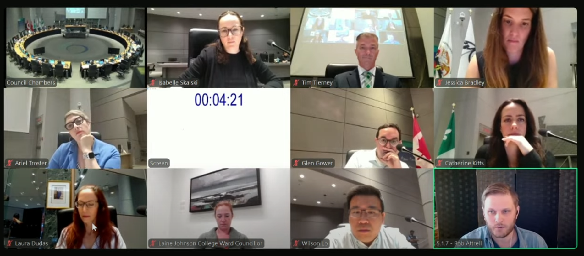
On Thursday, I had the opportunity to speak to the Public Works and Infrastructure Committee (PWIC; formerly the Transportation Committee) about the final draft of Ottawa’s Transportation Master Plan. When you do this (which I had never done before), you get 5 minutes to speak on the item, and councillors can then ask you questions about what you’ve said. This was a great experience, and though prep was quite a bit of work, I think it was worth it.
I was glad to get some good feedback from councillors, and I hope this opens/continues a dialogue on reducing car dependency in the suburbs as this plan and our zoning by-law reviews are completed for the city. Below, I’ve embedded the City Council video, timestamped to the start of my comments, along with the full text of my comments below.
Good morning,
Thanks for giving me the time to speak with you today, this is my first time delegating.
My name is Rob Attrell, and I am a resident of Convent Glen North in Ward 2 in Orleans. I’m also a Board Director and volunteer with the Convent Glen-Orléans Wood Community Association. I live in the suburbs, I have three young kids, and along with our minivan, my family’s second vehicle is a cargo bike. I’d really like to spend less of my time and money on driving, and research consistently shows the only way to reliably reduce car dependency and traffic congestion in the long term is to enable and prioritize viable alternatives to driving.
First, I’d like to acknowledge all the work that city staff and my councillor has put into the Transportation Master Plan, and I want to say that I strongly support the vision this plan puts forward. The policies in our Official Plan and in Part 1 of the TMP correctly identify what’s needed: a sustainable transportation network that supports more efficient land use, more housing, and mixed-use, walkable neighbourhoods. The problem is that the investments laid out in the Capital Infrastructure Plan for Orleans in particular, and for the suburbs in general do not come anywhere close to funding that vision. And as the inimitable city planner Brent Toderian says, “The truth about a city’s aspirations isn’t found in its vision. It’s found in its budget.” There is a profound disconnect here between the city’s stated goals and its planned investments.
This is especially critical now, during the once-in-a-generation review of our Zoning By-laws. A great transportation plan is meaningless if it isn’t funded, and a great zoning plan is impossible if it isn’t supported by a robust multi-modal transportation network. On the zoning side, this means legalizing corner stores in addition to a larger mix of housing types and densities within our neighbourhoods. On the transportation size, a variety of nearby destinations give people more reasons to skip the car trip. Without these places integrated into local communities, even the most reliable LRT or safest bike lane is just a path to another overbuilt parking lot. We cannot achieve our housing and climate goals without a transportation system that gives people real alternatives to driving to most destinations.
The arrival of the LRT in Orleans is another generational opportunity. But its success hinges on residents getting to stations without a car. Part 1 of the TMP imagines our major arterial roads—like Orleans Boulevard, Innes Road, Tenth Line, and St. Joseph—as true multi-modal corridors. But Part 2 only funds a few disconnected pieces. This isn’t building a network; it’s a one-off gesture.
If we approve this plan without the funding to match its ambition, we are paving the way for densification in the suburbs without the multi-modal transportation choices needed to sustain it. This risks creating vertical sprawl—densely populated neighbourhoods that are still wholly car-dependent. Neighbourhoods built like this will suffer from even worse congestion than suburban residents complain about now. The current plan builds infrastructure for a city we say we don’t want.
So, my ask of the committee is this: Direct staff to level up the capital plan so that it actually funds the vision already laid out in the Official Plan and the TMP. We need a network that centres transportation on walking, biking, and transit, where cars are just one tool among strong alternatives. And finally, our plan must be flexible. The city needs the ability to massively accelerate our sustainable transportation plans as the environmental and political climates continue to change. We must be able to adapt quickly, and with the urgency we’ve seen in cities like Montreal and Paris. Let’s not just approve a vision; let’s commit to building it.
—
There is a fundamental connection between transportation and land use which means that a transportation plan alone can only move the needle so much on the choices people make in how they move around the city. We cannot build a sustainable transportation system on a foundation of unsustainable land use.
The city is currently going through consultations (New Zoning By-law | Engage Ottawa) to renew plans for upcoming zoning bylaw changes. Here are a couple of changes to zoning that would radically improve the ways we interact with our community and the city.
I am writing to provide feedback on the new Zoning By-law, and to advocate for a comprehensive, forward-thinking approach to reforming our suburban neighbourhoods. The current zoning review presents a generational opportunity to address the interconnected challenges of housing affordability and municipal fiscal sustainability at their root, and I believe a bold vision is required to build a more resilient and equitable Ottawa for the future.
Our city’s traditional reliance on low-density, car-dependent sprawl in the suburban transects is no longer tenable. It creates a significant structural deficit where the tax revenue from these areas cannot cover their long-term infrastructure costs, while simultaneously limiting housing choice and driving up prices. To counter this, I urge you to consider two specific, transformative actions city-wide: first, to establish a more permissive baseline for all neighbourhoods by eliminating our most restrictive residential zones (like N1/N2) in favour of a zone that allows for gentle density, such as what is presented in N3; and second, to integrate permissions for low-impact, neighbourhood-serving commercial uses (the ‘-c’ designation) directly into all residential zones.
These changes are not about radical transformation overnight, but about decriminalizing the gradual, organic evolution of our neighbourhoods over decades. This will allow our communities to adapt, add needed housing, and develop the kind of vibrant, 15-minute communities envisioned in the Official Plan.
Specific Examples in Convent Glen
In my neighbourhood in Convent Glen North, I’ve put together what I imagine this would look like, with overlapping improvements to the transportation network and the zoning bylaws.
Legalizing low-impact and mixed-use upzoning throughout the suburban transect would enable small-scale, thoughtful, hyperlocal businesses to thrive in Orleans.
I believe that corner lots (at the intersections, pictured here) are some of the best-positioned to be able to take advantage of creating multi-use buildings with ground-floor retail space without disrupting the neighbourhood. However, doing this piece-meal and in small ways will make the needed transformation to walkable neighbourhoods take way longer than just allowing such low-impact changes to be made anywhere in the suburban transect. I think given the insular nature of the particular block of Convent Glen North is uniquely positioned to take advantage of such a change, being bordered by the Greenbelt farms, the highway, and the Ottawa River. If we could access most amenities you need on a regular basis within the community, our reliance on being connected to the rest of the city by only a handful of highway crossings would be greatly reduced.
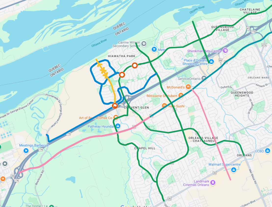
A map of key routes to be discussed below for addition to the TMP for western Orleans.
The city is currently going through consultations (Transportation Master Plan Update | Engage Ottawa) to renew plans for upcoming transportation infrastructure projects. Here are a handful of infrastructure projects that would radically improve the cycling mode share and overall safe cycling network in Orleans if implemented.
Candidates for “Complete Street” makeover with active transportation facilities:
Orleans Blvd (traffic calming, cycling infrastructure, bridge crossing, wide sidewalks) – In the TMP already; high priority
Safe, separated cycling facilities should take riders all the way from beyond Innes in the south of Orleans up to the River Pathway.
Along this route, there are schools, shopping centres, the library, connections to the LRT, St Joseph, Innes, Jeanne d’Arc, etc. It could connect all the way to Navan Rd in the south.
Of particular interest is the overpass over the 174, which is the quietest highway crossing with no on or off ramps, and therefore a necessary crossing over the highway that is the safest for less comfortable users.
Jeanne d’Arc Blvd (40kph, cycling infrastructure, roundabouts in Convent Glen North, wide sidewalks) – North section in the TMP already; high priority
This long road offers multiple chained routes covering most of western Orleans going from Petrie Island all the way to Mer Bleue.
This is also a prime candidate for cycle tracks, in particular the stretch from Champlain in the north all the way on to Mer Bleue where it meets up with Brian Coburn.
There is lots of space to include this infrastructure in the plans while sacrificing almost no traffic capacity. Countless school, businesses, and community amenities and services are within a couple of kilometres of this road.
The intersections along Jeanne d’Arc North between the 174 and Orleans could easily be cheaply transformed into roundabouts given traffic volumes, making it safer for kids to get to nearby schools and saving everybody time and energy waiting to turn left or waiting at red lights. Other intersections could probably also benefit from this treatment but these are the ones I know best.
There is also the opportunity along with the redesign of Jeanne d’Arc to put it in a perfectly placed pedestrian crossing right next to Fire Station 52 and Convent Glen Catholic School near Jeanne d’Arc and the new roundabout (see image below). This would be so helpful for local kids to get to school and active transportation in the community.
You can draw almost a perfectly straight line between these two MUPs, otherwise crossing here is a nearly 400 m walk.
Forest Valley (cycling infrastructure) – Not in TMP; medium priority
This route is commonly used by active transport users to get from the forest valley community down to the river and just out of Forest Valley to St Joseph or west to Montreal Road.
Youville (cycling infrastructure) – In TMP; listed as ‘pavement markings and signage’. Should be actual infrastructure for walking and cycling. Maybe a new MUP, there will be lots of new residents with towers going in.
With all the new development planned around Youville, this route should have more than painted lanes, something truly safe and comfortable. This route could also join up with Orleans on the other end offering a connection to Innes on the south end,
Champlain Street (cycling infrastructure) – Not in TMP
Safe travel from the river pathway all the way to Place d’Orleans Mall and Centrum would give shoppers or LRT connectors an easy way to safely get to and across the highway here as well.
This street is already so quiet traffic calming should only make things safer and give buses and cyclists the opportunity to move through this route quickly and easily.
St Joseph Blvd (complete street, cycling infrastructure, traffic calming, wide sidewalks, 40kph) – In TMP, but whole length is not listed. Also covered in Orleans Corridor Secondary Plan. High priority.
This road is a PRIME candidate for a complete makeover as part of the Orleans Corridor Secondary Plan, with wide sidewalks, less mandatory parking, frequent buses from all over Orleans, cycling infrastructure, the full package.
With the 174 so close, there is no reason whatsoever to make it efficient to speed traffic through this route, it should be a destination for people to come and enjoy the quiet and fun atmosphere with mixed use buildings like a Bank or Preston Street. It should be a no-brainer location for a street festival in the summer like streets downtown.
The part of St Joseph further west toward Montreal Road also deserves a real bike lane the whole length, with at least some kind of physical infrastructure that consists of more than paint and an unused shoulder.
Innes and Tenth Line (permanent cycling infrastructure, not just paint) – Not in TMP; medium priority.
I won’t go into details here, but both these roads could easily have bus priority lanes during rush hour and active transportation infrastructure, enabling more buses and more cycling without having too much impact on traffic (is likely to lead to less congestion).
These routes also connect shoppers to businesses, schools, Ray Friel, and many other community amenities.
Cycling Route Improvements
Belcourt / Frank Bender (additional modal filter, traffic calming) – partly listed in TMP, second modal filter on Frank Bender is an easy and cheap win if residents are on board.
The TMP already lists the modal filter at Frank Bender and Jeanne d’Arc as a completed project, and Belcourt is honestly already a pretty quiet street which is amenable to cycling.
This route is used by staff (especially younger staff) to get to businesses on Innes (you can see the bikes parked in the racks at the big box stores), and could easily be used by more shoppers as well.
Frank Bender is currently not particularly hospitable to active transportation, and I wonder whether the residents on the street would take the tradeoff of a modal filter halfway down Frank Bender to stop the car traffic that goes through. I bet it would be a nicer experience living on that street without the through traffic.
With a modal filter (pictured for example in yellow), local residents won’t have to deal with car traffic constantly cutting through the neighbourhood (despite speed bumps). Will also make this route much more accessible to folks shopping on Innes, especially with some tweaks to the intersection at Innes.
A ‘Fix’ for Lacking Sidewalks (upgrade sidewalk to MUP) – not in TMP, new suggestion.
Many streets in Convent Glen North (my neighbourhood) and other older residential boroughs of Orleans have a now outdated design with only one sidewalk on some collector roads, and often no sidewalks at all on local streets. This means that people out walking, running, or cycling in these areas are compressed into a very small or non-existent space for these activities. Sidewalks aren’t designed to handle this kind of mixed-use traffic, and their narrow and uneven surfaces aren’t designed for wheels like this.
My suggestion would be that when these single sidewalks reach end-of-life, the city should consider upgrading these sidewalks to nice, wide, bi-directional multi-use paths. This would make this experience nicer for everybody, would make winter maintenance more consistent, and would allow more people to comfortably make use of this infrastructure. If we are taking the step of redesigning active transportation in these communities, I think another step that would be a huge upgrade for safety and accessibility would be continuous sidewalks between side roads, so that to turn off or onto the main road, cars need to slow right now and be more aware of potential cross traffic before proceeding. This could even be done with coloured asphalt along the paths to make the delineation extra clear.
The collector roads (hopefully I have that terminology right) that I think would be good candidates for this would be (for example): Vineyard Dr, Voyageur Dr, Fortune Dr. There are probably a lot more, but these could absolutely be valuable additions to the connected active transportation network, without even asking to take space away from cars.
174 Farm Easement Path (new MUP connection) – not in TMP, new suggestion
There is a farm access road along the 174 that could be restructured and redesigned (in collaboration with the NCC) to include space for an active transportation easement popular with other urban and suburban farms in Ottawa. This is a much faster, safer, and more direct route to Canotek and on to downtown than the current options of the winding river pathway and the shoulder-straddling painted bike lanes on St. Joseph.
This path could extend all the way up to Jeanne d’Arc for a connection to the LRT and could include a break in the sound wall to connect to Vineyard Drive and the MUP path system in Convent Glen North, giving many walkers and cyclists a faster and more direct connection to local services and amenities via the MUP or the LRT.
In blue, the MUP connecting to Vineyard Dr and Jeanne d’Arc LRT. In yellow, the path system that connects to Convent Glen North.
This page is an overview of my feedback on the latest draft of the city of Ottawa’s Transportation Master Plan. There are three additional pages (linked below and in the relevant sections of the page) that complement the analysis.
Reconfigure zoning and land use so that every resident can access work, shops, parks, schools, and healthcare within a 15-minute walk or bike ride, reducing car dependency and transportation emissions significantly.
This compact urban form also boosts local economies by keeping spending in neighbourhoods and improving public health through daily physical activity.
Pretty much all of these ideas work best if all cars all the time is deprioritized in the transportation network so other modes of transportation can fill in gaps in a more sustainable way.
Introduce Congestion Pricing & Car-Free Downtown Zones
Implement dynamic tolls on private vehicles entering the core at peak times, reinvesting revenues into transit and cycling infrastructure; London’s Ultra Low Emission Zone reduced central traffic while raising money.
Complement with pedestrian-only streets on select avenues to activate plazas and support outdoor cafés, markets, and pop-up green spaces.
Launch a Citywide Community Agriculture & Edible Landscaping Program
Formalize allotment gardens and edible streetscapes on public land—transforming boulevards, medians, and underutilized plots into fruit-tree alleys and vegetable beds managed by neighbourhood co-ops.
This fosters local food security, slashes transportation emissions from food imports, and builds social cohesion through shared stewardship.
Retrofit Suburban Malls into Mixed-Use Eco-Hubs
Convert sprawling parking lots and underused retail shells into high-density, climate-positive villages with energy-efficient apartments, coworking labs, vertical farms, and daycare facilities.
By repurposing existing structures, the city saves on new infrastructure costs and curbs sprawl-related service expenses.
Expand Zero-Fare Transit for Low-Income Riders
Extend and promote the EquiPass program—already offering half-price fares for qualifying households—to full zero-fare status for anyone below the low-income threshold, ensuring that cost is never a barrier to transit access.
Studies show that eliminating fares for low-income groups can increase ridership while reducing social inequities in mobility.
Subsidize E-Bikes and Community Bike-Share Across All Neighbourhoods
Partner with Ottawa-Gatineau’s upcoming bike-share feasibility study to launch a city-funded e-bike lending program, offering deep subsidies or free membership for those earning under the median income.
Global pilots show e-bike subsidies can shift short car trips to cycle, cutting household transport costs.
Create a Citywide Micro-Mobility Hub Network
Install “mobility hubs” at every major transit interchange, offering shared bikes, e-scooters, carshare, parcel lockers, and real-time trip planning kiosks in one location. Part of this plan necessarily involves making sure safe and efficient connections exist across the city to make this hub function.
Integrated hubs reduce first-/last-mile barriers and can boost public transit usage.
Optimize Freight with Urban Consolidation Centres and E-Cargo Bikes
Establish a suburban consolidation centre where deliveries are sorted and then distributed into the core via e-cargo bikes—already under pilot in Ottawa—to cut downtown delivery truck traffic and reduce road damage and emissions.
This model lowers logistics costs for local businesses.
Integrate Stormwater Parks and Permeable Pavements
Redesign select plazas and parking areas as bioswale parks that detain, filter, and slowly release stormwater, reducing sewer overflows and treatment costs.
Pair with permeable asphalt on sidewalks and local streets to recharge groundwater and mitigate urban flooding at minimal incremental cost compared to traditional paving.
Scale Solar Microgrids on Rooftops and Parking Structures
Leverage flat rooftops of libraries, schools, and government buildings for community solar farms, tied into local microgrids that can island during extreme weather. Such systems reduce peak-hour grid demand, lowering city-wide electricity costs and enhancing resilience during blackouts.
This is an excerpt from a longer piece about Why I’m Obsessed With My Community from cgow.ca, where I publish urbanism stuff specific to my work with the local community association.
Cars (and other motor vehicles), in the way we’ve designed and built cities these days, are typically the most convenient and flexible way to get places. The key here is to think about how monumental a task it has been to get out of the way of cars to have that be the case. Cars are not convenient and flexible inherently, it’s because cities have been doing socioeconomic gymnastics for decades making sure cars are king.
Look at any suburban neighborhood with an eye for how much space we set aside almost exclusively for motor vehicle use. The easiest way to see this is to look for parking lots, which are really easy to see in satellite view because they’re extremely empty the vast majority of them, and they typically reflect a lot of light, so they are nice and bright from above. But one must also consider garages, where cars live for an incredible majority of their lives (think about how many hours you drive in a typical day, the rest of that time your car is in a garage or a parking lot). Another important space taker in the suburbs is driveways, which can easily take up even more space than a garage in terms of square footage. Some residents use their driveways for hockey or basketball or chalk drawings, but a lot of the time it’s just the place your car lives or the way your car gets to the garage.
So far, I haven’t even brought up streets and roads yet. Despite the fact that in the suburbs, only a very very small percentage of road space is actually used by cars at any given moment, to venture there outside a car is considered extremely dangerous. We teach our kids to be on high alert when they have to cross even the street we live on, because at any moment a car could basically appear and take precedence as road users, despite the fact that (again) there is no sidewalk.
Now that we’ve spent a little time talking about just how much work we have done to ensure that cars have the absolute priority in transportation almost everywhere, we can talk about how frail car supremacy actually is. Cars are flexible and convenient for everyone, up to and until everyone actually tries to express this freedom all at the same time. This leads to a little discussed phenomenon called ‘traffic’, and it is the main way in which arguments for car-dependent culture fall completely flat for me.
The reason I created a website called lesscar.ca last year is that it is a unifying idea. If you’re driving to work and moving 5kph on the highway, the idea of “less car” is super appealing. If you’re downtown looking for parking and spend 15 minutes circling the block to park and get to a restaurant, in that moment what you want is less car. When you are trying to head home after a football game at Lansdowne and stuck behind a lineup of 300 cars trying to leave the parking lot, would you prefer there to be more car, the same amount of car, or less car. The choice is obvious to all of us in those cases, but the same arguments can be applied to almost every situation.
In an ideal world with no changes to the way our cities are laid out, any sane person would want to be the only one driving. Why wouldn’t you want a transportation system that is designed perfectly for your use case and your use case alone, and why can’t other people stop using it so much. I hope this is obvious, but people want to go to places that are nice, and if places are nice, people want to go there. If you want to go somewhere, other people are probably also going to want to go as well. Cars scale just terribly, they are good for going somewhere that has mainly straight or gently curving lines along the way, and they do best with a lot of open space around them.
Cars are not maneuverable, they cannot change size, shape, or direction easily, and they have to go somewhere when you’re not using them. When you are in a car, you cannot see anything except what’s right in front of you. A modern car from the driver’s perspective is mostly blind spots, with some affordances to try to help you determine whether anything is occupying that space around you. The very first time I drove an SUV, it was a rental car and I absolutely hated it. At the time, I was mainly getting around on a bike or by bus, both of which have great visibility (and in a bus, only a single person actually needs to concern themselves with what’s going on around the vehicle). I sat down in the rental, and realized that on this trip, I wasn’t going to be able to see…anything… Sure, I could see out the front windshield fairly easily, as long as I didn’t want to look up or down, but a shoulder check in a vehicle like this shows you basically nothing.
Cars are by far the most isolating form of transportation. There are an extremely small number of ways to communicate with other drivers. You have: 2 turn signals, brake lights, 4-way flashers, flicking your headlights on and off, and a couple of hand gestures if you happened to be moving at low relative speed with respect to another driver so there is any way they can see your hands, and of course the car horn.
The horn is by far the funniest to me, because it is the most ambiguous communication signal in the entirety of human existence. Imagine going on a first date except you can’t talk or gesture or signal anything, each of you just has a button to facilitate communication. It would be completely useless. Now imagine the restaurant you’re having this date at is full of couples with buttons and anytime one is used you have to also figure out if it was your date who actually pushed it. I’d watch that dating show, except no I wouldn’t because as funny as it would be for a few minutes, it would be so painful.
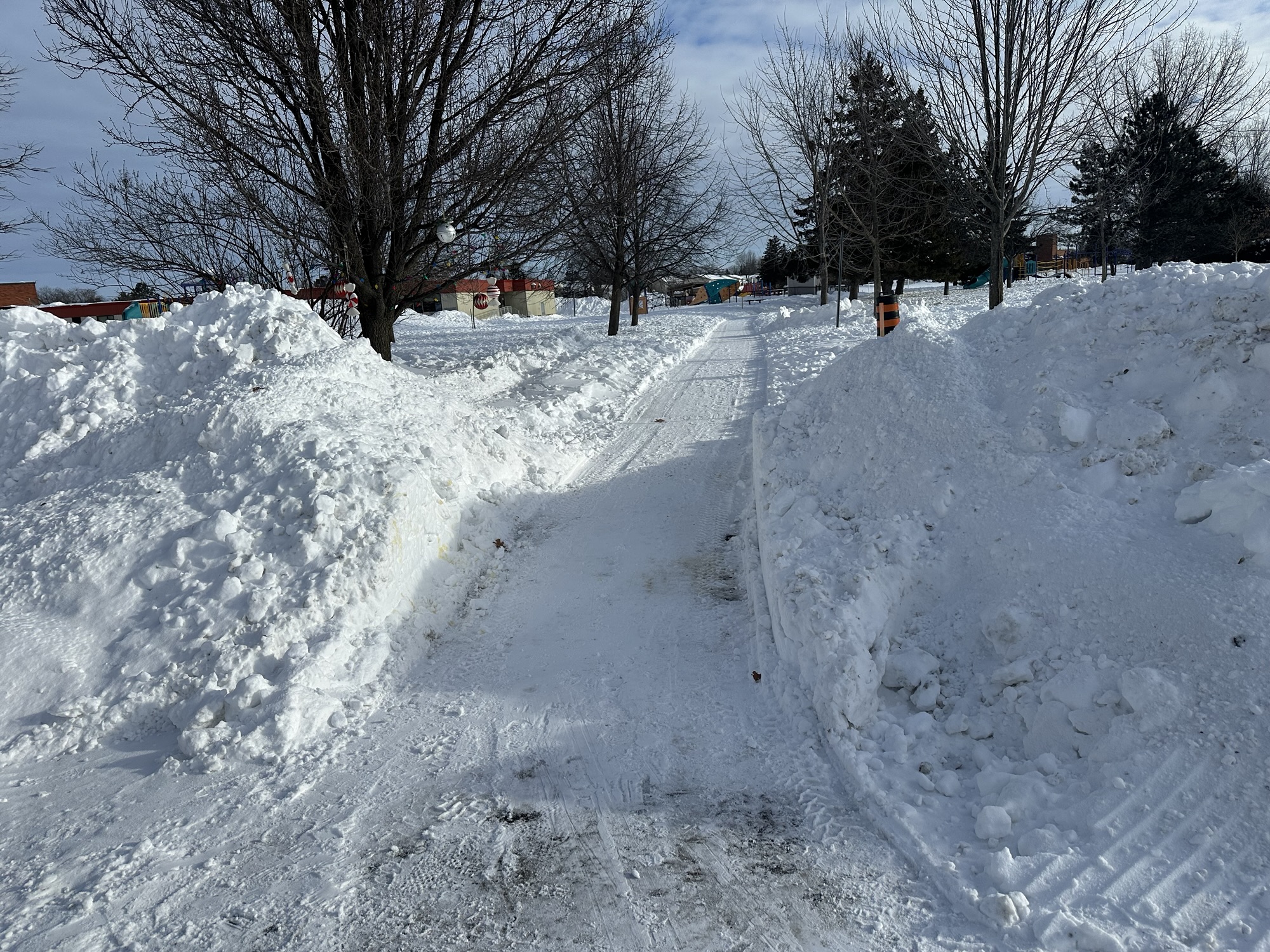
Photo taken on Feb 19, 2025 near my house. Massive snowbank with a plow track through it.
I want to give a massive shoutout to the city of Ottawa for continuing to maintain the parts of this path system that they’ve committed to, to the best of their ability (and it has really been solid!). This has made school drop-off every day this winter on foot way easier (not to mention getting around the community whenever we need to!).
In past years before these paths were maintained, when I was bringing my kids to kindergarten and daycare, if (when, realistically) it snowed a bunch, this would look very different. You can basically picture the exact landscape from this picture, except instead of having a neat path cut through it, it is just a giant impassable mountain.
The unspoken but excellent thing about this end result (a walkable path system) is that typically the paths are cleared very early in the process, within 4-6 hours of the snow being done, and sometimes while snow is still falling. Later, since this connects to a side street that isn’t cleared very often, a plow will usually come by and clear the whole street. That street clearing tends to leave a giant snowbank piled right in front of the mouth of the path, which obviously isn’t ideal. In this case, though, the path plow has been excellent about coming back within a short time after the plow has come to clear the path again, which leads to the image you see at the top of this post.
This snow clearing makes this path walkable and gives many community residents access to the neighbourhood and nearby schools, without requiring people to get around on short trips using only their cars. It also gives the active older population of the community a safe way to get moving in the fresh air without resorting to walking on the streets or risking falling trying to trudge through deep or dense snow.
The fact that the city has prioritized maintaining these connections has made a huge difference in the walkability of the community, and hopefully we will be able to get more paths in the area upgraded to be plowable so the whole extensive park system can all be accessible through the winter.
Great work!
Contrast the extremely clear and accessible path above with the situation 2 years ago in January when I first started asking about this:
Photo taken on January 26, 2025 near my house of a gigantic snowbank with a narrow path around it.
This is basically the same view as above except not only was the path not cleared, but you had to blaze a trail of your own around a literal mountain to get through, only to need to trudge through deep snow on the other side as well to get to school.
I could make it through here, but my kids definitely weren’t making the walk with a toboggan to pull them in, and it was a huge workout even as a relatively fit person in my 30s. It is SO much better now.