It was a real pleasure to sit down with Ben Durham on the “Wheels and Beyond” podcast. The conversation started off with the interesting way we connected through his sister, Jamie, who happens to be a colleague of mine. It was reassuring to learn I wasn’t the only one doing the daily commute without a car; finding that shared experience with Jamie was what sparked this whole conversation.
I got to share my “mobility story,” starting from my university days in Ottawa and how, even after moving to the suburbs in 2019, I’ve tried to maintain a lifestyle that doesn’t revolve around a car. We sold our second car during the pandemic, and honestly, I haven’t missed it. My cargo bike has been completely life-changing. It’s not just for my 20km commute; it has just plain become our second vehicle. I talked about how it’s the “minivan of bicycles”, perfect for hauling everything from kids and groceries to cases of Girl Guide cookies.
A big part of our discussion focused on the challenges and opportunities of suburban living. I explained how moving to Orleans with young kids opened my eyes to how car-centric design can make it difficult to build community and access amenities without driving. It was rewarding to share how my own kids are noticing the benefits of biking—the friendly interactions with neighbours, the freedom from traffic jams—things they just don’t experience from the backseat of a car.
This experience is what motivated me to start LessCar.ca about a year ago. I explained to Ben that the core idea isn’t about being “anti-car,” but about embracing “less car”. Cars are a powerful tool, a “superpower” as I called them, but that doesn’t mean it’s a good idea to use and rely on them for every single trip. By making conscious choices to walk, bike, or take transit more often, we save money, get exercise, and build a stronger community.
I was particularly keen to discuss the structural issues that hold our neighbourhoods back. We delved into how outdated zoning bylaws in many suburban areas prevent the evolution of our communities, making it illegal to build the kind of mixed-use, walkable places that so many people want (even if they may not realize it). This is a topic I’m passionate about, and I mentioned the “modernizing Orleans” package I’ve been working on to advocate for changes to our local transportation and zoning regulations. It’s crucial that we allow our neighbourhoods to adapt and grow incrementally.
We ended on a hopeful note. I’m genuinely optimistic about the future, especially with the LRT extension coming out east to Orleans, which will be a game-changer for connecting the suburbs to downtown without as strong a compulsion to drive. The City of Ottawa has some excellent high-level plans, like the 15-minute neighbourhood concept outlined in the Official Plan, but the real challenge is overcoming public resistance and NIMBYism at the local level to actually get it done.
My main takeaway for listeners was a call to action: get involved. Go to your local community association meetings, talk to your neighbours, and advocate to the people in your community and elected leaders for the kind of neighbourhood you want to live in. The idea of “less car” is a positive one that benefits everyone through cleaner air, quieter streets, and safer, more connected communities. Even people stuck in traffic on the highway are wishing for less car.
Overall, it was a fantastic conversation, and I’m grateful to Ben for providing a platform to share these ideas. It reinforces the importance of continuing to push for more resilient, human-scaled communities across Canada and the world.
How a city organizes its space—its land use and population density—has a profound impact on its financial health and the daily lives of its residents. Denser, more compact urban areas are better able to generate tax revenue to pay for amenities and services because they accommodate more homes and businesses on less land. A single parcel of land with a multi-story building containing apartments or condos and ground-floor retail, for example, generates multiple times more tax value than the same-sized parcel with a single-story structure surrounded by a parking lot. At the same time, this concentration of services, amenities, and housing gives people a greater opportunity to live their lives with less reliance on a car. When workplaces, shops, schools, and parks are located close to where people live, walking, cycling, and public transit become convenient and practical choices for daily trips.
In this post, I’d like to make a comparison of two very different city streets that highlight the significant difference in tax revenue based on good and inefficient urban design.
First: Kent Street in Centretown. Second: St Joseph in Orleans.
Measuring Efficiency
A helpful way to think about this is through the concept of land use efficiency, which is similar to the fuel efficiency of a vehicle. Just as a car can have good or bad gas mileage, land can be used more or less efficiently. While fuel efficiency is measured in litres per 100 kilometres (or perhaps miles per gallon), land use efficiency can be measured in dollars of tax revenue generated per hectare. With this measure, a bigger number means more efficient land use, a very practical consideration when it comes to what our city can afford at budget time.
As we established, fuel efficiency measures how far a vehicle will be able to take you for a given amount of gas. Land use efficiency, then, measures how much a given property will generate in tax revenue to pay for city services, amenities, and infrastructure based on the size of the given parcel of land.
This metric reveals how productively our land is being used to fund the essential city services we all depend on, and it will be the measure we use here.
The contrast between Kent Street and St. Joseph Boulevard is a lesson in the power of land use.
To start, let’s look at a 3-block wide section of Centretown around Kent/Bank Street (between Lyon and O’Connor). This is an area of mixed commercial and residential use, and it yields $16.8 million in annual municipal taxes from about 40 hectares according to the city’s tax data. The chosen section of Centretown features some apartments and condos but specifically doesn’t include the core downtown blocks with the most tax efficient high-rise office towers. This makes for a great comparison because it’s a sort of middle ground between the densest parts of the city and the sparse suburban landscape.
2024 Municipal Taxes: $16.8 M Area: 39.5 ha Revenue Density: $ 426k / ha
Kent and Bank Streets, with a mix of residential apartments and condos, ground-level retail, and more pedestrian- and bike-friendly infrastructure, creates a highly efficient and valuable urban landscape. Every block is maximized to house lots of people, generate economic activity and, consequently, provide a ton of value for the city. In addition, the people who live there who can probably get away with far fewer (or no) car trips in a given week.
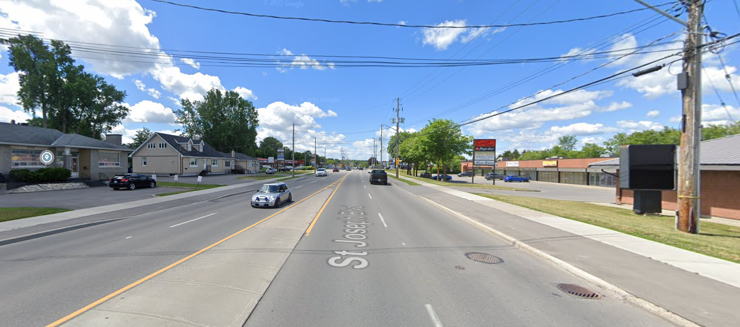
Suburban “Density”: St Joseph Boulevard
By contrast, a key commercial corridor in Orleans, St. Joseph Boulevard, provides only $16.5 million in tax revenue from a much (8 x) larger area of 225 hectares. St Joseph is literally the heart of Orleans’ business district, and it represents a more traditional suburban model for a shopping area. Characterized by single- or two-story commercial plazas, vast surface parking lots, and a car-centric layout, its land use is dramatically less intensive.
2024 Municipal Taxes: $16.5 M Area: 225 ha Revenue Density: $73k / ha
This sprawling design generates significantly less tax revenue per hectare, effectively nobody lives on the street proper, and the street is just simply not a nice place to be outside a car. This increased distance to get from where people live to where they need to go means people living in Orleans are far more dependent on cars for more of their weekly trips, which means cost of living is almost necessarily higher, even if you factor in high housing costs for suburban homes.
The Math
Street Area
Kent/Bank Street
St Joseph
2024 Municipal Taxes
$16.8 M
$16.5 M
Developed Land Area
39.5 ha
225 ha
Revenue Density (taxes / developed area)
$ 426 k / ha
$73 k / ha
This results in a revenue density of $426,000 per hectare for Kent and Bank Streets versus $73,000 for St. Joseph. All of this means St Joseph offers 1.8% less tax revenue over a 5.7 x larger area, meaning land developed like Centretown is 5.8 x more valuable to the city.
This gap suggests a considerable opportunity for Ottawa’s eastern communities. Adopting principles of densification and modern urban planning could allow Orleans to increase its tax revenue and encourage local economic growth.
Comparing These Directly
If we overlay the size and shape of our Centretown area over St Joseph (rotated, of course) at the same scale, you can see the tremendous size of the St. Joseph Business District (Heart of Orleans) in comparison.
Keep in mind that the smaller Kent/Bank Street footprint (which doesn’t include the portion of the street with high-rise office towers that make up the part of this area further north into downtown) brings in slightly more tax revenue for the city than does ALL of the St Joseph region in significantly less space. For its size, Centretown outperforms St Joseph by a factor of 5.8x. Think of what the city could do with tax revenue coming from that portion of Orleans if the whole area were a similar density and distribution as Centretown.
Applying Centretown’s revenue density value to St Joseph and surroundings would bring in $96 million in annual municipal tax revenue, an increase over today of $79 million, which would enable things like better city services and amenities, more frequent bus service, all kinds of needed investments to make the area shine. This is just one stretch of one suburban corridor that can bring in that much additional tax revenue, imagine if other parts of the suburbs made even small but meaningful steps towards additional density and mixed-use neighbourhoods.
What Can We Do?
The good news is that the vision for a more prosperous and dynamic St. Joseph Boulevard is not a distant dream. The City of Ottawa has laid the groundwork for change multiple times already, first through the St. Joseph Boulevard Corridor Study early in the 2000s, and now through the Orléans Corridor Secondary Plan. These plans explicitly call for the transformation of the boulevard from a suburban commercial strip into a more intensely developed, mixed-use urban district. The goal is to create a “15-minute neighbourhood” where new and existing residents can access daily needs within a short walk, supported by improved transit and a more inviting public realm.
The Heart of Orléans Business Improvement Area (BIA) is a key partner in this revitalization effort, advocating for the interests of local businesses and promoting the area as a destination for arts, culture, and unique shopping and dining experiences. The BIA’s involvement is crucial in ensuring that redevelopment meets the needs of the existing community while attracting new investment.
It’s not to say this transformation will be easy, but the end result will be a layout that works for more people and the increased tax revenue in turn funds other improvements the city needs and is planning for.
The city’s urban design guidelines that apply here provide a clear roadmap for how this transformation can be achieved. These guidelines emphasize:
Mixed-Use Development: Integrating residential units above ground-floor retail and commercial spaces.
Increased Density: Encouraging the development of mid-rise and high-rise buildings, particularly around future transit stations.
Pedestrian-Friendly Design: Wider sidewalks, street trees, and reduced setbacks to create a more inviting and walkable environment.
Reduced Parking Requirements: Shifting away from large surface parking lots in favor of on-street parking and structured parking to free up land for more productive uses.
The financial upside of this shift is undeniable. If St. Joseph Boulevard could even begin to approach the revenue density of Kent Street, the resulting increase in municipal taxes would be transformative for Orleans and the city as a whole. This new revenue could be reinvested into the community to further enhance infrastructure, improve public services, and fund new amenities.
Modernizing the layout of our suburban districts is not just about increasing tax revenue; it’s about building more sustainable, resilient, and enjoyable communities. By strategically intensifying development along key corridors like St. Joseph Boulevard, we can create a more prosperous future for Orleans, one that is less reliant on cars, more supportive of local businesses, and ultimately, a more vibrant place to live, work, and play. The blueprint for a more valuable boulevard is already in our hands; it’s time to build it.
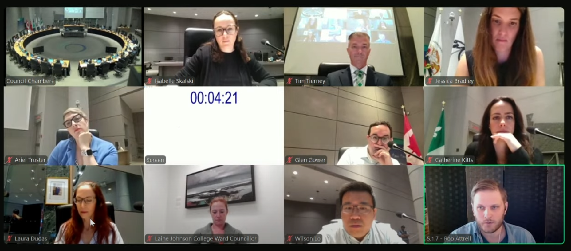
On Thursday, I had the opportunity to speak to the Public Works and Infrastructure Committee (PWIC; formerly the Transportation Committee) about the final draft of Ottawa’s Transportation Master Plan. When you do this (which I had never done before), you get 5 minutes to speak on the item, and councillors can then ask you questions about what you’ve said. This was a great experience, and though prep was quite a bit of work, I think it was worth it.
I was glad to get some good feedback from councillors, and I hope this opens/continues a dialogue on reducing car dependency in the suburbs as this plan and our zoning by-law reviews are completed for the city. Below, I’ve embedded the City Council video, timestamped to the start of my comments, along with the full text of my comments below.
Good morning,
Thanks for giving me the time to speak with you today, this is my first time delegating.
My name is Rob Attrell, and I am a resident of Convent Glen North in Ward 2 in Orleans. I’m also a Board Director and volunteer with the Convent Glen-Orléans Wood Community Association. I live in the suburbs, I have three young kids, and along with our minivan, my family’s second vehicle is a cargo bike. I’d really like to spend less of my time and money on driving, and research consistently shows the only way to reliably reduce car dependency and traffic congestion in the long term is to enable and prioritize viable alternatives to driving.
First, I’d like to acknowledge all the work that city staff and my councillor has put into the Transportation Master Plan, and I want to say that I strongly support the vision this plan puts forward. The policies in our Official Plan and in Part 1 of the TMP correctly identify what’s needed: a sustainable transportation network that supports more efficient land use, more housing, and mixed-use, walkable neighbourhoods. The problem is that the investments laid out in the Capital Infrastructure Plan for Orleans in particular, and for the suburbs in general do not come anywhere close to funding that vision. And as the inimitable city planner Brent Toderian says, “The truth about a city’s aspirations isn’t found in its vision. It’s found in its budget.” There is a profound disconnect here between the city’s stated goals and its planned investments.
This is especially critical now, during the once-in-a-generation review of our Zoning By-laws. A great transportation plan is meaningless if it isn’t funded, and a great zoning plan is impossible if it isn’t supported by a robust multi-modal transportation network. On the zoning side, this means legalizing corner stores in addition to a larger mix of housing types and densities within our neighbourhoods. On the transportation size, a variety of nearby destinations give people more reasons to skip the car trip. Without these places integrated into local communities, even the most reliable LRT or safest bike lane is just a path to another overbuilt parking lot. We cannot achieve our housing and climate goals without a transportation system that gives people real alternatives to driving to most destinations.
The arrival of the LRT in Orleans is another generational opportunity. But its success hinges on residents getting to stations without a car. Part 1 of the TMP imagines our major arterial roads—like Orleans Boulevard, Innes Road, Tenth Line, and St. Joseph—as true multi-modal corridors. But Part 2 only funds a few disconnected pieces. This isn’t building a network; it’s a one-off gesture.
If we approve this plan without the funding to match its ambition, we are paving the way for densification in the suburbs without the multi-modal transportation choices needed to sustain it. This risks creating vertical sprawl—densely populated neighbourhoods that are still wholly car-dependent. Neighbourhoods built like this will suffer from even worse congestion than suburban residents complain about now. The current plan builds infrastructure for a city we say we don’t want.
So, my ask of the committee is this: Direct staff to level up the capital plan so that it actually funds the vision already laid out in the Official Plan and the TMP. We need a network that centres transportation on walking, biking, and transit, where cars are just one tool among strong alternatives. And finally, our plan must be flexible. The city needs the ability to massively accelerate our sustainable transportation plans as the environmental and political climates continue to change. We must be able to adapt quickly, and with the urgency we’ve seen in cities like Montreal and Paris. Let’s not just approve a vision; let’s commit to building it.
—
There is a fundamental connection between transportation and land use which means that a transportation plan alone can only move the needle so much on the choices people make in how they move around the city. We cannot build a sustainable transportation system on a foundation of unsustainable land use.
The city is currently going through consultations (New Zoning By-law | Engage Ottawa) to renew plans for upcoming zoning bylaw changes. Here are a couple of changes to zoning that would radically improve the ways we interact with our community and the city.
I am writing to provide feedback on the new Zoning By-law, and to advocate for a comprehensive, forward-thinking approach to reforming our suburban neighbourhoods. The current zoning review presents a generational opportunity to address the interconnected challenges of housing affordability and municipal fiscal sustainability at their root, and I believe a bold vision is required to build a more resilient and equitable Ottawa for the future.
Our city’s traditional reliance on low-density, car-dependent sprawl in the suburban transects is no longer tenable. It creates a significant structural deficit where the tax revenue from these areas cannot cover their long-term infrastructure costs, while simultaneously limiting housing choice and driving up prices. To counter this, I urge you to consider two specific, transformative actions city-wide: first, to establish a more permissive baseline for all neighbourhoods by eliminating our most restrictive residential zones (like N1/N2) in favour of a zone that allows for gentle density, such as what is presented in N3; and second, to integrate permissions for low-impact, neighbourhood-serving commercial uses (the ‘-c’ designation) directly into all residential zones.
These changes are not about radical transformation overnight, but about decriminalizing the gradual, organic evolution of our neighbourhoods over decades. This will allow our communities to adapt, add needed housing, and develop the kind of vibrant, 15-minute communities envisioned in the Official Plan.
Specific Examples in Convent Glen
In my neighbourhood in Convent Glen North, I’ve put together what I imagine this would look like, with overlapping improvements to the transportation network and the zoning bylaws.
Legalizing low-impact and mixed-use upzoning throughout the suburban transect would enable small-scale, thoughtful, hyperlocal businesses to thrive in Orleans.
I believe that corner lots (at the intersections, pictured here) are some of the best-positioned to be able to take advantage of creating multi-use buildings with ground-floor retail space without disrupting the neighbourhood. However, doing this piece-meal and in small ways will make the needed transformation to walkable neighbourhoods take way longer than just allowing such low-impact changes to be made anywhere in the suburban transect. I think given the insular nature of the particular block of Convent Glen North is uniquely positioned to take advantage of such a change, being bordered by the Greenbelt farms, the highway, and the Ottawa River. If we could access most amenities you need on a regular basis within the community, our reliance on being connected to the rest of the city by only a handful of highway crossings would be greatly reduced.