

This page is an overview of my feedback on the latest draft of the city of Ottawa’s Transportation Master Plan. There are three additional pages (linked below and in the relevant sections of the page) that complement the analysis.

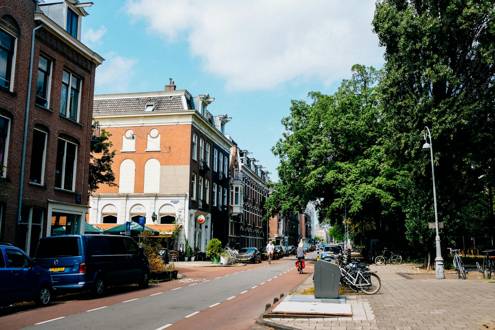
By focusing on active mobility and becoming a transit-first city, Ottawa has enormous potential to shift away from car dependence by reorienting infrastructure, policy, and land use toward walking, cycling, and transit. Below are ten revolutionary interventions that could reshape how Ottawa moves—dramatically reducing car mode share and making sustainable options the default choice for most trips.
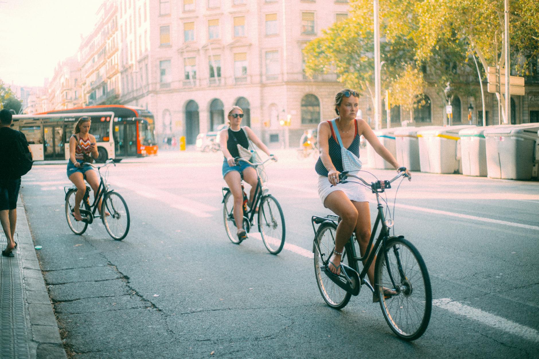
What to do: Design and implement an all-season network of protected, separated bike lanes that connect every ward, prioritizing routes to schools, transit stations, and commercial corridors. This network should feature physically protected intersections, snow-cleared paths, and strong wayfinding.
Why it works: Safety is the #1 reason people don’t bike. Where cities like Paris and Vancouver have installed citywide protected lanes, cycling mode share has doubled or tripled within a few years. Ottawa’s current fragmented bike infrastructure is great in places, but to shift trips out of cars, it needs to be safe, fast, and connected everywhere.
What to do: Redesign major corridors like Bank Street, Montreal Road, and Baseline Road with dedicated bus lanes, physically separated bike lanes, widened sidewalks, and traffic-calming measures. Limit private vehicle lanes and restrict curbside parking during peak hours.
Why it works: Streets are public space—we’ve just been using them inefficiently. Giving transit and active transportation the majority of the road space increases throughput, reduces collisions, and shortens travel times for the majority of users. When done well, transit-first streets become vibrant, people-friendly destinations.
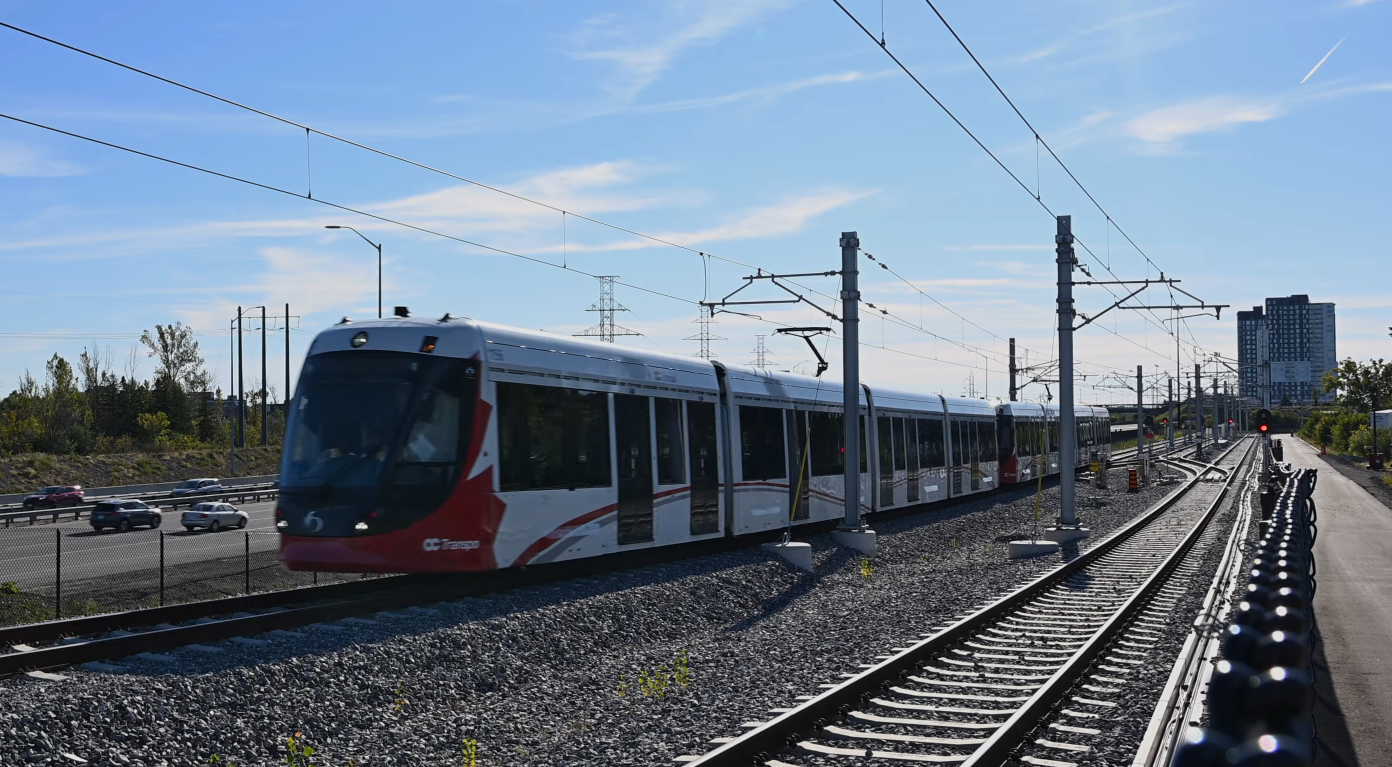
What to do: Build out a network of fully separated, signal-prioritized BRT lines with all-door boarding and off-board payment—especially in areas not served by rail. Treat BRT as “surface rail”: fast, frequent, and reliable.
Why it works: BRT is faster and cheaper to deploy than rail and offers rail-like service when properly implemented. Ottawa pioneered this with the Transitway; expanding and upgrading this system would deliver immediate reliability and speed gains without the delays of rail construction.
What to do: Remove minimum parking mandates for all new development citywide, including in suburban zones. Encourage shared parking, unbundled parking leases, and redeployment of existing lots for better land uses like housing or mobility hubs.
Why it works: Parking minimums incentivize car ownership and sprawl. Dropping these mandates cuts building costs, discourages car ownership, and frees up land for walkable development. Cities like Buffalo and Minneapolis have seen a measurable decline in car use and housing costs after making this change.
What to do: Develop a grid of ultra-frequent (5–10 min) bus and train routes that serve as the backbone of the city’s transit system. These should be easy to navigate, reliably fast, and run all day—including evenings and weekends.
Why it works: Most trips don’t go downtown anymore. A high-frequency grid simplifies trip planning, reduces transfer penalties, and makes transit work for trips across town. Transit agencies from Houston to Barcelona have seen ridership surge after adopting this approach.
What to do: Reform zoning to allow mixed-use, mid-rise development along every major street and near all transit stops. Enable corner stores, daycare, clinics, and housing in formerly single-use zones to support car-free lifestyles.
Why it works: You can’t walk or bike to things that don’t exist nearby. Enabling small-scale mixed-use infill throughout the city cuts the need for car trips and supports active transportation. Cities like Portland and Paris are leveraging this model to reshape travel patterns toward walkability.
What to do: Develop a unified app that allows users to plan, book, and pay for trips combining OC Transpo, bike-share, e-scooters, carshare, and on-demand microtransit—complete with real-time updates and dynamic routing.
Why it works: People are more likely to use sustainable transport when it’s seamless and easy to understand. MaaS platforms in Helsinki and Vienna have increased mode shifts by simplifying multimodal travel and reducing the need to own a car.
What to do: Close streets around schools to non-local traffic during arrival and dismissal times. Improve pedestrian crossings, reduce speed limits to 20 km/h in school zones, and install traffic diverters to reduce through traffic.
Why it works: Kids are more likely to walk or bike to school when their route is safe. This not only reduces school-related congestion and emissions but instills lifelong active travel habits. Cities like Montreal and Milan are already leading in this area.
What to do: Build secure, covered bike parking at every major transit station, shopping hub, and public institution. Include lockers, repair stations, and showers at workplaces and campuses.
Why it works: Lack of secure parking is a major barrier to cycling. Studies show that people are twice as likely to bike if secure facilities are available. This is especially important for commuters, families, and e-bike users who need to protect high-value bikes.
What to do: Convert low-traffic residential streets, rail corridors, utility rights-of-way, and riverside trails into an all-ages greenway network that links schools, parks, transit, and commercial areas. Limit car access, add greenery, and design for social use.
Why it works: Greenways are more than transport—they’re public health infrastructure. They provide safe, low-stress routes for walking and cycling, encourage social connection, and increase nearby property values. They’ve been transformative in cities like Bogotá and Rotterdam.
By taking a network-wide, people-first approach to mobility—centered on comfort, speed, and accessibility—we can make walking, biking, and transit not just viable alternatives to driving in Ottawa, but the preferred choice for most trips. This isn’t just a dream—it’s within reach, and cities around the world are doing it already.
Engage Ottawa just launched a new wave of public consultations on making the city more green and resilient. I’m sure I won’t be pitching any new ideas, but I went through the exercise of putting together a few key thoughts on this. Go ahead and steal any of these ideas when you go fill out their survey.

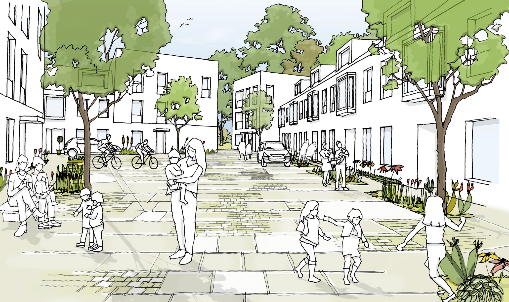
Reconfigure zoning and land use so that every resident can access work, shops, parks, schools, and healthcare within a 15-minute walk or bike ride, reducing car dependency and transportation emissions significantly.
This compact urban form also boosts local economies by keeping spending in neighbourhoods and improving public health through daily physical activity.
Pretty much all of these ideas work best if all cars all the time is deprioritized in the transportation network so other modes of transportation can fill in gaps in a more sustainable way.
Implement dynamic tolls on private vehicles entering the core at peak times, reinvesting revenues into transit and cycling infrastructure; London’s Ultra Low Emission Zone reduced central traffic while raising money.
Complement with pedestrian-only streets on select avenues to activate plazas and support outdoor cafés, markets, and pop-up green spaces.
Formalize allotment gardens and edible streetscapes on public land—transforming boulevards, medians, and underutilized plots into fruit-tree alleys and vegetable beds managed by neighbourhood co-ops.
This fosters local food security, slashes transportation emissions from food imports, and builds social cohesion through shared stewardship.
Convert sprawling parking lots and underused retail shells into high-density, climate-positive villages with energy-efficient apartments, coworking labs, vertical farms, and daycare facilities.
By repurposing existing structures, the city saves on new infrastructure costs and curbs sprawl-related service expenses.
Extend and promote the EquiPass program—already offering half-price fares for qualifying households—to full zero-fare status for anyone below the low-income threshold, ensuring that cost is never a barrier to transit access.
Studies show that eliminating fares for low-income groups can increase ridership while reducing social inequities in mobility.
Partner with Ottawa-Gatineau’s upcoming bike-share feasibility study to launch a city-funded e-bike lending program, offering deep subsidies or free membership for those earning under the median income.
Global pilots show e-bike subsidies can shift short car trips to cycle, cutting household transport costs.
Install “mobility hubs” at every major transit interchange, offering shared bikes, e-scooters, carshare, parcel lockers, and real-time trip planning kiosks in one location. Part of this plan necessarily involves making sure safe and efficient connections exist across the city to make this hub function.
Integrated hubs reduce first-/last-mile barriers and can boost public transit usage.
Establish a suburban consolidation centre where deliveries are sorted and then distributed into the core via e-cargo bikes—already under pilot in Ottawa—to cut downtown delivery truck traffic and reduce road damage and emissions.
This model lowers logistics costs for local businesses.
Redesign select plazas and parking areas as bioswale parks that detain, filter, and slowly release stormwater, reducing sewer overflows and treatment costs.
Pair with permeable asphalt on sidewalks and local streets to recharge groundwater and mitigate urban flooding at minimal incremental cost compared to traditional paving.
Leverage flat rooftops of libraries, schools, and government buildings for community solar farms, tied into local microgrids that can island during extreme weather. Such systems reduce peak-hour grid demand, lowering city-wide electricity costs and enhancing resilience during blackouts.
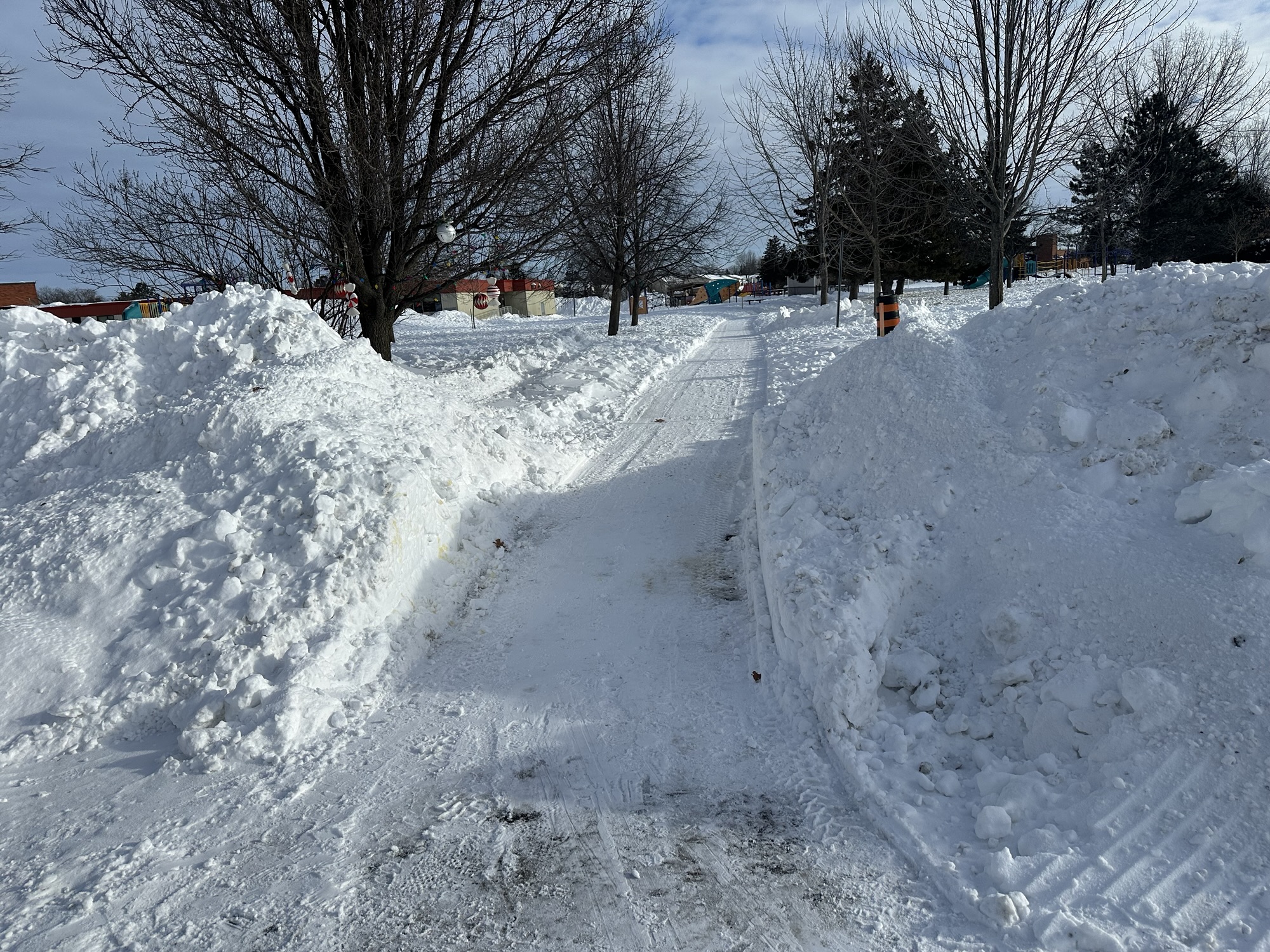

I want to give a massive shoutout to the city of Ottawa for continuing to maintain the parts of this path system that they’ve committed to, to the best of their ability (and it has really been solid!). This has made school drop-off every day this winter on foot way easier (not to mention getting around the community whenever we need to!).
In past years before these paths were maintained, when I was bringing my kids to kindergarten and daycare, if (when, realistically) it snowed a bunch, this would look very different. You can basically picture the exact landscape from this picture, except instead of having a neat path cut through it, it is just a giant impassable mountain.
The unspoken but excellent thing about this end result (a walkable path system) is that typically the paths are cleared very early in the process, within 4-6 hours of the snow being done, and sometimes while snow is still falling. Later, since this connects to a side street that isn’t cleared very often, a plow will usually come by and clear the whole street. That street clearing tends to leave a giant snowbank piled right in front of the mouth of the path, which obviously isn’t ideal. In this case, though, the path plow has been excellent about coming back within a short time after the plow has come to clear the path again, which leads to the image you see at the top of this post.
This snow clearing makes this path walkable and gives many community residents access to the neighbourhood and nearby schools, without requiring people to get around on short trips using only their cars. It also gives the active older population of the community a safe way to get moving in the fresh air without resorting to walking on the streets or risking falling trying to trudge through deep or dense snow.
The fact that the city has prioritized maintaining these connections has made a huge difference in the walkability of the community, and hopefully we will be able to get more paths in the area upgraded to be plowable so the whole extensive park system can all be accessible through the winter.
Great work!
Contrast the extremely clear and accessible path above with the situation 2 years ago in January when I first started asking about this:

This is basically the same view as above except not only was the path not cleared, but you had to blaze a trail of your own around a literal mountain to get through, only to need to trudge through deep snow on the other side as well to get to school.
I could make it through here, but my kids definitely weren’t making the walk with a toboggan to pull them in, and it was a huge workout even as a relatively fit person in my 30s. It is SO much better now.

In many North American communities, the prevailing expectation is that driving is the primary, if not the only, way to get around. This assumption has shaped our transportation infrastructure in ways that often go unnoticed but have significant impacts on accessibility and livability. Streets and even whole suburban neighbourhoods are designed with cars in mind. Often neglected are the needs of pedestrians, cyclists, and public transit users, basically anybody who isn’t in a vehicle.
This car-centric approach can lead to a range of issues, from increased traffic congestion and pollution to reduced safety and mobility for those who do not drive. It can also cause issues when road infrastructure eventually needs to be replaced or upgraded, because a single road closure (for a crash or construction) in the wrong place can block traffic until it’s cleared up. With a more diverse transportation network, people can walk or bike past construction to nearby amenities or take the bus for longer journeys. And for people who don’t want to do that, driving around the blocked streets will be easier for them too. By examining the consequences of this expectation, we can begin to understand the importance of creating a more balanced transportation network that serves all members of the community.
Expectations play a crucial role in shaping urban transportation options. Currently, throughout the continent there is a widespread expectation that cars should be able to navigate almost anywhere with minimal delay and in the shortest possible time. This assumption heavily influences how transportation infrastructure is designed and maintained. It is extremely rare in North America to find communities where car isn’t #1 and any other transportation options are typically orders of magnitude less important in terms of planning
There are suburban streets (including the one my house is on) in my community and suburb where there are no sidewalks at all. When the community was built, the expectation was that everyone would be driving everywhere, and if people wanted to leave their house for a walk literally anywhere, they could walk in the street with the cars.
I have stood at my window and watched as an SUV pulls up to the curb (I live across from a lovely park, for which I am very grateful), and watched a mother get out of the car. She got a bike out of the trunk and her son out of the back seat. This woman (who I absolutely do not know) felt compelled by our road and/or path network to teach her child to ride a bike far enough from where they live that she couldn’t get there on foot, or possibly didn’t feel safe doing so. This is a symptom of community infrastructure that fails to meet the needs of its residents.
The system we’ve created and continue to rely on EXPECTS almost exclusively people in cars in many places. We give vehicles a literal red-carpet experience to move through our neighbourhoods, but don’t afford any of the same luxuries to people walking, cycling, taking the bus, or using any other mode of transportation.
If we as a city and community can escape the car-centric design bubble and apply the same expectations we have for cars, trucks, and other vehicles to other modes of transportation, such as cycling and public transit, we can create a more inclusive and efficient transportation network. When a city anticipates that its transportation network will be used by a variety of modes—cars, pedestrians, cyclists, strollers, scooters, or buses—it becomes easier to design and prioritize infrastructure that accommodates all users, as well as to justify diversifying the network further.
In truth though, this is more nuanced than just a checkbox ‘there’ or ‘not there’ for sidewalks, bike lanes, bus routes, paths, etc. There are degrees of expectation for transportation infrastructure, and here again we see huge disparities in many suburban places in North America.
We have more than our fair share of spacious, 4-lane roads with speed limits of anywhere from 40 up to 80 kph. Lots of these roads are often lined with massive parking lots leading to shops with almost nowhere for people to exist in between. This is because the whole system is designed for the expectation that people will drive ‘there’ (wherever ‘there’ is), do whatever they need to do, and drive home. Sidewalks along these roads are basically never more than a few feet wide, and you sometimes (but definitely not always) get a 2–3-foot asphalt or grass buffer from the roads.
If a transportation network is instead designed with the expectation that pedestrians, cyclists, and buses will use it, the infrastructure must therefore be maintained according to those expectations, lest it be considered inadequate. This means ensuring routes (including paths and bike lanes, painted or separated) are clear of snow, free of obstacles, and safe for use. It means sidewalks should be wide and friendly and not right next to fast-moving and loud car traffic. It means buses and other public transit should be able to follow their routes without getting stuck in car traffic, and should offer frequent service and with a variety of local and commuter routes.
By setting these expectations, cities can create a more resilient, reliable, and user-friendly transportation system for everyone. Once this has started to change, when users can trust that their chosen mode of transportation is supported by the transportation infrastructure, they are more likely to get out and try to use it confidently. This almost inevitably leads to increased usage of alternative transportation options, reducing traffic congestion and promoting a healthier, more sustainable urban environment.
These expectations continue to be true regardless of the weather. Right now, for example, it’s mid-January and we’ve just experienced a pretty cold snap, with weather between -10 and -25 Celsius for the last 3-4 days. At the moment in Orleans, where I live, we have had to bug and poke and plead to get some of the main community paths cleared in the winter. This was only possible due to recent asphalt upgrades on the paths to fit them for modern standards and to have the mini-plows drive over them without ripping up the pavement.
However, what minimal active transportation networks we have access to in better weather, other than the paths I just described, are not maintained at all. When transportation infrastructure is maintained in the winter according to the expectations of its users, people use it. This is true of cars and roads, and also the other transportation options we’ve been talking about. When there is a blizzard in Ottawa, road crews ask drivers to stay off the road outside of emergency situations, because driving in these conditions is less safe than once roads are cleared. Without maintenance in the winter when necessary, none of our transportation options are safe or accessible.
If the city took the transportation network seriously all the way from Kanata to Orleans, with separate and safe infrastructure for people outside of cars, maintaining that infrastructure through the year could be an easily achievable goal. This would have the added benefit of helping us mitigate the effects of climate change and traffic congestion (and more) over time. It is not and probably never will be for everyone to cover long distances in the winter on foot or on bike, but for short (2-5 km) trips unless it is extreme cold warning levels of cold, being on a bike is actually quite nice. We are so used to being cold in the winter because we are using no energy to keep ourselves warm, but on a bike, you’re moving and it’s much easier to not get cold, especially if you’re prepared for it.
If you spend your days driving around in a car in the winter, you’re much less likely to be prepared to be outside for more than a couple of minutes. If you’re dressed to be outside though, it truly doesn’t take much to stay warm, especially if you’re moving on foot or by bike. Combine changes to the transportation network with zoning changes to slowly allow small businesses to build and operate inside our single–family-home-exclusive neighbourhood, and it is certainly much easier to imagine running errands and getting around the community without relying on a car.
Setting clear expectations for diverse transportation modes and maintaining the infrastructure to support them can transform urban transportation networks. By doing so, cities can ensure that all users have access to safe, efficient, and reliable transportation options. This is not something that is likely to change overnight, but when presented with the opportunity as a community, we should jump at it. Funding for future-thinking projects like this don’t come around often.

The title of this post references the old adage, “When all you have is a hammer, everything looks like a nail.” This saying is especially true when it comes to transportation in suburban Ottawa.
If all you have is a car, everything looks like a drive.
I have come to reject this car-dependent framing, not because I think cars should play no role in the suburban transportation network. Instead, I believe that more viable transportation options—walking, public transit, cycling—will give residents more tools to make sustainable choices when getting around their communities. Coupled with relaxing zoning restrictions to allow small businesses like cafes or convenience stores to exist near where most people live, this creates a recipe for making it possible for some people to go about their daily routines without needing a car.
I often use the following line when discussing transportation in my suburb with friends and acquaintances: “If you’re sitting in stop-and-go traffic on the highway, do you want more car, less car, or the same amount of car?” Even if begrudgingly, everyone ultimately tells me they want fewer cars. Despite the fact that many suburban residents aren’t ready to personally use their own vehicles less (or get rid of one if they have multiple), hopefully, most people can get behind the idea that someone else should theoretically drive less, even selfishly.
I’d like to revisit the hammer/nail metaphor from earlier. Imagine you have been given a hammer and are now wandering around a construction site hitting things with it. From your perspective, this is perfectly reasonable, and to be honest, it’s literally all you can do. You have no other options. It doesn’t necessarily make sense to hit a screw or try to cut drywall with a hammer, but you’re making the best of what you have.
Now, imagine the foreman comes along and shows you a workbench with a screwdriver set, some wrenches, a saw, a belt sander—a whole shop full of different tools with different purposes. Suddenly, you don’t have to use a hammer for everything. You can use a variety of tools to get the job done better. I’ll also point out that even though you have a whole workshop of tools laid out in front of you, sometimes you still actually need a hammer.
Now we can bring this metaphor back into the real world and apply it to our transportation network. In a suburban environment where walking, cycling, public transportation, and more are all supported, made safer, and encouraged where appropriate, there is less car traffic to get stuck in. You might be able to sell or not buy/finance that second or third family car. You might actually appreciate having a network of sidewalks and paths, bus or bike lanes, real transportation options that meet a variety of needs.
Of course, the final lesson of the metaphor is the most important to keep in mind. Even in an environment with many transportation options, sometimes, for some people, a car/van/truck may be the most sensible option for a particular trip. When my family of five goes to a restaurant five kilometers away in a minivan, or I am helping a friend move and letting them use my truck, these are the most sensible transportation options for those trips. However, the same can’t be said for a solo grocery trip 1.5 km away for a few items, visiting a friend a few blocks over, or taking the kids to swim lessons across the highway. Another huge example would be taking your personal vehicle alone 10-20+ km to work and back each day on a route literally thousands of other people are already taking at the exact same time as you.
The transportation systems that underpin the vehicle network already have lots of room for modularity (rear/roof racks, trailers, fold-down seats, taxis/rideshare, rental cars/vans, car seats, etc.) because not every driving situation requires the same tools. The same can be true for a multi-modal transportation network. You can complement the long list of motor vehicle modularity above with accessible public transit, city or cargo bikes with baskets or panniers, bike trailers, bikeshare, wide, well-maintained and connected sidewalks and paths—the list goes on. By focusing on and primarily funding (and subsidizing) only the car network in the suburbs, we are missing an opportunity to make use of a whole toolbox full of different options to get around.
The next time you see someone advocating for more transportation options in the suburbs, keep in mind that since the dawn of the automobile, nobody in their right mind has ever suggested that personal or professional vehicles should not be allowed anywhere or for any reason. The staunchest active and public transportation advocates all understand and acknowledge that options are a good thing and cars, vans, and trucks of all sizes in moderation are a vital part of a healthy and accessible modern city when necessary. However, the dose makes the poison, and if these are your ONLY transportation options, you’re going to experience the downsides (traffic, cost, pollution, crashes) as well as the advantages (comfort, flexibility, convenience, at least by certain measures) of car dependency. Life is a process of balancing tradeoffs, and we as a community can choose resiliency and sustainability over instant convenience and perceived independence from one another (boy do I have thoughts on this) if we so choose.

Today, I’d like to share an idea with you. This might be something you have never thought about before, and in fact it may be a lot of work up front to convince you that thinking about this is even worth your time. If you’ve felt at one time or another – over the last 5, 10, or even 20 years perhaps – like something fundamental is missing from your community, come along for this ride with me. And if you *don’t* have or haven’t ever had this feeling, I hope you will hear me out, and I’m curious if you find yourself nodding along. It may be a winding road, but I think there is a lot of value to following it.
Obviously, anybody reading this is bringing with them their own life experiences and unique history. Some of our human experiences are shared by almost everyone, while others are quite rare and won’t be relatable to as many people. I can only really speak from my own experiences, so you may have to either put yourself in my shoes or map your own life to my history to really understand what makes me feel this way.
I was raised in a central urban community mostly in the 90s and early 2000s in Calgary. While I was in that situation, as a kid, I wouldn’t say I cherished the experience, but I certainly made the most of it. The furthest I ever had to go to get to school was 3.5 km to get to high school, and it was a calm, quiet ~15-minute bike ride. I would frequently walk to school as well, and I could get anywhere I needed to go in the city on bike or by public transit.
I didn’t realize it at the time, but growing up in this environment, self-sufficient without a car in a community that had other good options, prepared me very well for not needing a car as an adult either. My first job was within easy walking distance, and every job I had in Calgary was close enough that I could walk, bike, or take the bus/train. I got my learner’s driving permit at 14 (as was/is? the legal age in Alberta), but I didn’t actually get my full driver’s license (nor did I need it) until my mid/late 20s because I didn’t need to drive anywhere, and I had other good options to get around. For example, Calgary built an LRT for the 1988 Winter Olympics and has continued to extend and improve it over the decades.
Even when I moved to Ottawa in 2006 for university, I lived in at least a half dozen residences and apartments before moving into a condo with my wife in 2014. All of these places before the condo were within a 10-20 minute walk to university campus and to the places I worked. I didn’t have a car, and I certainly wasn’t going to buy one without a license or a need for it. Even when I did move out near the Montfort hospital to the condo, I would take the bus to work on the worst weather days, and still most of the year I would bike or even rollerblade downtown. I would drive in occasionally (we’re talking 1-2 times a year at most when I needed to bring something heavy or awkward to the office), but in my entire life I have never routinely commuted anywhere by car.
In 2019, my wife and our 1-year-old daughter moved to Convent Glen North. It was a major change in my life, but it was always pitched as the ‘endgame’ of city life to buy a house and move to the suburbs. You have so much space for yourself and your family, and the suburbs are littered with shopping centres and “main streets” with all the amenities that seem like they’re trying their best to feel a little like the ones downtown, as long as you don’t look that closely.
Fast forward to 2024, and I have a stable job and have fully settled into suburban routine. The pandemic helped a lot with that settling process, as our home became the office, as well as the daycare for quite a while. We are now a family of 5 starting to attend the school we can walk to while only crossing our own street and the park, which really makes it feel quite urban most days. We have a lot of space that feels like it is truly just ours, but over the last year or two, the whole rest of my life experience I described earlier has been sitting in the back of my mind, brewing up thoughts and feelings.
When I said earlier that I can only speak from my own experiences, here is where those experiences shape my feelings about this pocket of the suburbs. If I had to describe the feeling in a single word, I would call it isolating. I’m a strong introvert, so it’s not like I want to be friends with and talk to everybody all the time, but actually meeting and chatting with your neighbours feels like an anomaly more than how it is supposed to work. I have some of my own feelings about the reasons why this is the way it feels, and I’d like to try to break it down now.
I think calling human interaction in the suburbs an ‘anomaly’ is sort of the perfect way to describe it. It’s not that you can’t see people who live near you, because you totally can, but it is almost deliberately outside the norm. Interactions with your neighbours only happen through coincidence or through direct and deliberate action. Living in the suburbs, where effectively everyone has at least one car, and some families have at least two or three, most of what you do to get places involves getting in your car (maybe even from inside your garage) and going somewhere that isn’t anywhere near your home, or even in your neighbourhood. Compare that to a condo subdivision or apartment complex, where there is shared space and sidewalks and elevators where you will definitely see and interact with people as a matter of course going about your daily life.
The way most suburban neighbourhoods are set up is very obfuscating to your sense of direction, with almost exclusively single-family homes clustered together in large, loopy patterns with no or very few higher-density housing options. If you want to go somewhere or do something, by default, you get in the car, because almost nothing is within walking distance. Compared to the grid that serves as the root system for older urban neighbourhoods, wayfinding by feel in a suburb requires repetitive trips and experience to learn how to get around or relying on GPS navigation. Between that and the cookie cutter approach to home design, many suburbs literally feel like a maze, relying on individual homeowners to make distinctive changes to their properties to give the neighbourhood any character at all. While this maze-like road design does tend to make walks for adventure and exercise more interesting than a grid layout, walking for transportation is inefficient and can be downright dangerous. Our suburbs, for example, don’t have any sidewalks at all on most local streets, and often have only one sidewalk on collector roads.
This winding and branching structure of suburban neighbourhoods has another detrimental side effect that makes cars seem like the obvious or only choice for transportation. Sending buses or any public transit through these communities is a massive logistical challenge, because the population density along any route is quite low, and there are no efficient straight-line roads for buses. It is possible to plan routes through these neighbourhoods, of course, but sending full-size buses through the neighbourhood every 30-60 minutes during peak times (like we do now) is not a recipe for people using the transit system for anything other than their commute, at best. For a transit system to really make sense as a funnel to get people to nearby business hubs (like St. Joseph) or connect to other transit (like the LRT to get downtown), something like a compact 16-24 seat community shuttle running every 10-15 minutes makes far more sense.
You will never be able to beat a car 1 to 1 on the basis of convenience getting almost anywhere in a city, if you already have a car and you don’t take into account that the decision to drive is not made in a vacuum. However, if you play that out in reality with a whole population, traffic drastically changes the equation, and suddenly your trip time can double or even triple just by leaving for your destination at a different time. Driving a car is wildly less convenient if you plan around a 10-15 minute commute to go downtown, and it ends up taking you over an hour because of traffic, a crash on the highway, and spending 10-15 minutes circling the block looking for parking.
The reason I feel compelled to describe the bait and switch convenience a car promises in this story is that transportation efficiency isn’t the only consideration you’re making when choosing how to get where you need to go. By getting into a car, you are (possibly without realising it) choosing to isolate yourself from society and the world around you. When a whole community (and their kids, mind you) choose to pile in to their individual cars every day to run errands, attend events, pick up dinner at the drive thru, commute to work and school, and do anything else you might want to do, it means absolutely no chance of incidental casual conversations with people in your immediate vicinity.
By getting in your car in the garage or driveway, rolling up to your faraway destination in a closed box, and seeing other people who’ve done the same, you end up having very little connection to the place you live. Not your house, but the immediate surroundings, the 10-20 closest neighbours. In contrast, when you choose to bike to your destination, or walk to the bus and wait at the stop, or do anything other than jump in the car, the opportunities for face-to-face time with people in your community multiply rapidly and almost instantly.
The ability to flip an ignition switch and get literally anywhere within a 50km radius in under an hour (rush hour notwithstanding) is nothing short of magical when you need it. But this magical power is not without its tradeoffs, and I think this is having a meaningful impact on quality of life in the suburbs, even if it is very hard to see unless you’re looking for it. When you are going about your life outside of a car, you are interacting with other human beings in your surroundings. If you need help, someone to talk to, friendship, entertainment, or any other personal connection, the people that are just out in the world can actually connect and be that for you, or just be there for you. In a car, you are completely isolated, without any way to interact with anybody. All your interactions are mediated by car horns, wheel turning, and maybe hand signals or facial expressions if you are within a few feet of another car. We have become much less likely to give affordances to machines on the roads than we are to people on the roads. I think sometimes we’re actually starting to treat cyclists and pedestrians outside our cars more like mechanical objects than fellow human beings, in ways we would never do if a vehicle wasn’t mediating our interactions.
With the incredible and lightning-fast changes to our society brought about by new and improving technologies, it’s easy to attribute a change in the feeling of community to things like the internet or mobile phones. The rise in phenomena like online dating over meeting in person and job interviews taking place online only and mostly via algorithms seem like they are entirely products of the internet. But I think a big part of why the online versions of these things are so much harder now than their real-life equivalents is that we’re so used to being in our own social bubbles and getting very little exposure to people we aren’t already in contact with. It’s not to say there aren’t both pros and cons to hiring and dating online (obviously, there are pros as well), but there are real tangible benefits to having options to do those things in person as well.
Over the last few decades, we have changed from a society that would mainly interact face to face and with people who lived within 2-3 city blocks of us. There would certainly be occasions where people travelled longer distances, but it was unusual that people would traverse a whole major city on a regular basis as a matter of normal routine. Now, with the ease of being able to jump in the car and get anything or see anyone, our social circles today are much less likely to include people who live near us. Coupling this with the exclusionary residential zoning typical especially of suburban communities, and it’s easy to see how it’s much harder to meet new people and run into people you know.
The places where people spend their downtime have a massive overwhelming impact on our lives, who they know, and the kinds of things they can do. For a large portion of people, kids or adults, outside of our homes work or school are the only places we spend any meaningful amount of time relaxing. It is very hard to form relationships or get to know people better when this is all you see of them, and it is almost impossible to do this if two people or groups don’t even share a workplace or school.
One big thing that can help this phenomenon of a loss of regular community social interaction is new considerations for what sociologists call ‘Third Places’. These are social places in the heart of a community where people feel comfortable just existing and spending time with others. These can be community centres, cafes, bars or pubs, libraries, or any other manner of public spaces that can be used either free of charge or for very little cost. It is possible for individual private homes to become third places, but this is usually temporary for events like birthdays or holidays. In a suburb which is almost exclusively only allowed to legally contain single-family homes, third places have now generally become a destination with a high energy barrier to access. I spent my university years as a chemist, so in case that chemistry metaphor doesn’t track, I’ll try to put it in plain English.
Going to the local coffee shop, a restaurant, the gym, kids’ activities, your job, the grocery store, the library, etc., etc., etc. all require piling in to the car, driving for some non-trivial number of minutes, and finally arriving at your destination to do the thing you want or need to do. We tend not to think about it as such but visiting a place where you feel comfortable and can relax outside your home like this requires a tremendous amount of energy output. This is probably because the car is the thing actually outputting the energy to get you there. However, the end result is that for most people, they tend to just stay in and not try to expend that large amount of energy to get somewhere unless they really decide it’s worth their while.
In case you don’t believe me, just try to imagine doing one day worth of moving around centered in your suburb WITHOUT a vehicle. Suddenly, the energy required comes into stark focus. If all or many of the things you needed to get to on an average day were within a 10–15-minute low energy walk, you might find you don’t even need a gym membership, much less a second car or even a car at all the majority of the time. The old joke about routinely driving to the gym and then taking the escalator up to get your workout in is actually a call to better urbanism in disguise.
I believe the solution to reconstituting the heart of our community is to actually spend time thinking about the neighbourhoods we live in as a destination, not as a starting point. Building better local places so it is more interesting to spend time in them benefits all of us and is almost certainly good for our mental health. The typical suburb has just a TON of space in it, and a lot of it at the moment is designed to hold and move as many cars as possible (seriously, look at a map and just think about the space set aside for highways, roads, parking lots, driveways, and garages). These places don’t have a lot of space for people to move around and exist comfortably.
It doesn’t have to be this way, and investing more in mixed-use zoning, pedestrian or walkable spaces, a well maintained and separated path network for walking and cycling, public transportation, and public community spaces is the way to transform our community into a space we can all be proud to call home. Such a system is also much better at paying for itself from an economic standpoint, and doing this at the community level can rescue the city’s finances and help us contribute positively to the tax base rather than being a drain on it.
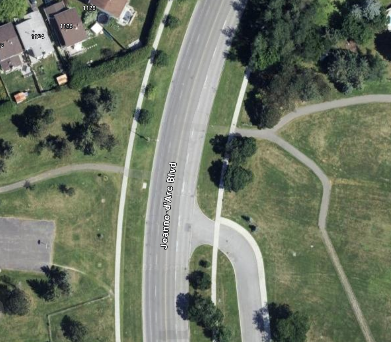
Creating a new pedestrian crossing to get across a certain problematic section of Jeanne d’Arc Boulevard is something I’ve been mulling over and wanting to talk about for literal months.
My version of this story contains some aspects of government bureaucracy, car-friendly transportation rules, and common-sense safety and accessibility changes. The exact spot I’m describing today is on Jeanne d’Arc, between the intersection of Vineyard/Fortune and Voyageur/Vorlage (names in the suburbs get weird where the same road gets multiple names even though sections of the road are less than a kilometre long.

Even from the level of detail of this first map, keen-eyed observers can see there is something going on here, a pair of green lines that seem to match up almost perfect, separated by a big ol’ road. This is basically the exact spot that served as my measurement location for the first post on this blog: Jeanne d’Arc Boulevard North – Road Layout Update. This specific spot is also home to of the most obvious places for new pedestrian infrastructure in this whole neighbourhood.
Getting a little closer to this ‘intersection’, you can clearly see that an effort was made here to connect the path network, but maybe someone lost an argument, or it was decided that traffic being slowed or stopped one extra time here if someone wanted to cross was unacceptable.

Personally, in the 5 years I’ve lived in this neighbourhood, I have crossed this road at this point probably a dozen times. I’ve done it with a stroller, I’ve done it with a toboggan (to a community event, no less). It’s frankly embarrassing that the path system is so wholly broken by this one disconnect that it has probably prevented hundreds, if not thousands, of trips that could be walked but were instead driven.
To those not familiar with the area, in the 300 m or so around this spot, there are two schools, a fire station, a basketball court (in dire need of a renewal, by the way), 2 soccer fields, a baseball diamond, a boarded hockey rink, a community shopping plaza (micro strip mall, basically), several large green spaces, parks and playgrounds, and some very nice active transportation paths that form a nice network. These amenities would all unilaterally become more accessible if this crossing were opened up with a controlled signal or any kind of pedestrian infrastructure.
Now, for those of you thinking “Rob, why don’t you ask your local municipal representative about this”. It seems like a pretty obvious safety and accessibility win to open up this crossing, traffic impact would probably be minimal, and commuters might see their trips slowed by a few seconds 1-2 times a week at most.
I want to preface what I say next by saying that I don’t begrudge the local municipal staff, councillors, or really anybody involved locally for not rocking the boat for this. Incremental change like this, whether you agree it is a good idea or not, has become somewhat radical, especially if it makes things technically harder for cars.
However, another thing I’ll say before I talk about the politics of this is that a BIG discussion going on in the community right now, happened a little over 200 m away from this spot, is the addition of a roundabout near the local school, designed to help the buses visiting the soon-to-be-completed Jeanne d’Arc LRT station turn around once they’ve completed their routes.
This has become a huge discussion point because parents of the children at this school are concerned about safety at this intersection, and many view buses and this roundabout as dangerous for kids getting to school. I think this is pretty silly, the roundabout is very well considered, and will itself have a controlled pedestrian signal and a crossing guard. The design is almost certainly safer for students, given the lower vehicle speeds to navigate the intersection and the only result of these changes will be less car traffic through this intersection, not more.
Anyhow, this tangent is to add nearby context to the discussion, now back to the bureaucracy.
Now, when I reached out to my councillor to ask about this spot and the possibility of adding a crossing, I wasn’t necessarily expecting smooth sailing and that this would happen within a month or two. Even I am not that naive. However, I didn’t expect the actual response I got, which I’ll paraphrase here.
I was told that provincial regulations dictated that a pedestrian crossing (PXO is the acronym they used, so I’ll borrow that here) could not be placed less than 200 m away from another signalized intersection. The other intersection I mentioned (with Voyageur/Vorlage) is about 160 m from the spot I’d propose makes the most sense for a PXO. I’ll note that this 200 m number is totally arbitrary, and I can think of PLENTY of exceptions to it in Ottawa that were surely based on some kind of reasoning that could be applied here. Usually, the reasoning would involve safety or some kind of exceptional road design.
The argument was made (by traffic engineers and city staff, relayed to me by the councillor’s office) that because the road curves at this spot, and the speed limit along this stretch is relatively high at 60 kph, having motorists potentially need to stop for this PXO signal is dangerous. Personally, I would argue that if it is dangerous having pedestrians cross because of the speed and the design of the road, perhaps the speed limit shouldn’t be 60, since you are driving between an elementary school and a fire station.
Another factor to consider is that due to upcoming changes to the road nearby, like the roundabout going in, there is already ongoing discussion about the speed limit along this whole stretch being reduced to 40 kph. This is because over a relatively short stretch, passing several schools, the road already jumps from speed limits of 40 and 60 several times, and a new speed camera a couple of blocks further east on this road has been giving massive numbers of tickets to drivers in the community. This isn’t surprising, because the road itself is absolutely encouraging you to go faster than this with its design, wide lanes and clear sight lines.
The road will also bottleneck down to 1 lane on either end once the roundabout goes in, so I would make the argument now is a perfect time to bite the bullet and say that this road should just be 1 lane at 40 kph for the whole length in this section. At that point, not only would a PXO be more reasonable, having big flashing lights for motorists would be less necessary (though I would argue still a good idea), and travel distance in traffic would be reduced by half for pedestrians (only needing to cross two lanes instead of four).
Now, before concluding this piece, I’d like to return to the provincial regulation requiring 200 metres between signalized intersections to add a PXO. With a distance to the nearest intersection in this case of about 160 m, here is what traffic engineers are suggesting when a pedestrian approaches this spot from either direction with a hypothetical crossing. Rather than having motorists slow down or stop for a few seconds occasionally to let a pedestrian or cyclist continue their walk along a path, it is suggested that they should have to walk at least 320 m (160 m there and 160 m more back) in order to allow for traffic flow. They are also saying that this should still be the case even if the detoured walk is a total of nearly 400 m. It’s no surprise at all to me that unless I am with my young family doing this on foot, I sometimes just walk across the road (dangerously!).
One last point to wrap up this logical garden path: there is already a roundabout going in at one of the two nearby intersections. The logic for that roundabout going in is that buses accessing the nearby LRT station need to be able to turn around. However, I would make the argument that if all the described changes take place (40 kph limit, reduction to one lane, adding a PXO crossing), having a roundabout replace the signalized intersection at Jeanne d’Arc and Voyageur/Vorlage as well makes perfect sense.
This intersection could also have a pedestrian crossing with lights like at the other roundabout, and given this change in traffic pattern, its entirely possible that traffic flow through the area on an average basis actually moves a little better, with less likelihood of starting and stopping almost all of the time. And when there is a higher likelihood of interactions between pedestrians and motorists at these places (rush hour and around the start/end of the school day), should we not be prioritizing the safety of our children anyhow? These intersections are already patrolled by crossing guards, surely these changes would only make their job easier.
To wrap up, I have a lot to say about this set of upgrades to the road design of this stretch of Jeanne d’Arc Blvd. I think it is doable in a fairly short time frame and without too much expense, and the resulting road design is not only fairer and more equitable, but it’s safer and requires less upkeep and maintenance.