The title of this post references the old adage, “When all you have is a hammer, everything looks like a nail.” This saying is especially true when it comes to transportation in suburban Ottawa.
If all you have is a car, everything looks like a drive.
I have come to reject this car-dependent framing, not because I think cars should play no role in the suburban transportation network. Instead, I believe that more viable transportation options—walking, public transit, cycling—will give residents more tools to make sustainable choices when getting around their communities. Coupled with relaxing zoning restrictions to allow small businesses like cafes or convenience stores to exist near where most people live, this creates a recipe for making it possible for some people to go about their daily routines without needing a car.
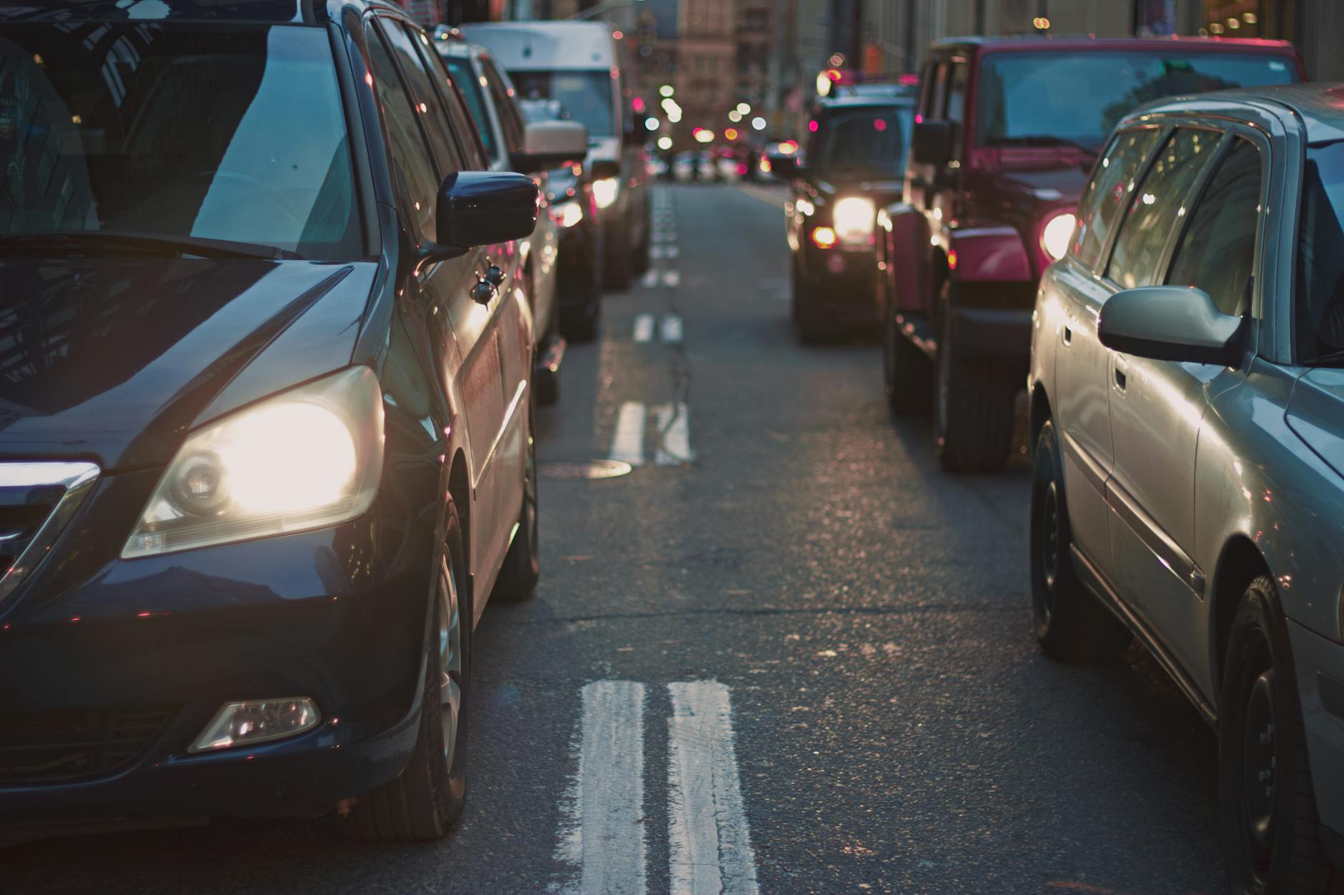
I often use the following line when discussing transportation in my suburb with friends and acquaintances: “If you’re sitting in stop-and-go traffic on the highway, do you want more car, less car, or the same amount of car?” Even if begrudgingly, everyone ultimately tells me they want fewer cars. Despite the fact that many suburban residents aren’t ready to personally use their own vehicles less (or get rid of one if they have multiple), hopefully, most people can get behind the idea that someone else should theoretically drive less, even selfishly.
Building on the Metaphor
I’d like to revisit the hammer/nail metaphor from earlier. Imagine you have been given a hammer and are now wandering around a construction site hitting things with it. From your perspective, this is perfectly reasonable, and to be honest, it’s literally all you can do. You have no other options. It doesn’t necessarily make sense to hit a screw or try to cut drywall with a hammer, but you’re making the best of what you have.
Now, imagine the foreman comes along and shows you a workbench with a screwdriver set, some wrenches, a saw, a belt sander—a whole shop full of different tools with different purposes. Suddenly, you don’t have to use a hammer for everything. You can use a variety of tools to get the job done better. I’ll also point out that even though you have a whole workshop of tools laid out in front of you, sometimes you still actually need a hammer.
Transportation Options
Now we can bring this metaphor back into the real world and apply it to our transportation network. In a suburban environment where walking, cycling, public transportation, and more are all supported, made safer, and encouraged where appropriate, there is less car traffic to get stuck in. You might be able to sell or not buy/finance that second or third family car. You might actually appreciate having a network of sidewalks and paths, bus or bike lanes, real transportation options that meet a variety of needs.
Of course, the final lesson of the metaphor is the most important to keep in mind. Even in an environment with many transportation options, sometimes, for some people, a car/van/truck may be the most sensible option for a particular trip. When my family of five goes to a restaurant five kilometers away in a minivan, or I am helping a friend move and letting them use my truck, these are the most sensible transportation options for those trips. However, the same can’t be said for a solo grocery trip 1.5 km away for a few items, visiting a friend a few blocks over, or taking the kids to swim lessons across the highway. Another huge example would be taking your personal vehicle alone 10-20+ km to work and back each day on a route literally thousands of other people are already taking at the exact same time as you.
A Multi-Modal Network
The transportation systems that underpin the vehicle network already have lots of room for modularity (rear/roof racks, trailers, fold-down seats, taxis/rideshare, rental cars/vans, car seats, etc.) because not every driving situation requires the same tools. The same can be true for a multi-modal transportation network. You can complement the long list of motor vehicle modularity above with accessible public transit, city or cargo bikes with baskets or panniers, bike trailers, bikeshare, wide, well-maintained and connected sidewalks and paths—the list goes on. By focusing on and primarily funding (and subsidizing) only the car network in the suburbs, we are missing an opportunity to make use of a whole toolbox full of different options to get around.
The next time you see someone advocating for more transportation options in the suburbs, keep in mind that since the dawn of the automobile, nobody in their right mind has ever suggested that personal or professional vehicles should not be allowed anywhere or for any reason. The staunchest active and public transportation advocates all understand and acknowledge that options are a good thing and cars, vans, and trucks of all sizes in moderation are a vital part of a healthy and accessible modern city when necessary. However, the dose makes the poison, and if these are your ONLY transportation options, you’re going to experience the downsides (traffic, cost, pollution, crashes) as well as the advantages (comfort, flexibility, convenience, at least by certain measures) of car dependency. Life is a process of balancing tradeoffs, and we as a community can choose resiliency and sustainability over instant convenience and perceived independence from one another (boy do I have thoughts on this) if we so choose.
As a resident of our suburban neighborhood with family roots here since the early 90s, I’ve come to appreciate the tranquility, space, and sense of calm that comes with living outside the hustle and bustle of the inner city. The wide streets, ample yards, and peaceful environment are some of the things people cherish most about suburban life. However, I’ve come to realize that this lifestyle, while comfortable, comes with hidden costs and challenges that affect not just our wallets, but also our environment, health, and community cohesion. One of the biggest challenges I see is that it’s nearly impossible to maintain any sense of community and get to know people when we’re all so spread out and have so few public spaces to gather. I believe it’s time to rethink how we use and live in our suburbs to create more resilient and affordable communities, without losing the qualities we love.
The Hidden Subsidy of Suburban Living
One of the most surprising revelations is how urban centers end up subsidizing suburban areas. Urban neighborhoods generate significantly more tax revenue per acre due to their higher density. This means more people and businesses are contributing to the tax base, compared to the sprawling, low-density suburbs. As a result of this, the infrastructure costs in suburbs—roads, water lines, sewer systems—are much higher due to the larger area they cover. The tax revenue generated in these areas often doesn’t cover these costs, leading to a reliance on subsidies from the higher revenues of urban centers.
This financial imbalance is a key principle highlighted by Strong Towns, an organization advocating for financially resilient communities. They emphasize that land is a finite resource and must be used efficiently. Suburban sprawl, with its extensive infrastructure needs, is an inefficient use of land, leading to higher costs that are not fully borne by suburban residents. Instead, these costs are often covered by the higher tax revenues from urban centers, creating an unsustainable financial model.
Environmental and Health Impacts
Beyond the financial aspects, suburban sprawl has significant environmental and health impacts. The uniquely car-dependent nature of suburbs leads to increased greenhouse gas emissions, contributing to climate change. Large suburban homes also consume more energy for heating, cooling, and electricity, further exacerbating environmental issues. Additionally, the spread of suburbs often encroaches on natural habitats and agricultural land, destroying ecosystems and reducing the land available for food production.
Health-wise, the design of suburban neighborhoods discourages walking and cycling for transportation, by spreading things out so much you have to drive everywhere. Suburban street design also makes reliable and frequent public transit challenging. All of this leads to a sedentary lifestyle that contributes to higher rates of obesity and related health issues. Increased car usage also results in higher levels of air pollution, which can cause respiratory problems. The isolation and longer commutes associated with suburban living can contribute to stress and reduced social interaction, impacting mental health.
Safety and Social Cohesion
Street safety is another concern in cities that have car-dependent suburban areas. The reliance on cars to get around in these places increases the risk of traffic accidents, and the spread-out nature of suburbs can even delay emergency response times. Socially, suburban design often leads to isolation, with fewer opportunities for casual social interactions and weaker community engagement. This can reduce the sense of community and belonging, making it harder to build strong social networks.
Moving Towards Resilient Communities
So, what can we do to address these issues and create more resilient and affordable communities? The advocacy group Strong Towns proposes for a return to traditional development patterns that prioritize financial solvency, efficient land use, and community resilience. This includes promoting mixed-use developments and higher density housing, which can generate more tax revenue per acre and reduce infrastructure costs.
By making our neighborhoods more walkable and less car-dependent, we can improve air quality, encourage physical activity, and foster stronger community interactions. Reducing car dependency also makes neighborhoods more accessible to those who cannot drive, including the elderly, children, and low-income residents, promoting equity and inclusivity.
Embracing Change Without Losing What We Love
It’s understandable that some residents might feel apprehensive about changes to their beloved suburban neighborhoods. However, it’s important to note that densifying our communities and allowing mixed-use zoning doesn’t mean losing the qualities we cherish. In fact, it can enhance them. Imagine having local shops, cafes, and parks within walking distance, making daily errands more convenient and enjoyable. These changes can bring more vibrancy and life to our neighborhoods, creating spaces where people can gather and interact, strengthening our sense of community.
Moreover, higher density doesn’t mean high-rise buildings everywhere. Thoughtful planning can ensure that new developments blend seamlessly with the existing character of the neighborhood. Small apartment buildings, townhouses, and duplexes can be integrated into the community, providing more housing options without overwhelming the area.
In Conclusion
While the suburban lifestyle has advantages for lots of people, it’s important to recognize the hidden costs and challenges it brings. By understanding these impacts and adapting principles from urban advocacy groups like Strong Towns, we can work towards creating more sustainable, resilient, and vibrant communities. Embracing these changes doesn’t mean losing what we love about our suburbs; it means enhancing our quality of life and ensuring a better future for all residents. It’s time to rethink our approach to suburban development and embrace changes that will benefit us all in the long run.
Strong Towns has a vibrant Ottawa chapter, if any of this is interesting to you, I would encourage you to check it out.
Today, I’d like to share an idea with you. This might be something you have never thought about before, and in fact it may be a lot of work up front to convince you that thinking about this is even worth your time. If you’ve felt at one time or another – over the last 5, 10, or even 20 years perhaps – like something fundamental is missing from your community, come along for this ride with me. And if you *don’t* have or haven’t ever had this feeling, I hope you will hear me out, and I’m curious if you find yourself nodding along. It may be a winding road, but I think there is a lot of value to following it.
Obviously, anybody reading this is bringing with them their own life experiences and unique history. Some of our human experiences are shared by almost everyone, while others are quite rare and won’t be relatable to as many people. I can only really speak from my own experiences, so you may have to either put yourself in my shoes or map your own life to my history to really understand what makes me feel this way.
The Community You’re Raised With
I was raised in a central urban community mostly in the 90s and early 2000s in Calgary. While I was in that situation, as a kid, I wouldn’t say I cherished the experience, but I certainly made the most of it. The furthest I ever had to go to get to school was 3.5 km to get to high school, and it was a calm, quiet ~15-minute bike ride. I would frequently walk to school as well, and I could get anywhere I needed to go in the city on bike or by public transit.
I didn’t realize it at the time, but growing up in this environment, self-sufficient without a car in a community that had other good options, prepared me very well for not needing a car as an adult either. My first job was within easy walking distance, and every job I had in Calgary was close enough that I could walk, bike, or take the bus/train. I got my learner’s driving permit at 14 (as was/is? the legal age in Alberta), but I didn’t actually get my full driver’s license (nor did I need it) until my mid/late 20s because I didn’t need to drive anywhere, and I had other good options to get around. For example, Calgary built an LRT for the 1988 Winter Olympics and has continued to extend and improve it over the decades.
Even when I moved to Ottawa in 2006 for university, I lived in at least a half dozen residences and apartments before moving into a condo with my wife in 2014. All of these places before the condo were within a 10-20 minute walk to university campus and to the places I worked. I didn’t have a car, and I certainly wasn’t going to buy one without a license or a need for it. Even when I did move out near the Montfort hospital to the condo, I would take the bus to work on the worst weather days, and still most of the year I would bike or even rollerblade downtown. I would drive in occasionally (we’re talking 1-2 times a year at most when I needed to bring something heavy or awkward to the office), but in my entire life I have never routinely commuted anywhere by car.
What Changed?
In 2019, my wife and our 1-year-old daughter moved to Convent Glen North. It was a major change in my life, but it was always pitched as the ‘endgame’ of city life to buy a house and move to the suburbs. You have so much space for yourself and your family, and the suburbs are littered with shopping centres and “main streets” with all the amenities that seem like they’re trying their best to feel a little like the ones downtown, as long as you don’t look that closely.
Fast forward to 2024, and I have a stable job and have fully settled into suburban routine. The pandemic helped a lot with that settling process, as our home became the office, as well as the daycare for quite a while. We are now a family of 5 starting to attend the school we can walk to while only crossing our own street and the park, which really makes it feel quite urban most days. We have a lot of space that feels like it is truly just ours, but over the last year or two, the whole rest of my life experience I described earlier has been sitting in the back of my mind, brewing up thoughts and feelings.
When I said earlier that I can only speak from my own experiences, here is where those experiences shape my feelings about this pocket of the suburbs. If I had to describe the feeling in a single word, I would call it isolating. I’m a strong introvert, so it’s not like I want to be friends with and talk to everybody all the time, but actually meeting and chatting with your neighbours feels like an anomaly more than how it is supposed to work. I have some of my own feelings about the reasons why this is the way it feels, and I’d like to try to break it down now.
Why The Suburbs Feel Isolating
I think calling human interaction in the suburbs an ‘anomaly’ is sort of the perfect way to describe it. It’s not that you can’t see people who live near you, because you totally can, but it is almost deliberately outside the norm. Interactions with your neighbours only happen through coincidence or through direct and deliberate action. Living in the suburbs, where effectively everyone has at least one car, and some families have at least two or three, most of what you do to get places involves getting in your car (maybe even from inside your garage) and going somewhere that isn’t anywhere near your home, or even in your neighbourhood. Compare that to a condo subdivision or apartment complex, where there is shared space and sidewalks and elevators where you will definitely see and interact with people as a matter of course going about your daily life.
The way most suburban neighbourhoods are set up is very obfuscating to your sense of direction, with almost exclusively single-family homes clustered together in large, loopy patterns with no or very few higher-density housing options. If you want to go somewhere or do something, by default, you get in the car, because almost nothing is within walking distance. Compared to the grid that serves as the root system for older urban neighbourhoods, wayfinding by feel in a suburb requires repetitive trips and experience to learn how to get around or relying on GPS navigation. Between that and the cookie cutter approach to home design, many suburbs literally feel like a maze, relying on individual homeowners to make distinctive changes to their properties to give the neighbourhood any character at all. While this maze-like road design does tend to make walks for adventure and exercise more interesting than a grid layout, walking for transportation is inefficient and can be downright dangerous. Our suburbs, for example, don’t have any sidewalks at all on most local streets, and often have only one sidewalk on collector roads.
This winding and branching structure of suburban neighbourhoods has another detrimental side effect that makes cars seem like the obvious or only choice for transportation. Sending buses or any public transit through these communities is a massive logistical challenge, because the population density along any route is quite low, and there are no efficient straight-line roads for buses. It is possible to plan routes through these neighbourhoods, of course, but sending full-size buses through the neighbourhood every 30-60 minutes during peak times (like we do now) is not a recipe for people using the transit system for anything other than their commute, at best. For a transit system to really make sense as a funnel to get people to nearby business hubs (like St. Joseph) or connect to other transit (like the LRT to get downtown), something like a compact 16-24 seat community shuttle running every 10-15 minutes makes far more sense.
You will never be able to beat a car 1 to 1 on the basis of convenience getting almost anywhere in a city, if you already have a car and you don’t take into account that the decision to drive is not made in a vacuum. However, if you play that out in reality with a whole population, traffic drastically changes the equation, and suddenly your trip time can double or even triple just by leaving for your destination at a different time. Driving a car is wildly less convenient if you plan around a 10-15 minute commute to go downtown, and it ends up taking you over an hour because of traffic, a crash on the highway, and spending 10-15 minutes circling the block looking for parking.
The reason I feel compelled to describe the bait and switch convenience a car promises in this story is that transportation efficiency isn’t the only consideration you’re making when choosing how to get where you need to go. By getting into a car, you are (possibly without realising it) choosing to isolate yourself from society and the world around you. When a whole community (and their kids, mind you) choose to pile in to their individual cars every day to run errands, attend events, pick up dinner at the drive thru, commute to work and school, and do anything else you might want to do, it means absolutely no chance of incidental casual conversations with people in your immediate vicinity.
By getting in your car in the garage or driveway, rolling up to your faraway destination in a closed box, and seeing other people who’ve done the same, you end up having very little connection to the place you live. Not your house, but the immediate surroundings, the 10-20 closest neighbours. In contrast, when you choose to bike to your destination, or walk to the bus and wait at the stop, or do anything other than jump in the car, the opportunities for face-to-face time with people in your community multiply rapidly and almost instantly.
The ability to flip an ignition switch and get literally anywhere within a 50km radius in under an hour (rush hour notwithstanding) is nothing short of magical when you need it. But this magical power is not without its tradeoffs, and I think this is having a meaningful impact on quality of life in the suburbs, even if it is very hard to see unless you’re looking for it. When you are going about your life outside of a car, you are interacting with other human beings in your surroundings. If you need help, someone to talk to, friendship, entertainment, or any other personal connection, the people that are just out in the world can actually connect and be that for you, or just be there for you. In a car, you are completely isolated, without any way to interact with anybody. All your interactions are mediated by car horns, wheel turning, and maybe hand signals or facial expressions if you are within a few feet of another car. We have become much less likely to give affordances to machines on the roads than we are to people on the roads. I think sometimes we’re actually starting to treat cyclists and pedestrians outside our cars more like mechanical objects than fellow human beings, in ways we would never do if a vehicle wasn’t mediating our interactions.
What This All Means For a Sense of Community
With the incredible and lightning-fast changes to our society brought about by new and improving technologies, it’s easy to attribute a change in the feeling of community to things like the internet or mobile phones. The rise in phenomena like online dating over meeting in person and job interviews taking place online only and mostly via algorithms seem like they are entirely products of the internet. But I think a big part of why the online versions of these things are so much harder now than their real-life equivalents is that we’re so used to being in our own social bubbles and getting very little exposure to people we aren’t already in contact with. It’s not to say there aren’t both pros and cons to hiring and dating online (obviously, there are pros as well), but there are real tangible benefits to having options to do those things in person as well.
Over the last few decades, we have changed from a society that would mainly interact face to face and with people who lived within 2-3 city blocks of us. There would certainly be occasions where people travelled longer distances, but it was unusual that people would traverse a whole major city on a regular basis as a matter of normal routine. Now, with the ease of being able to jump in the car and get anything or see anyone, our social circles today are much less likely to include people who live near us. Coupling this with the exclusionary residential zoning typical especially of suburban communities, and it’s easy to see how it’s much harder to meet new people and run into people you know.
The places where people spend their downtime have a massive overwhelming impact on our lives, who they know, and the kinds of things they can do. For a large portion of people, kids or adults, outside of our homes work or school are the only places we spend any meaningful amount of time relaxing. It is very hard to form relationships or get to know people better when this is all you see of them, and it is almost impossible to do this if two people or groups don’t even share a workplace or school.
What About Solutions?
One big thing that can help this phenomenon of a loss of regular community social interaction is new considerations for what sociologists call ‘Third Places’. These are social places in the heart of a community where people feel comfortable just existing and spending time with others. These can be community centres, cafes, bars or pubs, libraries, or any other manner of public spaces that can be used either free of charge or for very little cost. It is possible for individual private homes to become third places, but this is usually temporary for events like birthdays or holidays. In a suburb which is almost exclusively only allowed to legally contain single-family homes, third places have now generally become a destination with a high energy barrier to access. I spent my university years as a chemist, so in case that chemistry metaphor doesn’t track, I’ll try to put it in plain English.
Going to the local coffee shop, a restaurant, the gym, kids’ activities, your job, the grocery store, the library, etc., etc., etc. all require piling in to the car, driving for some non-trivial number of minutes, and finally arriving at your destination to do the thing you want or need to do. We tend not to think about it as such but visiting a place where you feel comfortable and can relax outside your home like this requires a tremendous amount of energy output. This is probably because the car is the thing actually outputting the energy to get you there. However, the end result is that for most people, they tend to just stay in and not try to expend that large amount of energy to get somewhere unless they really decide it’s worth their while.
In case you don’t believe me, just try to imagine doing one day worth of moving around centered in your suburb WITHOUT a vehicle. Suddenly, the energy required comes into stark focus. If all or many of the things you needed to get to on an average day were within a 10–15-minute low energy walk, you might find you don’t even need a gym membership, much less a second car or even a car at all the majority of the time. The old joke about routinely driving to the gym and then taking the escalator up to get your workout in is actually a call to better urbanism in disguise.
Wrapping Up
I believe the solution to reconstituting the heart of our community is to actually spend time thinking about the neighbourhoods we live in as a destination, not as a starting point. Building better local places so it is more interesting to spend time in them benefits all of us and is almost certainly good for our mental health. The typical suburb has just a TON of space in it, and a lot of it at the moment is designed to hold and move as many cars as possible (seriously, look at a map and just think about the space set aside for highways, roads, parking lots, driveways, and garages). These places don’t have a lot of space for people to move around and exist comfortably.
It doesn’t have to be this way, and investing more in mixed-use zoning, pedestrian or walkable spaces, a well maintained and separated path network for walking and cycling, public transportation, and public community spaces is the way to transform our community into a space we can all be proud to call home. Such a system is also much better at paying for itself from an economic standpoint, and doing this at the community level can rescue the city’s finances and help us contribute positively to the tax base rather than being a drain on it.
For many suburban parents, reading the title of this article might send shivers down your spine. For a lot of families, one car per adult in the household is pretty typical, unless a car is in the shop or out of commission for some other reason. In my case, one of the reasons we are a one-vehicle household (a minivan, which is great by the way), is to accommodate our financial priorities. We would rather spend our money elsewhere rather than finance a second car for the rare occasion we are doing two things at once that require one. We are a family of 5 with one income at the moment, and not looking to change that.
The Setup
When my wife got the opportunity to visit some friends in Toronto, she felt incredibly guilty taking our van on the trip, and in fact almost took the train with our youngest just to leave me the vehicle. It turns out the train is VERY expensive unless you book weeks in advance. However, from my perspective, as someone who has never commuted to work by car and doesn’t particularly enjoy or want to drive very much, this past weekend was a great opportunity to demonstrate that I was perfectly capable of getting around the suburbs with kids (who are 6 and nearly 4), with just my long-tail cargo bike.
I encouraged my wife to drive because the train was so expensive, which meant that for 3 days (Friday being a PD Day), I was going to be a solo parent for a whole weekend for the first time, and I would not have a car. I know that some parents (and some people without kids) in this situation would accept this reality and just decide they were going to stay very close to home for the weekend. However, I wanted my kids to have a fun weekend, and we had commitments and activities on the calendar that none of us wanted to miss, including swimming lessons and a birthday party, along with Orleans Family Fun Day on Saturday.
I didn’t do this because I thought it would be a fun experiment (though I did think it would be one). I did it because I knew that I could, and because I wanted to prove to myself that it was not only possible, but actually a positive experience and one I would seek to replicate whenever possible.
Downtown by Transit
On Friday, I packed a bag with snacks and water, and the three of us made our way downtown by bus and then train. The kids get very excited every time we get to take public transportation, and my son is an especially big fan of what he calls the ‘double wrecker bus’ (hopefully you can figure that one out). We went to the Rideau Centre and visited the canal locks, and then made our way back home after a few hours, and the kids had a great time.
Transit service gets talked about a lot in Ottawa, and it would have been easier for us if the network had more frequent service, but all considered it was totally fine, and we didn’t have to pay for gas or parking and got some exercise. We had to walk from Convent Glen North up to the highway at Jeanne d’Arc, about a 10-minute walk, and the 30 came almost immediately. Trains off-peak are now at 10-minute headways, so we had an 8-minute wait for a train, and both the bus and train were quite full the whole way (suggesting perhaps people are actually using the network and maybe funding it would be a good idea after all). One thing we didn’t encounter the entire weekend was more than 1-2 minutes of traffic on the bus at the very end of our journey.
Swimming Lessons
Getting to swimming lessons is pretty straightforward in comparison. We probably could have just walked to Bob Macquarrie Rec Complex from Convent Glen North, but given the kids preference for the bike, that was an easy choice for me to save some time. The construction on Jeanne d’Arc at the highway makes that a little more stressful, but the pylons blocking off one lane make for a pretty nice, protected bike lane on weekends when there are no trucks there. And honestly, the cramped lanes navigating the roundabout construction are downright spacious on even the biggest bicycle. It is a little over 1 km for me to get to Bob Macquarrie, and I am certain the percentage of people who (justifiably, mind you) drive there for activities is well over 80%, despite most people having very short trips.
Orleans Family Fun Day (Barrington Park)
Orleans Family Fun Day is a bit of a longer trek, but still well within easy biking distance (the event was at Barrington Park next to the Orleans library branch). The toughest part of that trip is the unfriendliness of Orleans Blvd to any form of transportation that isn’t a car, but with a little creativity and a few minutes of steeled nerves and hoping for patient and friendly drivers to get across the highway overpass which is down to one lane with construction. After spending 3 lovely hours at Family Fun Day, we ended up stopping to run a couple of errands at Innes Road, and then headed back to the Convent Glen Metro near our house to pick up some groceries for dinner and the rest of the weekend (the front basket is excellent for groceries when the kids are with me).
Birthday Party / Museum
The other major outing we did on the weekend involved a typical suburban parent experience, one kid has a birthday party to attend, the other wants to do something with you. The party was for 2 hours down off Montreal Road, across the Greenbelt at Canotek. On this particular occasion though, I had an ace up my sleeve since on weekends into October, the Parkway is open exclusively for active transportation. I packed the gift, the three of us hopped onto my bike, and after a short trip along the River Pathway, we joined up with the Parkway and made quick work of the trip to Shefford. The entire ~3 km trip we had almost no interactions with motor vehicles, as residential streets and the industrial park were both essentially empty on the weekend.
After dropping my daughter off at the party, I brought my son to the Aviation and Space Museum (another nearly 7 km) for a little over an hour (we have an annual pass), which he always appreciates. Another ~7 kms back, we were picking my daughter up from the party, and we were making our way home. Finally, we had made plans to walk to their grandparents for dinner, so we wrapped up the weekend with a nice 10 minute walk through the path system bisecting Vineyard and Voyageur. Wrapping up the math of the weekend, I spent a total of less than a dollar on electricity to charge my bike, biked over 35 km over 2 days, and spent 2 OC Transpo fares to go downtown and back. In exchange, we got to spend good quality time with many friends and acquaintances over the weekend days, many of whom we saw or spent time with in the community. I spent about $60 on groceries and picked up a few fun things for the kids too. We also got to see lots of people that live around us just by walking or biking past or seeing them in passing, something that happens so rarely when we’re all just jetting around in cars.
Wrapping Up
To just explicitly make the point I’ve been making implicitly while telling this story, it is extremely possible to get around your community without getting in and out of a car all day, and I can promise you it is way more fun (especially for kids) and I encountered literally zero traffic on any street or path I was on.
A couple of other things here are also true. The suburbs have some work to do to make forms of transportation other than cars safe enough for the average person to feel very comfortable getting anywhere in their neighborhood on a bicycle (with or without kids). But most places are quite accessible very easily now, even if you do have to go a little out of your way.
Public transit also needs some work, especially in the suburbs. A lot of people either don’t trust it, feel they are above it, or feel it isn’t good enough in comparison to their car to get them where they need to go when they need to get there. And in many cases right now, that’s true. OC Transpo needs more funding, more ridership, or some combination of the two, to be more reliable, more accessible, and more resilient. However, there are lots of new stations coming online in the next few years, and I believe OC Transpo truly believes in the mission of improving service, pulling the system out of the death spiral that has been threatening over the last 5 years.
The system is not perfect, but these options, walking, cycling, and public transit, are going to be key to Ottawa’s Official Plan and the Orleans Corridor Secondary Plan. The more we can use these other options, the better for the climate, traffic, and our combined sense of community.
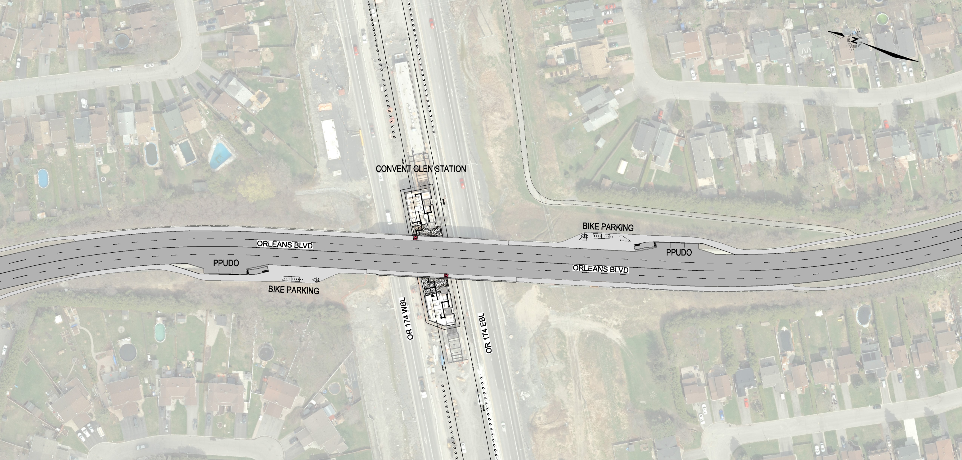
However, it appears that thought was skipped by the planners, and instead the road will be returned basically to its state before the renovation (plus a pair of bus stops and room for people driving to the train stop, and bike parking is a great addition too).
This seems like a failure of imagination at the very least.
It’s my understanding that at this point (not sure exactly when this was posted on the City website, but it can’t have been that long ago) the actual design in terms of what’s being built is fully locked in, which is a shame but you literally can’t change the past. However, it does seem like there is at least an opportunity to take what infrastructure is set and mould it to be a little more environmentally friendly (not to mention safer).
Specifically, what I’m talking about is the possibility of the outer lanes of the overpass being reserved for bus and bike traffic. I have been getting to work on bike via Rideau Street through downtown where the road has the same setup (4 lanes, 2 reserved for buses) and even at rush hour it’s fine.
The last 2(+?) years with the overpass down to 1 lane has proved (in my opinion) that car traffic volume doesn’t support the need for 4 lanes, even at rush hour this isn’t really a concern that needs to be factored in (and are we really building for the 10-15 minutes a road is the absolute busiest, which is already a choice many drivers make?).
If the overpass ISN’T given lanes with bus/bike priority, and traffic comes anywhere close to slowing down or stopping over the overpass, I’d argue this is bad for everybody, as it means buses and bikes will get stuck in that, and when buses stop, cars will get annoyed and be unhappy anyways. It’s fairly easy for a bike to wait for a bus if necessary (obviously not ideal, but the space is what it is), and the lanes are wide enough when the bus is stopped that a bike can probably easily pass safely if they feel comfortable.
The only thing I haven’t really considered above so far is the passenger pickup/dropoff spaces, but I think cars actually dropping off or picking up using the lane would be fine to do that (outside the flow of traffic) and then merge back in.
All of this obviously only considers the absolute busiest times on this road, the other ~98% of the time it’s just obvious that having dedicated infrastructure like this makes sense in terms of public transit flow and bike safety, there is no way there is enough traffic the rest of the time for 4 lanes to be anywhere close to necessary for cars.
I feel very strongly that we dedicate far too much road space for cars, I am definitely biased in that direction, but I also feel that it lines up with the priorities of the community and the city to make mobility and transportation network decisions thinking in this way. I’d really be interested to hear if any conversation like this (basically using different paint/signs on this road while keeping the actual built infrastructure as designed) has taken place.
I really look forward to the day when all of Orleans Blvd is a complete street accessible in this way by all road users, but for now this seems like an easy win, and will make it easier for people north of the highway to access St. Joseph and the Heart of Orleans without getting into their cars.
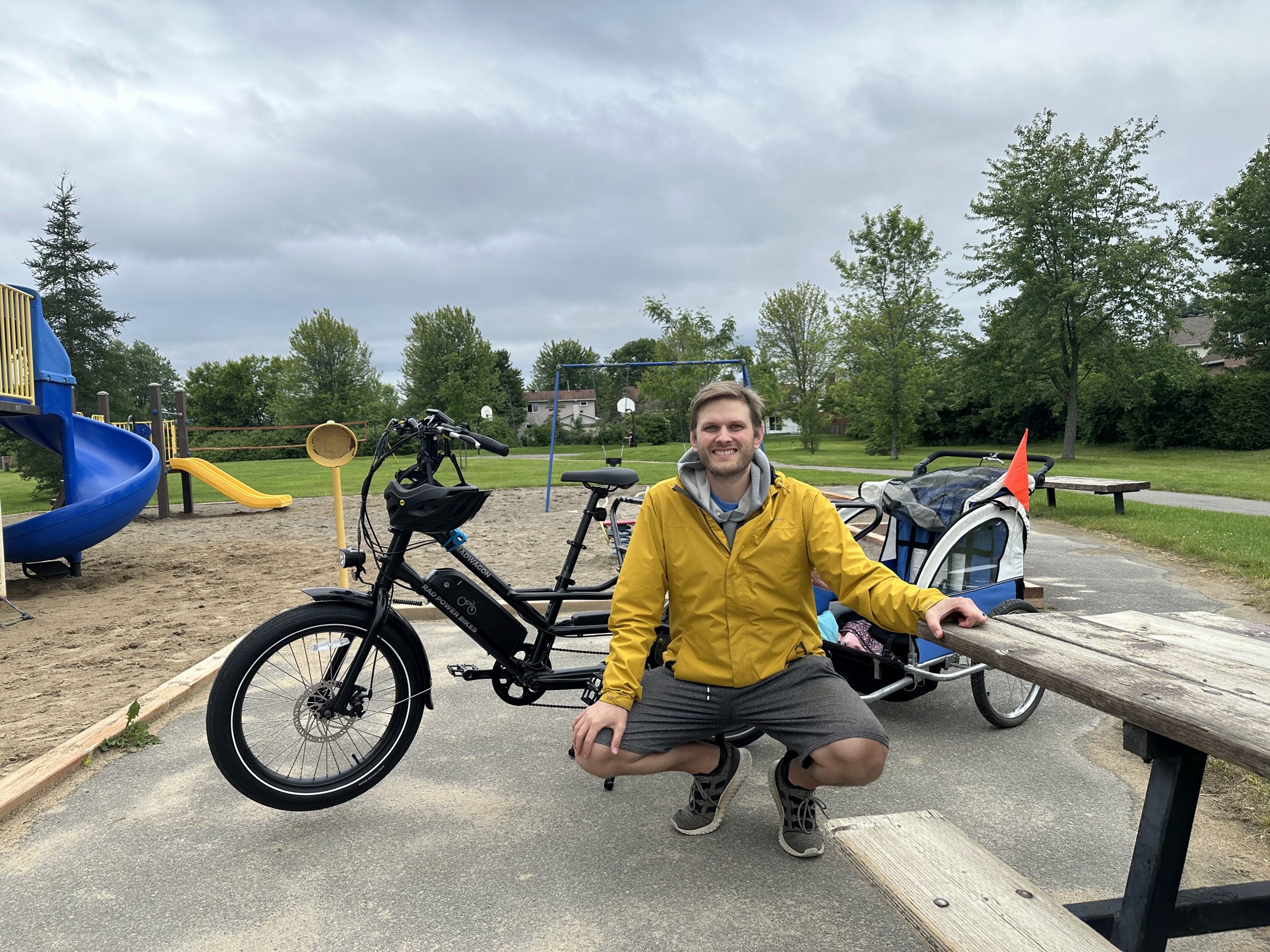
My older kids are 6 and 3 (coming up on 4 now), and they absolutely love spending time on the back of my cargo ebike. In past years, we would go for rides together, but they were in a trailer behind my hybrid bike, and it wasn’t really a family ride since my wife didn’t have a bike to join us. It was also much less convenient to run errands like groceries with a bike trailer with 2 kids and no additional storage on my bike.
This year, since I’ve had my ebike for right around 2 months now, my kids are eager and excited to hop on the back of my bike, and we have done excursions and run errands together multiple times, especially since they’ve been off school, and I just wrapped up 4 weeks of parental leave. I love the fact that my kids are so excited to spend time on the bike, and it’s clear to me that they are making all kinds of observations about the world from their vantage point behind me.
What the Kids See and Do
The first thing worth mentioning that I observed from them on the back of my bike was that my daughter (6) said unprompted “biking to Metro is more fun than the car” while we were on the way to the grocery store. They both agreed that taking the bike was more fun, and I completely agree. Being out in the open and riding through it on a bike is a completely different experience compared to what feels more like floating through or even overtop of the community when you’re in a car. There is absolutely no connection to the rest of the world, you’re just in a sealed-off little bubble only interacting with the other little bubbles that are the other cars.
In the Neighbourhood
We’ve gone for a few longer rides now since that one, including visiting the library and going to Petrie Island (which is about a 15-20km round trip). On the library trip, we had to take a couple of less busy streets to avoid fast-moving cars on the main roads, and so we ended up passing by at least 4-5 different little parks and playgrounds. Since the kids weren’t trapped in the car bubble, and we weren’t floating around at 40-60 kph, they could spend longer actually seeing what the world around them looks like. On the way home, we picked one of the playgrounds to stop and play at for a bit, and this is a playground we never would have even known about without this trip. Now, the kids know where this park is and can even see it from the nearest main road (Jeanne d’Arc Blvd), so they’re even able to get a better sense of direction and context for the layout of their neighbourhood no matter how they’re getting around.
Being Friendly
Finally, the kids have started doing an absolutely incredible thing since our trip to Petrie Island. When they were on the back of the bike, every time we would pass someone on the paths, both of them started jubilantly calling ‘Hello!’ to people. It was so cute when they first started doing that and seeing that people were responding, not just saying hi or hello back, but waving, and smiling big smiles back. It’s not typical that you get such a greeting when you’re out walking or biking (people in Orleans will say hi or nod as you pass, but usually not a fun hello like that). I could watch peoples’ neutral faces absolutely light up when they were greeting, and basically everybody responded with a smile and a wave.
They’ve done this every bike ride or errand trip since, and the most interesting thing I observed was that my son (3) tried to say Hello to an SUV while we were crossing a street, and my daughter (6) reminded him that they couldn’t hear us in the car. The fact that she picked up on that right away and they both agreed wordlessly that saying it to vehicles was useless really struck me, and just makes me want to do more and more with them on bike.
Cycling and walking in your neighbourhood/community is super important for social development, whether you’re a small child or an adult, and I really think it’s a great way to stay connected to the people around you, not to mention it can make someone’s day.
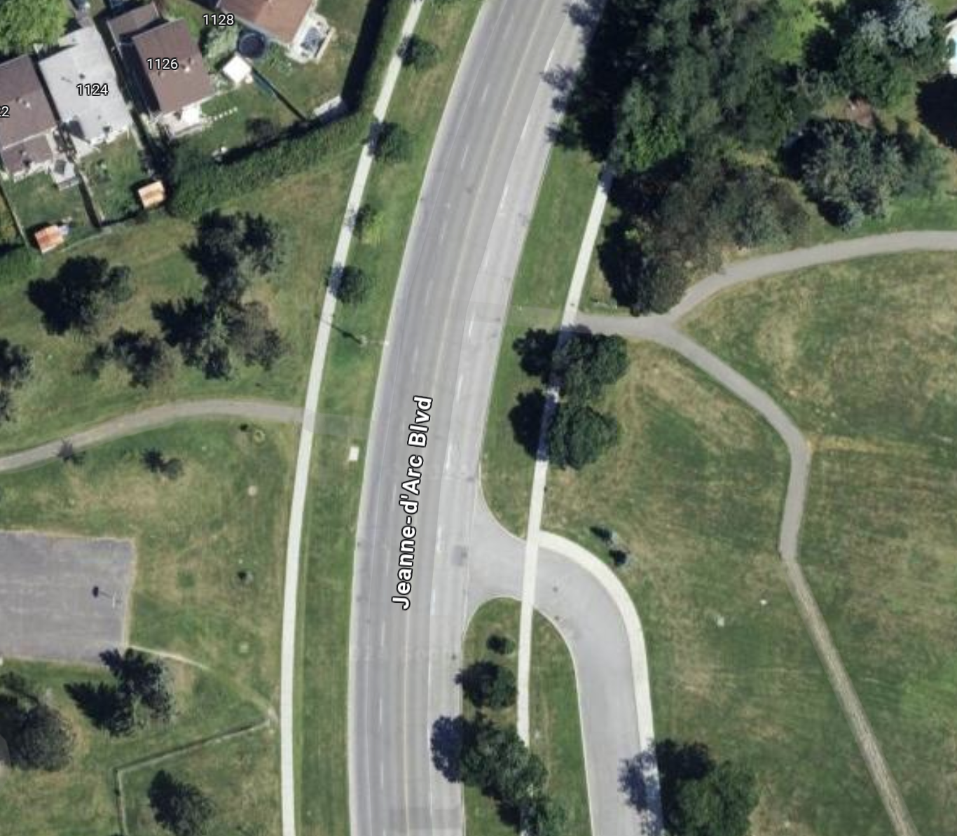
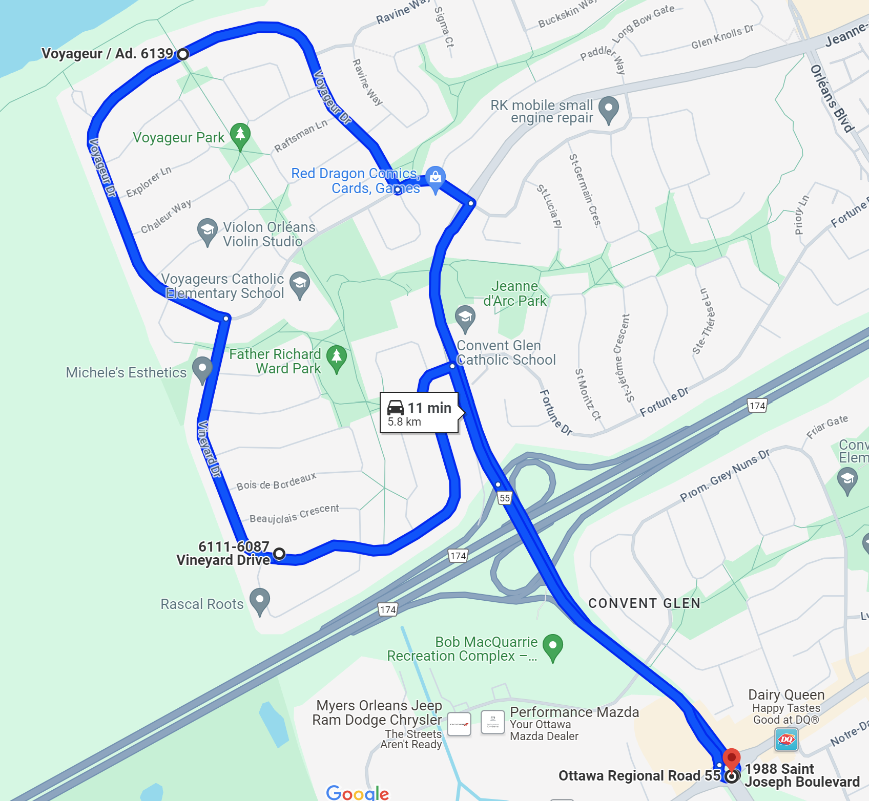
Creating a new pedestrian crossing to get across a certain problematic section of Jeanne d’Arc Boulevard is something I’ve been mulling over and wanting to talk about for literal months.
My version of this story contains some aspects of government bureaucracy, car-friendly transportation rules, and common-sense safety and accessibility changes. The exact spot I’m describing today is on Jeanne d’Arc, between the intersection of Vineyard/Fortune and Voyageur/Vorlage (names in the suburbs get weird where the same road gets multiple names even though sections of the road are less than a kilometre long.
Even from the level of detail of this first map, keen-eyed observers can see there is something going on here, a pair of green lines that seem to match up almost perfect, separated by a big ol’ road. This is basically the exact spot that served as my measurement location for the first post on this blog: Jeanne d’Arc Boulevard North – Road Layout Update. This specific spot is also home to of the most obvious places for new pedestrian infrastructure in this whole neighbourhood.
Zooming In
Getting a little closer to this ‘intersection’, you can clearly see that an effort was made here to connect the path network, but maybe someone lost an argument, or it was decided that traffic being slowed or stopped one extra time here if someone wanted to cross was unacceptable.
Personally, in the 5 years I’ve lived in this neighbourhood, I have crossed this road at this point probably a dozen times. I’ve done it with a stroller, I’ve done it with a toboggan (to a community event, no less). It’s frankly embarrassing that the path system is so wholly broken by this one disconnect that it has probably prevented hundreds, if not thousands, of trips that could be walked but were instead driven.
To those not familiar with the area, in the 300 m or so around this spot, there are two schools, a fire station, a basketball court (in dire need of a renewal, by the way), 2 soccer fields, a baseball diamond, a boarded hockey rink, a community shopping plaza (micro strip mall, basically), several large green spaces, parks and playgrounds, and some very nice active transportation paths that form a nice network. These amenities would all unilaterally become more accessible if this crossing were opened up with a controlled signal or any kind of pedestrian infrastructure.
The Bureaucracy
Now, for those of you thinking “Rob, why don’t you ask your local municipal representative about this”. It seems like a pretty obvious safety and accessibility win to open up this crossing, traffic impact would probably be minimal, and commuters might see their trips slowed by a few seconds 1-2 times a week at most.
I want to preface what I say next by saying that I don’t begrudge the local municipal staff, councillors, or really anybody involved locally for not rocking the boat for this. Incremental change like this, whether you agree it is a good idea or not, has become somewhat radical, especially if it makes things technically harder for cars.
Tangent: The Roundabout
However, another thing I’ll say before I talk about the politics of this is that a BIG discussion going on in the community right now, happened a little over 200 m away from this spot, is the addition of a roundabout near the local school, designed to help the buses visiting the soon-to-be-completed Jeanne d’Arc LRT station turn around once they’ve completed their routes.
This has become a huge discussion point because parents of the children at this school are concerned about safety at this intersection, and many view buses and this roundabout as dangerous for kids getting to school. I think this is pretty silly, the roundabout is very well considered, and will itself have a controlled pedestrian signal and a crossing guard. The design is almost certainly safer for students, given the lower vehicle speeds to navigate the intersection and the only result of these changes will be less car traffic through this intersection, not more.
Anyhow, this tangent is to add nearby context to the discussion, now back to the bureaucracy.
Now, when I reached out to my councillor to ask about this spot and the possibility of adding a crossing, I wasn’t necessarily expecting smooth sailing and that this would happen within a month or two. Even I am not that naive. However, I didn’t expect the actual response I got, which I’ll paraphrase here.
The Argument for Status Quo
I was told that provincial regulations dictated that a pedestrian crossing (PXO is the acronym they used, so I’ll borrow that here) could not be placed less than 200 m away from another signalized intersection. The other intersection I mentioned (with Voyageur/Vorlage) is about 160 m from the spot I’d propose makes the most sense for a PXO. I’ll note that this 200 m number is totally arbitrary, and I can think of PLENTY of exceptions to it in Ottawa that were surely based on some kind of reasoning that could be applied here. Usually, the reasoning would involve safety or some kind of exceptional road design.
The argument was made (by traffic engineers and city staff, relayed to me by the councillor’s office) that because the road curves at this spot, and the speed limit along this stretch is relatively high at 60 kph, having motorists potentially need to stop for this PXO signal is dangerous. Personally, I would argue that if it is dangerous having pedestrians cross because of the speed and the design of the road, perhaps the speed limit shouldn’t be 60, since you are driving between an elementary school and a fire station.
More Road Design Considerations
Another factor to consider is that due to upcoming changes to the road nearby, like the roundabout going in, there is already ongoing discussion about the speed limit along this whole stretch being reduced to 40 kph. This is because over a relatively short stretch, passing several schools, the road already jumps from speed limits of 40 and 60 several times, and a new speed camera a couple of blocks further east on this road has been giving massive numbers of tickets to drivers in the community. This isn’t surprising, because the road itself is absolutely encouraging you to go faster than this with its design, wide lanes and clear sight lines.
The road will also bottleneck down to 1 lane on either end once the roundabout goes in, so I would make the argument now is a perfect time to bite the bullet and say that this road should just be 1 lane at 40 kph for the whole length in this section. At that point, not only would a PXO be more reasonable, having big flashing lights for motorists would be less necessary (though I would argue still a good idea), and travel distance in traffic would be reduced by half for pedestrians (only needing to cross two lanes instead of four).
This is About Tradeoffs
Now, before concluding this piece, I’d like to return to the provincial regulation requiring 200 metres between signalized intersections to add a PXO. With a distance to the nearest intersection in this case of about 160 m, here is what traffic engineers are suggesting when a pedestrian approaches this spot from either direction with a hypothetical crossing. Rather than having motorists slow down or stop for a few seconds occasionally to let a pedestrian or cyclist continue their walk along a path, it is suggested that they should have to walk at least 320 m (160 m there and 160 m more back) in order to allow for traffic flow. They are also saying that this should still be the case even if the detoured walk is a total of nearly 400 m. It’s no surprise at all to me that unless I am with my young family doing this on foot, I sometimes just walk across the road (dangerously!).
One last point to wrap up this logical garden path: there is already a roundabout going in at one of the two nearby intersections. The logic for that roundabout going in is that buses accessing the nearby LRT station need to be able to turn around. However, I would make the argument that if all the described changes take place (40 kph limit, reduction to one lane, adding a PXO crossing), having a roundabout replace the signalized intersection at Jeanne d’Arc and Voyageur/Vorlage as well makes perfect sense.
This intersection could also have a pedestrian crossing with lights like at the other roundabout, and given this change in traffic pattern, its entirely possible that traffic flow through the area on an average basis actually moves a little better, with less likelihood of starting and stopping almost all of the time. And when there is a higher likelihood of interactions between pedestrians and motorists at these places (rush hour and around the start/end of the school day), should we not be prioritizing the safety of our children anyhow? These intersections are already patrolled by crossing guards, surely these changes would only make their job easier.
In Summary
To wrap up, I have a lot to say about this set of upgrades to the road design of this stretch of Jeanne d’Arc Blvd. I think it is doable in a fairly short time frame and without too much expense, and the resulting road design is not only fairer and more equitable, but it’s safer and requires less upkeep and maintenance.
I’m wrapping up 4 weeks of parental leave from work (going back Monday), and so for the last few month I have been spending all day every day with kids. Since I got the new bike (which can carry the older two on the back), the kids have been wanting to run errands and do things on the bike instead of the car (which I love to hear of course as I feel the same way). This means that I have been thinking a lot about bike routes to certain places I’ve only imagined actually getting to with kids on the bike.
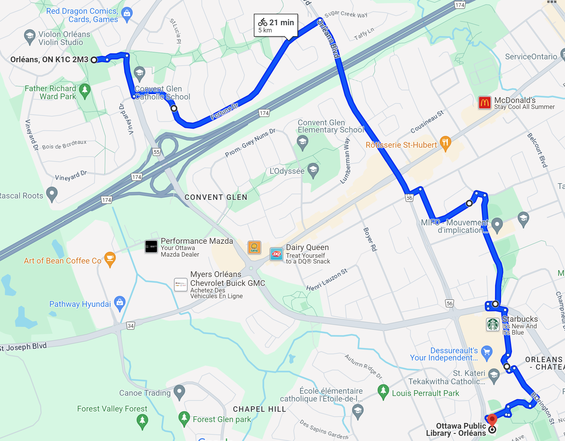
Getting to the Library
The library is one of the places I aim to go to more often with my kids, the local library was one of my favorite places to be growing up, and it was especially nice when I could make it there on my own on the bike. In Calgary where I grew up, the library wasn’t particularly easy to get to on a bike, but it wasn’t far and I am very comfortable on a bike, so from an early age I just biked in traffic, and this was the late-90s, early 2000s, so bike infrastructure definitely wasn’t a thing.
In setting out to do this, I got looking at maps to see that the most efficient several routes to get to the library were all just on the street. Some streets were less busy than others, but the stretch to get across the highway consists of two options, both of which are heavily under construction and each consist of 2-lane roads where you’re asked to ‘share the road’ single file.
Crossing the highway
I could only do that short stretch because I feel very comfortable taking the full lane, and because I’ve biked enough that I can travel about 30kph up the hill across the bridge to cross the highway. For those of you who don’t bike on the streets often, when you need to share the lane, every car behind you INSTANTLY feels the need to try to pass you at speed even if there is additional danger for them in doing that. This is obviously exacerbated by a larger speed difference between the speed limit and the speed of your bike, but even if I’m going 30 and the car traffic should be going 40, cars will typically exceed the speed limit temporarily just to get around you, sometimes a lot, because they won’t have to wait 30 seconds behind you.
I’m happy to note this particular stretch across the highway on the two nearby bridges (Jeanne d’Arc and Orleans Blvds) are being improved, and so both are partly under construction right now. There will be a pair of multi-use paths going in to cross these two bridges, which I expect will greatly improve the comfort and safety of getting across the highway. It has been under construction for over a year now, and cycling even alone hasn’t felt particularly safe for me at any point during that time, nor did it feel safe at any time before construction began.
Once we got across the highway, the road opens back up to 4 total lanes again, which for such a low volume route (with sections at both ends that bottleneck to 1 lane, by the way) basically means the outer two lanes function as bike lanes outside of the very short morning and afternoon rush (I’ve never witnessed this busy period to be honest, but there are people who swear traffic volume requires 2 lanes each way).
The Rest of the Way
Once I made it across the highway, I got some advice from a fellow bike parent that you could avoid some car traffic to do the last stretch of the route following basically back roads through the adjacent neighbourhoods. I had the map (below) in my head as an approximate route plan, but it basically involves winding through local streets and on to and off pathways. It’s kind of a maze but it does work, and with kids on the bike it does feel way safer than the alternative.
When I tried to bike to the library on my own in preparation for this trip (imagine ‘trying’ a trip alone in a car to make sure it’s safe to take a family later 😢), I attempted to use the logical efficient route (and the one suggested for bikes by Google Maps) and essentially follow Orleans Blvd for the entire last half of the route. On the map that would basically be replacing the whole last section weaving through the community with just following the obvious straight line path across the highway all the way up the hill to the library. It’s actually a very simple route in a car where you’re not worrying about these things.
Orleans Blvd
Orleans Blvd has TONS of space for wider sidewalks and cycle tracks (see this post for an example of the space there is in this right-of-way), but in its current form, it’s a 4-lane road with a speed limit of 60, and it is designed for cars to feel totally comfortable going MUCH faster than that. Even on an ebike going full tilt without passengers on my test run, I was going low 30s kph and being passed in the other lane by cars going 60-70. Again, the road volume doesn’t require 2 lanes each way, so cars typically wouldn’t need to close pass you in your lane, but they certainly would try if it came to saving a few seconds and there was another car next to them. Going up a hill in traffic is the worst, because as I said before it all comes down to the speed difference, I think cycle tracks on this route would probably be the most beneficial because it will enable less confident riders to feel comfortable taking this route, where I wouldn’t recommend its use today at all.
The one nice thing about the route we were required to take to feel safe (not to say this wouldn’t be possible if there was safe bike infrastructure) is that while taking back roads through the neighbourhood, we passed by at least 4-5 little parks and playgrounds, each of which the kids absolutely would have stopped and played at. On the way home, we did pick one of them to stop at, which really capped off the experience for the kiddos.
Conclusions
In summary, I think this ride is absolutely doable if you feel up for being hassled by cars as you cross the highway (it is literally 1-2 blocks of the whole trip), but with some consideration of this kind of bike traffic, this route could be SO MUCH BETTER. Given traffic volumes in the area, having this bridge be one lane is not a big deal (it’s been like this for a year!), and it would enable so many more people to get around outside of their cars.
I’m a big fan of efficient, convenient, and frequent bus routes that access or connect common amenities. Growing up in Calgary, I made frequent use of what that city calls ‘community shuttles’, basically smaller buses that tend to run shorter closed loops in a community connecting riders to transit hubs or nearby amenities.
A Tangent on Community Shuttles
From what I hear (and I did a fair bit of research on this), the community shuttle program has been difficult to maintain in Calgary, but part of this is because ridership on some of these smaller routes is precarious, so some are being converted to full big bus routes (a good problem to have, I guess), whereas some are underused and are being cancelled in favour of an attempt at an on-demand service where you call or schedule a pickup, which will obviously take more work and probably longer overall unless your timing is known in advance and you’re a good planner.
The community shuttles still being used today are vehicles reminiscent of something like an airport shuttle, I did source a few reference pictures from a very helpful forum website, the Canadian Public Transit Discussion Board (because there is a niche for absolutely everything) or CPTDB, and some very helpful Reddit users on r/Calgary.
Latest design of community shuttlesInterior of community shuttles (older model)
A Community Shuttle Streetcar?
Now, with this tool at hand, we can start to look at the possibility raised by having a vehicle like this in the OC Transpo fleet. Personally, I find accessing the businesses and amenities across the highway from my neighbourhood to be challenging outside of a car at the BEST of times. Sure, if you need to, you can do it, but if you already have a car, and ESPECIALLY if you are bringing family (kids, mostly) or multiple people, best case scenario now you’re walking a long way through infrastructure that is signalling that you’re sort of a nuisance that must be legally accommodated.
Despite the fact that there is a complete set of bus stops and shelters within a few hundred feet of the Jeanne d’Arc highway overpass, the sidewalks and crossing infrastructure is currently bolted on to what the planners already considered a perfectly acceptable design for a car-centric area. Now, this is already under construction to be much better with the LRT stop opening here next year, but there’s a real community opportunity to make this a viable, multi-modal connection bridging the two sides of the highway with safe infrastructure, with these complete street designs diving all the way into the community on both sides rather than ending a few hundred feet down in either direction and dropping you back on to a 4-lane road with narrow sidewalks.
Anyhow, along with that vision for the overpass, I think there is a great opportunity to draw people in and enable them to actually use reliable active and public transportation options, which is to run a set of local shuttles that take riders from the community (there is a clear and obvious loop I’ve highlighted below that would accommodate this, as an example). The loop has the shuttle cross the highway, loop around the roundabout at the far end, and then return and do the loop again.
A shuttle like this could run every 12-15 minutes like at a resort or large theme park, and reliably bring patrons or staff to and from the many businesses running along the strip down St. Joseph. Combine this with frequent buses along or down St. Joseph itself and there’s an opportunity here to make this street a safe, walkable destination that isn’t just filled with mostly underused parking that on average take up way more space than the businesses they attempt to support.
If you look at the map of this part of Orleans, it doesn’t take much creativity to start drawing our 5-6 other possible community shuttle routes that could run with a similar cadence, and make St. Joseph a destination like Westboro, Bank, or Elgin Street that people actually want to visit, as opposed to pulling up in a car to a specific shop, spending time buying something or eating there, and then driving away. And with linkages along these routes to the LRT, people can visit from other places in town or even from other cities without needing to rent a (VERY EXPENSIVE THESE DAYS) car.
Final Thoughts
I think the key to a program like this is to make the program affordable and incentivise people to actually use it. Maybe don’t charge on weekends for the shuttles for the first 3-6 months, and run them frequently throughout the day so you don’t even have to think about the schedule to go catch one. Get people used to thinking about it as a viable option, and worry less about a public good operating as a for-profit operation that needs to return on investment.
The bus that currently runs what this route will become once the LRT opens, the 237, literally only runs 4 times a day during peak hours on weekdays. It’s used to get downtown workers to the current LRT during rush hour, but we can do so much better. Aside from this bus, anybody in the community wanting to take public transit needs to walk anywhere from a few hundred metres at least, up to over a kilometre just to get to the nearest ‘main road’ at Jeanne d’Arc.
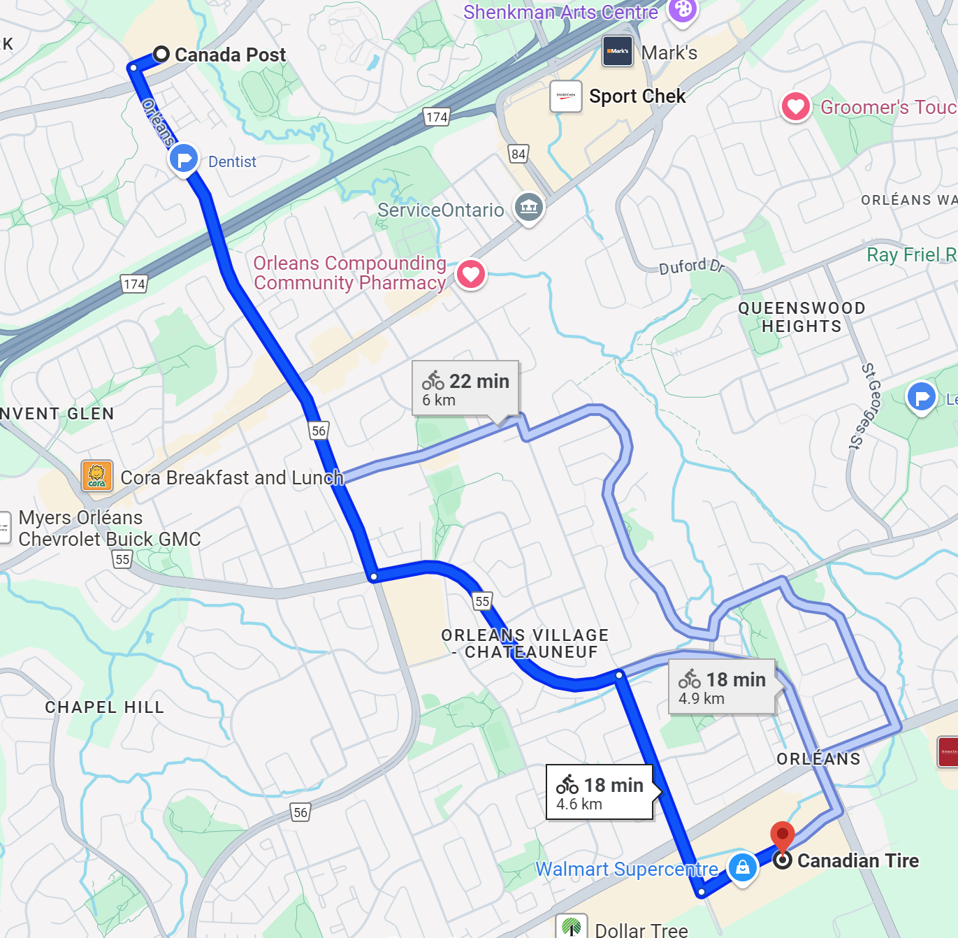
I did something today that would have been very hard to do without the cargo ebike I got this spring (I’ll describe this bike more in a future post). This afternoon I did a couple of errands on the bike, which is better in almost every imaginable way than doing equivalent tasks would have been in a car. After dropping off a fairly large package (big enough I never could have attempted this with my standard hybrid bike) at Canada Post in the Shoppers at Jeanne d’Arc and Orleans Blvds, I took Orleans Blvd south up the hill, then made my way over to Canadian Tire for some pool chemicals.
On the way there, I took Jeanne d’Arc to see the newly paved and painted intersection at Frank Bender on a bike. On the way, I tried to look at the sidewalks along Jeanne d’Arc leading up to that area. They look like they are pretty old, giving me some hope that if they do get prioritized for replacement in 2-5 years (or something) it may be possible to make better use of the Jeanne d’Arc right-of-way for active transport. I grew up on a bicycle so I feel quite comfortable on almost any road, but even talking to my parents in Calgary (in their 60s/70s) about how I’ve been biking more and advocating for an active transportation network in Ottawa last week, my parents mentioned that they don’t bike as much as they would when they were younger because of missing infrastructure links.
My route to Canadian Tire.
Anyhow, on the way back from Canadian Tire, I went straight through Frank Bender on to Belcourt Blvd using the newly paved connection I mentioned earlier, and I must say Belcourt is a dream cycling route, with almost no traffic since cars can’t get through. A few stop signs (including one that is totally redundant for bikes) are really the only things stopping bikes from cruising uninterrupted straight through the neighbourhood. The planners and folks who implemented this efficient community connection deserve a congrats! However, that route did just dump me out on to St. Joseph at the end, which is obviously less ideal for less experienced people. It would be cool if this kind of infrastructure had somewhat logical beginnings and destinations when they’re planned out, their disjointed nature makes them hard to use for less and more experienced people.
My route home (shows walking because the cycling connection where Frank Bender turns in to Belcourt (white dot in the blue dots near where it says ORLEANS VILLAGE – CHATEAUNEUF) is so new I had to edit Google Maps today).
All that said, I will celebrate progress. When I take routes like Jeanne d’Arc, Orleans Blvd, and St. Joseph Blvd, I can’t help but picture and imagine what they might look like if we took the climate, housing, and affordability crises deadly seriously and really committed like cities like Paris or Montreal to densification, a complete and less car-dependent transportation network, and allowing mixed-use zoning to make it easier to create complete neighbourhoods in a relatively compact space. I fully recognize it is MUCH easier to say those words in a vacuum than to implement any of those things while keeping a functional city running with a strapped budget, but I will keep dreaming about it.