For many suburban parents, reading the title of this article might send shivers down your spine. For a lot of families, one car per adult in the household is pretty typical, unless a car is in the shop or out of commission for some other reason. In my case, one of the reasons we are a one-vehicle household (a minivan, which is great by the way), is to accommodate our financial priorities. We would rather spend our money elsewhere rather than finance a second car for the rare occasion we are doing two things at once that require one. We are a family of 5 with one income at the moment, and not looking to change that.
The Setup
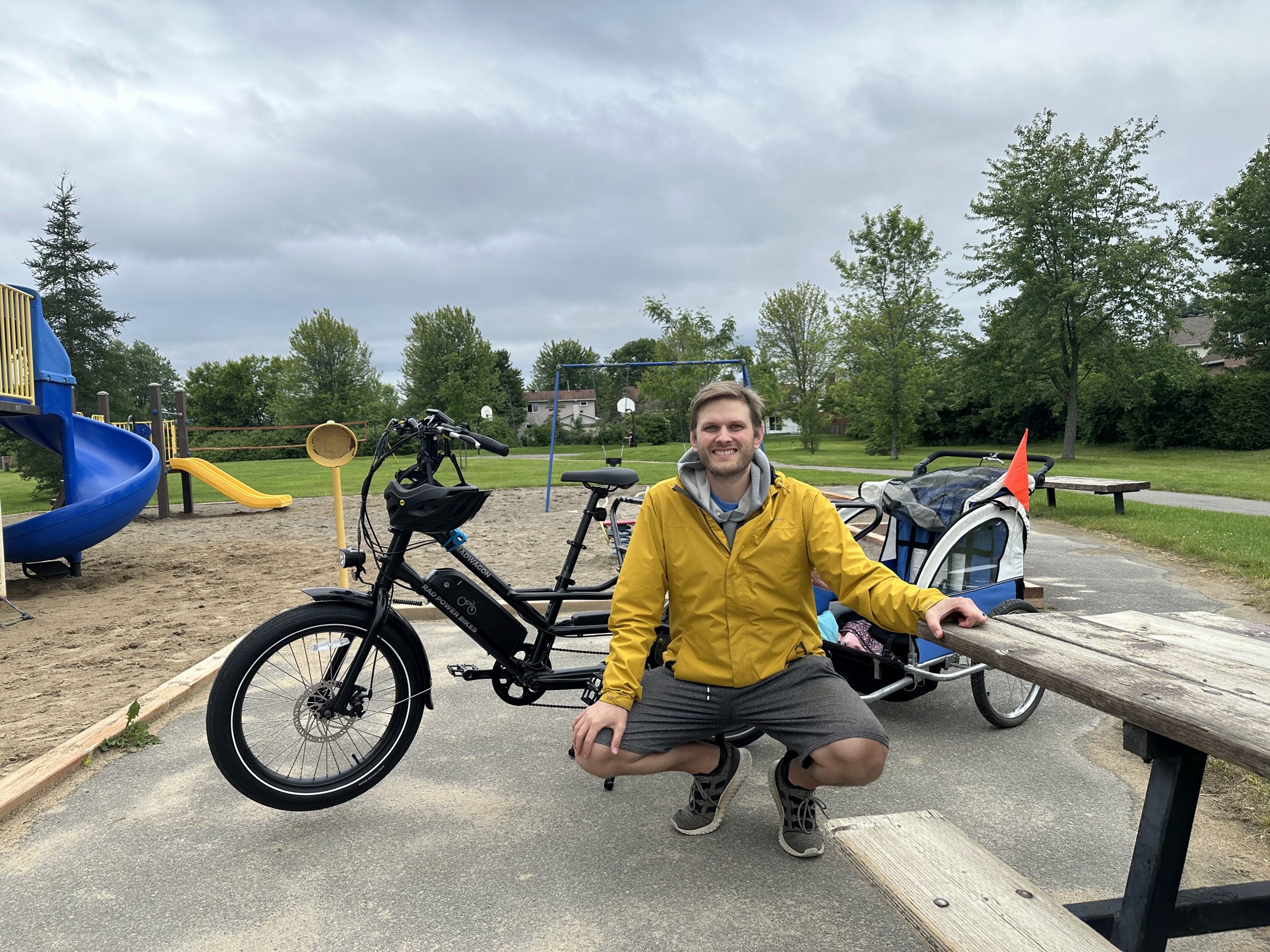
When my wife got the opportunity to visit some friends in Toronto, she felt incredibly guilty taking our van on the trip, and in fact almost took the train with our youngest just to leave me the vehicle. It turns out the train is VERY expensive unless you book weeks in advance. However, from my perspective, as someone who has never commuted to work by car and doesn’t particularly enjoy or want to drive very much, this past weekend was a great opportunity to demonstrate that I was perfectly capable of getting around the suburbs with kids (who are 6 and nearly 4), with just my long-tail cargo bike.

I encouraged my wife to drive because the train was so expensive, which meant that for 3 days (Friday being a PD Day), I was going to be a solo parent for a whole weekend for the first time, and I would not have a car. I know that some parents (and some people without kids) in this situation would accept this reality and just decide they were going to stay very close to home for the weekend. However, I wanted my kids to have a fun weekend, and we had commitments and activities on the calendar that none of us wanted to miss, including swimming lessons and a birthday party, along with Orleans Family Fun Day on Saturday.
I didn’t do this because I thought it would be a fun experiment (though I did think it would be one). I did it because I knew that I could, and because I wanted to prove to myself that it was not only possible, but actually a positive experience and one I would seek to replicate whenever possible.
Downtown by Transit
On Friday, I packed a bag with snacks and water, and the three of us made our way downtown by bus and then train. The kids get very excited every time we get to take public transportation, and my son is an especially big fan of what he calls the ‘double wrecker bus’ (hopefully you can figure that one out). We went to the Rideau Centre and visited the canal locks, and then made our way back home after a few hours, and the kids had a great time.
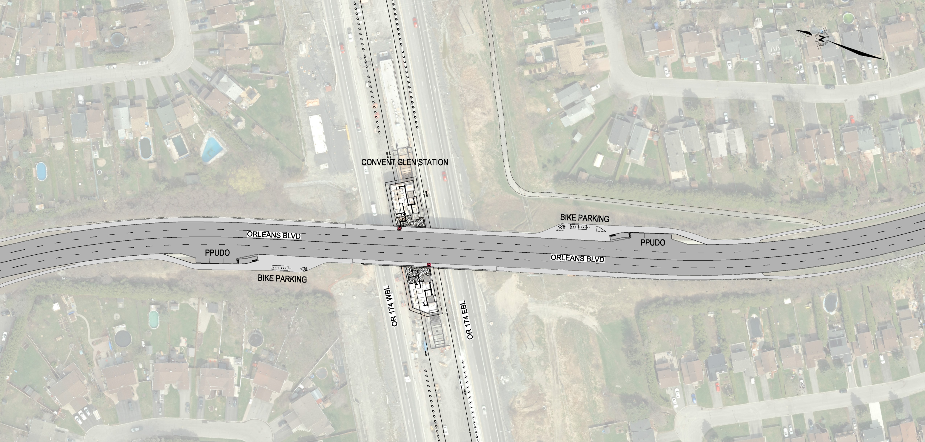
Transit service gets talked about a lot in Ottawa, and it would have been easier for us if the network had more frequent service, but all considered it was totally fine, and we didn’t have to pay for gas or parking and got some exercise. We had to walk from Convent Glen North up to the highway at Jeanne d’Arc, about a 10-minute walk, and the 30 came almost immediately. Trains off-peak are now at 10-minute headways, so we had an 8-minute wait for a train, and both the bus and train were quite full the whole way (suggesting perhaps people are actually using the network and maybe funding it would be a good idea after all). One thing we didn’t encounter the entire weekend was more than 1-2 minutes of traffic on the bus at the very end of our journey.
Swimming Lessons

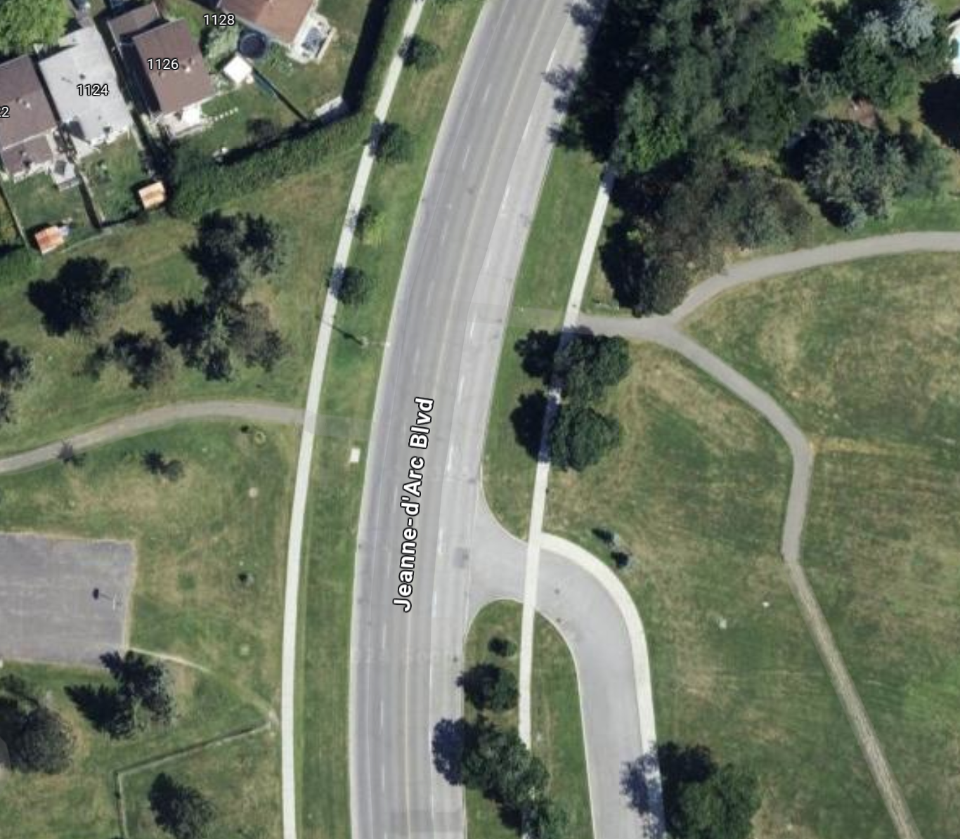
Getting to swimming lessons is pretty straightforward in comparison. We probably could have just walked to Bob Macquarrie Rec Complex from Convent Glen North, but given the kids preference for the bike, that was an easy choice for me to save some time. The construction on Jeanne d’Arc at the highway makes that a little more stressful, but the pylons blocking off one lane make for a pretty nice, protected bike lane on weekends when there are no trucks there. And honestly, the cramped lanes navigating the roundabout construction are downright spacious on even the biggest bicycle. It is a little over 1 km for me to get to Bob Macquarrie, and I am certain the percentage of people who (justifiably, mind you) drive there for activities is well over 80%, despite most people having very short trips.
Orleans Family Fun Day (Barrington Park)

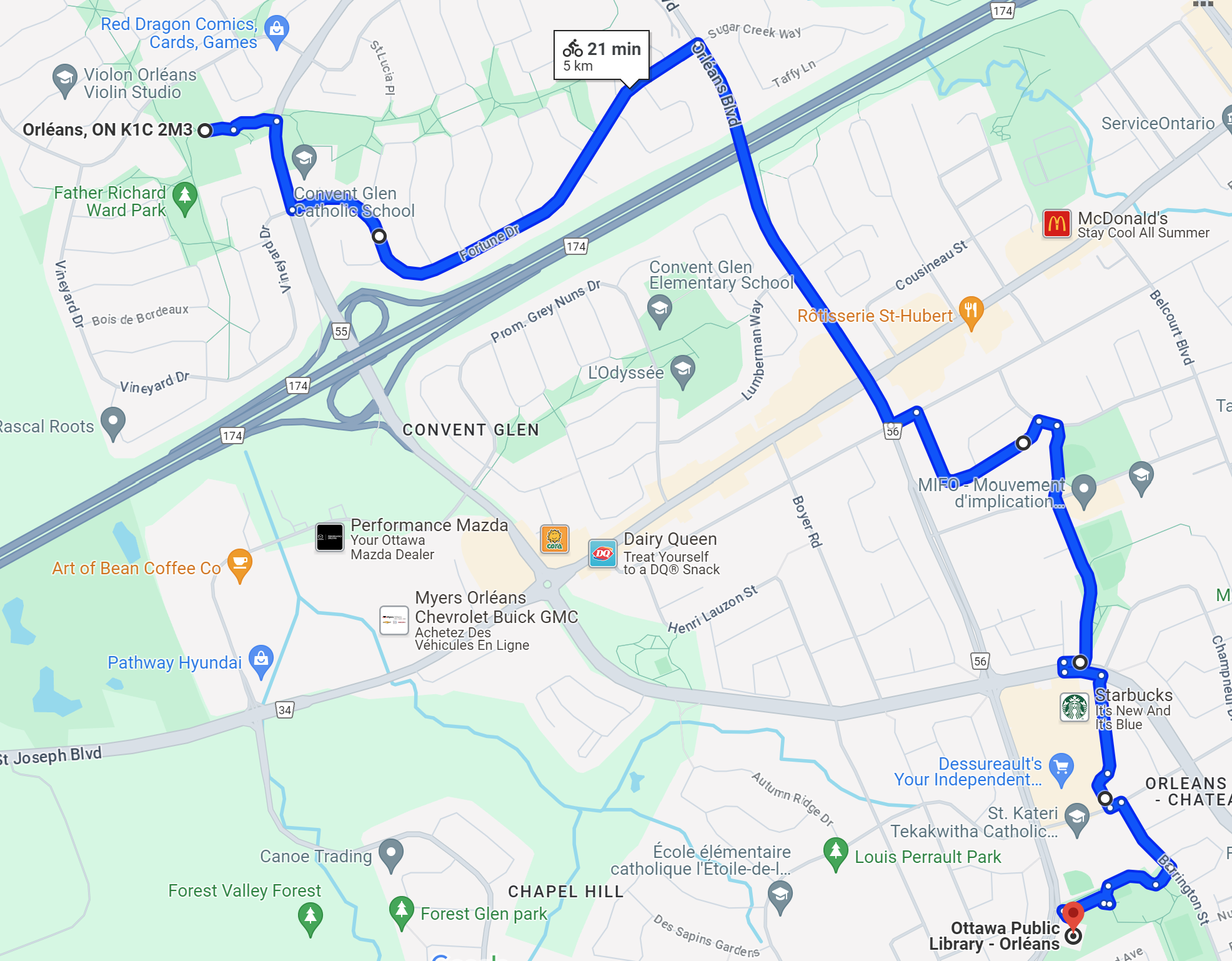
Orleans Family Fun Day is a bit of a longer trek, but still well within easy biking distance (the event was at Barrington Park next to the Orleans library branch). The toughest part of that trip is the unfriendliness of Orleans Blvd to any form of transportation that isn’t a car, but with a little creativity and a few minutes of steeled nerves and hoping for patient and friendly drivers to get across the highway overpass which is down to one lane with construction. After spending 3 lovely hours at Family Fun Day, we ended up stopping to run a couple of errands at Innes Road, and then headed back to the Convent Glen Metro near our house to pick up some groceries for dinner and the rest of the weekend (the front basket is excellent for groceries when the kids are with me).
Birthday Party / Museum

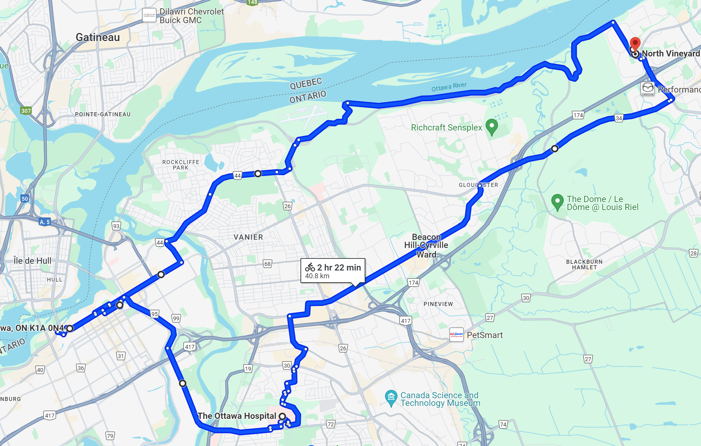
The other major outing we did on the weekend involved a typical suburban parent experience, one kid has a birthday party to attend, the other wants to do something with you. The party was for 2 hours down off Montreal Road, across the Greenbelt at Canotek. On this particular occasion though, I had an ace up my sleeve since on weekends into October, the Parkway is open exclusively for active transportation. I packed the gift, the three of us hopped onto my bike, and after a short trip along the River Pathway, we joined up with the Parkway and made quick work of the trip to Shefford. The entire ~3 km trip we had almost no interactions with motor vehicles, as residential streets and the industrial park were both essentially empty on the weekend.
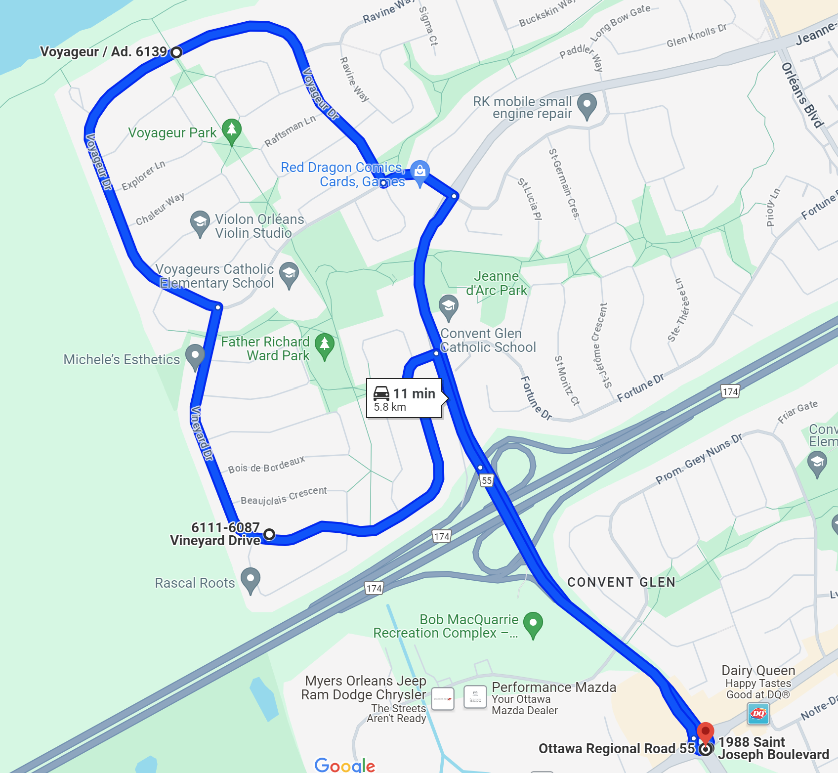
After dropping my daughter off at the party, I brought my son to the Aviation and Space Museum (another nearly 7 km) for a little over an hour (we have an annual pass), which he always appreciates. Another ~7 kms back, we were picking my daughter up from the party, and we were making our way home. Finally, we had made plans to walk to their grandparents for dinner, so we wrapped up the weekend with a nice 10 minute walk through the path system bisecting Vineyard and Voyageur. Wrapping up the math of the weekend, I spent a total of less than a dollar on electricity to charge my bike, biked over 35 km over 2 days, and spent 2 OC Transpo fares to go downtown and back. In exchange, we got to spend good quality time with many friends and acquaintances over the weekend days, many of whom we saw or spent time with in the community. I spent about $60 on groceries and picked up a few fun things for the kids too. We also got to see lots of people that live around us just by walking or biking past or seeing them in passing, something that happens so rarely when we’re all just jetting around in cars.
Wrapping Up
To just explicitly make the point I’ve been making implicitly while telling this story, it is extremely possible to get around your community without getting in and out of a car all day, and I can promise you it is way more fun (especially for kids) and I encountered literally zero traffic on any street or path I was on.
A couple of other things here are also true. The suburbs have some work to do to make forms of transportation other than cars safe enough for the average person to feel very comfortable getting anywhere in their neighborhood on a bicycle (with or without kids). But most places are quite accessible very easily now, even if you do have to go a little out of your way.
Public transit also needs some work, especially in the suburbs. A lot of people either don’t trust it, feel they are above it, or feel it isn’t good enough in comparison to their car to get them where they need to go when they need to get there. And in many cases right now, that’s true. OC Transpo needs more funding, more ridership, or some combination of the two, to be more reliable, more accessible, and more resilient. However, there are lots of new stations coming online in the next few years, and I believe OC Transpo truly believes in the mission of improving service, pulling the system out of the death spiral that has been threatening over the last 5 years.
The system is not perfect, but these options, walking, cycling, and public transit, are going to be key to Ottawa’s Official Plan and the Orleans Corridor Secondary Plan. The more we can use these other options, the better for the climate, traffic, and our combined sense of community.


 More on the Gaps in Infrastructure